Hurricane Katia update, Gulf Coast Disturbance headed NW, Labor Day weekend 26th Annual NKF Surf Festival, Hurricane preparation, Cape Canaveral Friday Fest, Surf Report Thursday afternoon (at 4:00 PM) and Surf Forecast for Cape Canaveral n Cocoa Beach, Uncle Joe got a new rocking chair (posted September 01, 2011)


This slideshow requires JavaScript.

Full size images below if you want to click on them and see full screen.

Maybe a 2nd chance at a barrel?  Photo by Mike Melito, an old surf buddy. Hurricane Irene, the 2nd day. Pic 1
Maybe a 2nd chance at a barrel? Photo by Mike Melito, an old surf buddy. Hurricane Irene, the 2nd day. Pic 1

FRIDAY NITE UPDATE (from this original Thursday afternoon surf report book 😉  Wind swell coming in late Saturday with waist high size and onshore winds; nothing exciting but something ridable somewhere 🙂

Sunday, the same wind swell, small, persists until late afternoon, when the first dribble of Cane Katia starts sending in waves.  Playalinda and Spanish House could have some nice chest high size and slight offshore winds (SSE to SE; S winds are 32 degrees offshore at Playalinda and 26 degrees at Spanish House).  2nd light to RC’s will have sideshore SSE to SE winds.

Monday and Tuesday will be growing from chest to overhead by Tuesday , right now looking onshore winds in the 15 to 20 range.


Wednesday and Thursday will be pushing the 2 to 4 foot plus overhead range, also with onshore winds, but………….Thursday and or Friday (or both days),  could be the big and offshore wind days.  So we will keep you updated on that mostly, once Tuesday and Wednesday night roll around when I can get more accurate wind data.

Oh, Katia is still a Cat 1 Hurricane, but it still shows to be a Cat 3 by Wednesday, and should be about 850 East of Daytona at that point, so if the wind sheer models hold, it should start aiming some Northward, and if the wind sheer models don’t hold,  then start packing…………just kidding, but listen close to the weather.

Here endeth the Friday , Sept. 2nd update for surf coming our way.  Below is my post from Thursday afternoon…

I just don’t know if the title of this post is quite long enough…

There’s a lot going on 😉

Katia went Hurricane Category 1 hurricane late last night or this morning.  Should be a Cat 3 by Monday, and by Tuesday it will only be 1100 miles from us, though the general consensus is that an upper wind sheer with keep it diverted off our part of the coastline anyhow.  As the general consensus goes.   Still,  like I mentioned the other day,  consider doing your Boy Scout stuff like water, canned goods, extra cat and dog food, batteries, fans and if you really wanna get anal, some water purification tablets…okay, I’m slipping into Alarmist syndrome here, my bad 🙂

Before we get into Katia and forecasts, we have some Hurricane Irene pics here from Saturday (the day after the big day 🙂  down around Slater Lane, mid-morning chest high waves, pretty much perfection. 

It did turn into some coverage.  Mike Melito photographer.  Hurricane Irene, glassy day two. Saturday
It did turn into some coverage. Mike Melito photographer. Hurricane Irene, glassy day two. Saturday

The photos were taken by a surf buddy and high school friend Mike Melito.  (He also did my Hurricane Earl and Danielle pics last year)

It was head high down by Satellite Beach, but I couldn’t make it down there. In between in North Cocoa Beach (as shown in these pics it was still pretty sweet)  But I did surf some incredibly fun waist to stomach high waves at Johnson Ave,  so needless to say, I was happy.

Also, Ross at CFLsurf.com has an incredible array of photos from Irene at his site (Picasa Web gallery) , check him out too.

Nice waist to chest high left.

The 1st Friday of the month Friday Fest of Cape Canaveral is September 2nd, this Friday.  The band Vilifi, whom I heard before is awesome, 3 piece band with incredible guitar player, drummer and bass.  (Obviously, those would be the 3 instruments for a 3 piece band, but my point is, each musician is incredible 🙂  If the link takes long to load, then just click on Cape Canaverals city website, and go to the 7th menu link for Friday Fest.

Hard to tell if it would be a good longboard day ;)  Photos by Mike Melito.
Hard to tell if it would be a good longboard day 😉 Photos by Mike Melito.

It still appears that Katia will start throwing us some waves Sunday night after dark,  with some waist to chest high waves building Monday, onshore winds.  The swell may provide some huge stuff, may last for 3 to 5 days.

The models are showing some possible offshore winds on Tuesday, which I would imagine that has to do with the storm in the Gulf which may become a cane also, heading toward Houston, cause it’s too early for Katia to be going offshore.

In Summary,  aside from a little wind swell we may have in the next couple days,  Monday starts Katia, and Tuesday it should be about 1100 miles offshore.  If it goes North with at least 600 miles off the coast we could have some killer waves by Wednesday or Thursday.

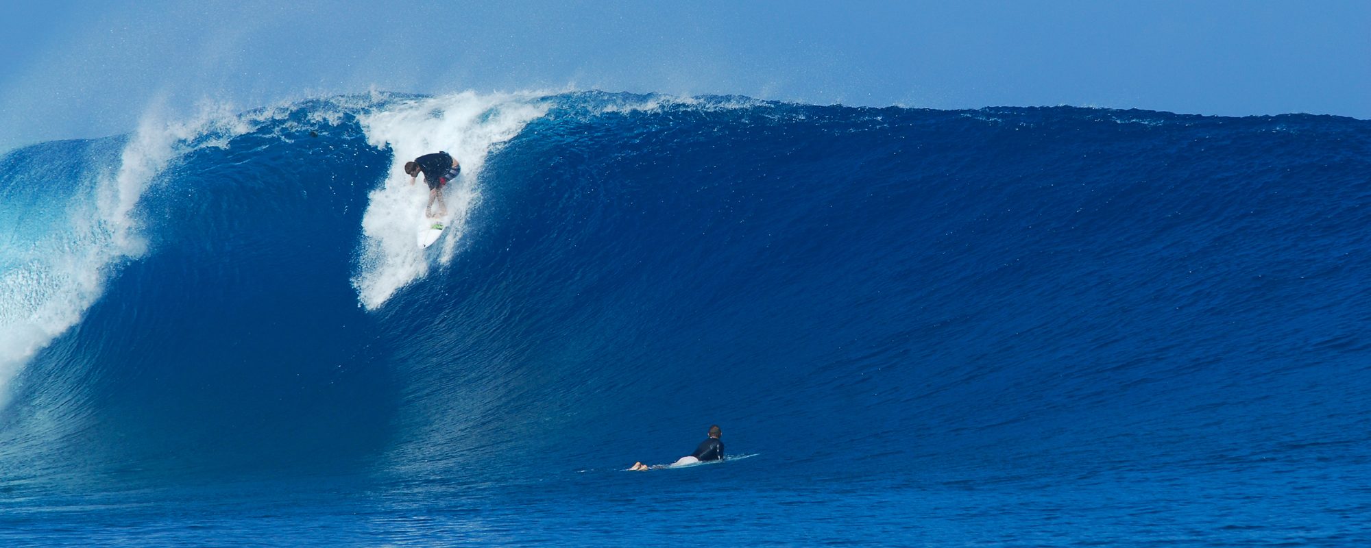
All alone...
All alone...

Don’t forget to have a blast and at the same time support the 26th Annual  NKF (National Kidney Foundation)  Surf Festival, check out their site for this year here.  The event takes place at the Cocoa Beach Pier starting Thursday Sept.1st.

Waitin on a duck diver to get in a good place :)  Hurricane Irene , the day after photos by Mike Melito
Waitin on a duck diver to get in a good place 🙂 Hurricane Irene , the day after photos by Mike Melito

We’ll keep ya posted.  If you don’t have a long leash for your cat or dog, get one, and a cage, just in case.  (what’s this guy so obsessed about pets for ?)

Later,

oldwaverider
Tropical Storm Katia, maybe Hurricane on Wednesday, Labor Day weekend 26th Annual NKF Surf Festival, Hurricane preparation, Surf Report Tuesday night (at 9:00 PM) and Surf Forecast for Cape Canaveral n Cocoa Beach (posted August 30, 2011)


Hurricane Irene, Brevard County, photographer at Gulfster.com

Tropical Storm Katia on the way…….But I had to show a few more of the awesome Friday, Hurricane Irene pictures from Gulfster.com  .  Many of the pictures on their site are Satellite Beach,  The Pier, and another spot I believe.

Tropical Storm Katia appears to be sending us waves on late Sunday or Monday, as it stands now, onshore winds bringing the storm in, in the 3 to 4 foot range.   By Sunday, it looks to be about 1500 miles from us, as a Cat 2 or 3 Hurricane.

Tropical Storm Katia, headed straight our way, 60 mph winds, 20 mph.  Possible hurricane by Wednesday some time.  Sunday could place it about 1500 miles WSW of us. Compliments of Stormpulse.com
Tropical Storm Katia, headed straight our way, 60 mph winds, 20 mph. Possible hurricane by Wednesday some time. Sunday could place it about 1500 miles WSW of us. Compliments of Stormpulse.com

With the sole intention of being an alarmist,  keep in your mind, preparation for a direct hit between us and Jacksonville.  No one is saying this,  just my thoughts.  Consider looking at your Boy Scout list of Hurricane preparation items.  Okay,  here endeth the alarmist 😉   …Not!  Katrina was 6 years ago in 2005.  It’s like they’re related 🙂

Image 2 here of Hurricane Irene, Brevard County, photographer at Gulfster.com

We should have some more news on this puppy (Katia) by Wednesday night, or Thursday.

I’m waiting on some pics for Saturday, in the chest high range from Irene, by Slater Lane.

Oh, in case you didn’t hear it or see it in today’s Florida Today.  Kelly Slater won the Tahiti Pro in huge waves meeting in the finals against Owen Wright.

Check out the killer slideshow at Magicseaweed.com  .  He was ranked 6th, after he skipped the tour in J-Bay (looked like 6 foot waves for that contest),  and he caught the once in a lifetime swell in Fiji.  30 to 40 foot , tow in and paddle in.  The same storm that they called the 50 year storm hitting Tasmania first, then Australia (thus the 50 year storm name) and on to Fiji and other places.   That big wave surf, very similar to Teahupoo except longer rides than Teahupoo.

Don’t forget about the 26th Annual NKF Surf FestivalLabor Day Weekend – Cocoa Beach – September 1-5, 2011. Read more about the Surf Festival here.

Later,

oldwaverider

Image 3 here of Hurricane Irene, Brevard County, photographer at Gulfster.com
Check out the board length to face size (yeah a little angled 🙂 in Image 3 here of Hurricane Irene, Brevard County, photographer at Gulfster.com
Image 4,  Hurricane Irene, Brevard County, photographer at Gulfster.com
Image 4, Hurricane Irene, Brevard County, photographer at Gulfster.com
Image 5, Hurricane Irene, Brevard County, photographer at Gulfster.com
Image 6, Hurricane Irene, Brevard County, photographer at Gulfster.com
Image 7, Hurricane Irene, Brevard County, photographer at Gulfster.com