Thursday Afternoon Surf Update Report 1 PM (11/17) Big Wind Swell arrives Friday morning followed by possible overhead groundswell next Tuesday (11/22), Photos from Thursday Big ENE Swell Hightowers in Satellite Beach, Surf Report for Cape Canaveral n Cocoa Beach (posted Thursday November 17, 2011)


This slideshow requires JavaScript.

Full size images below if you want to click on them and see full screen.

The Paddle Out.  Hightowers, Satellite Beach , ENE November 10 2011 swell, photos by oldwaverider
The Paddle Out. Hightowers, Satellite Beach , ENE November 10 2011 swell, photos by oldwaverider

What do ya do when you don’t have working ribs?  You learn how to hack WordPress themes using Hooks.  Duh 😉

Guess you had to be there.  I’ve been in school, if you will, learning how to tweak, hack, modify stuff since I can’t be out in the water.  (note: hacking is legal and friendly, cracking code is non-friendly).   Man, I’ve been sittin here to long.  Cause this is a blog kinda, I can rant like that since it’s not a “traditional” website.

Nice overhead backside barrel/cover.  Image 1 of 3 in sequence. Photo by oldwaverider
Nice overhead backside barrel/cover. Image 1 of 3 in sequence. Photo by oldwaverider

INCOMING SURF!  Our big NE windswell starts coming in after dark tonight.  It ain’t gonna be pretty, but it is waves. The swell period only climbs to 8 seconds, so no groundswell here, but like I said, waves……………

Friday, it should bring in some head high waves somewhere by noon, most likely down South, with 20 plus mph NE winds.

Image 2 of 3 sequence.  Quest for a little sunlight blockage.
Image 2 of 3 sequence. Quest for a little sunlight blockage.

Saturday,  a little bigger, overhead South, and hopefully, it starts to hit the Cape with some size by thenENE winds, maybe drop under 15 by Saturday morning here at the Cape, so dead high tide could be fun and semi-clean. (semi is the operative word :))

After that, More of the same, a little smaller until next Tuesday if our thankful surf models hold true.

A ground swell comes in from the ESE, and as it stands Wednesday morning could provide the wrap around of winds for us, but that is wayyyyy to far out to make any calls yet.  So, just prepare for a day between Tuesday and Thursday for a head high plus day with offshore winds.

Some nice coverage, but the roof was coming in early so he took an early exit on image 4, so I skipped that one. Image 3 of 3 at Hightowers on November 10 2011

The photos are from  last Thursday, November 10th, 2011, at Hightowers in Satellite Beach.  

When I was posting some pics for Satellite on Seaweed, I found a really good video from the huge NE Perfect Storm swell that hit on November 14, 2010.  Gulfster.com  (if you click on this link, scroll down to the last half of their images to get to the large wave photos) posted the most amazing photos from Satellite Beach that day which I also posted one of their 6 or 8 shot sequence out of a 20 shot sequence in Satellite Beach posted in my blog here.   Man, I cracked my rib in October of 2010 and missed that epic swell.  And then cracking it again a couple weeks ago I missed the one year anniversary storm.  Moral; no more shorebreak with epoxy longboards 😦   Oh, check out this awesome video from that Nov. 14 2010 day, taken at RC’s. If you never saw it, it’s less than 2 minutes, but nicely done, and nice quality footage.

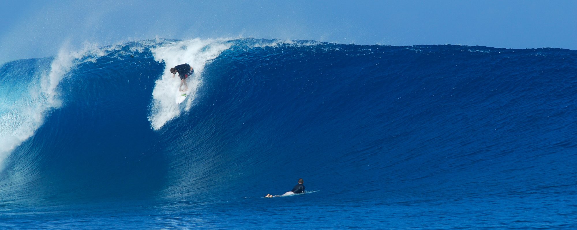
I had to put that first photo of the PADDLE OUTHey, when you click on the thumbnail to see the blow up photo, click on it again and scroll your browser window. I posted the pic 2500 pixels wide so you could get the feel of the paddle out. (except for my lousy aperture settngs & lack of filters and aiming the camera right into the sun, rookie, yeah, i know 🙂 Most of us having surfed the Pacific at some time or other know that most of the time, you have a channel to paddle out thru so you don’t have to take relentless pounding on the head.  My times were California, along with Baja Mexico, and down by Acapulco an hour or so above Escondido.  But this guy paddling out, granted doesn’t have to duck many waves, but it still is humorous to see that 10 foot face including whitewater that he has to gauntlet thru 🙂   The other photos are a 3 shot sequence of a nice few foot overhead barrel that does dump on him, but he did escape.

Enjoy the water folks.

oldwaverider
Sunday night 5:45 PM Nov 13 Surf Update, More Photos from Thursday Big ENE Swell Johnson Ave at the Cape, Surf Report for Cape Canaveral n Cocoa Beach (posted Sunday November 13, 2011)


This slideshow requires JavaScript.

Full size images below if you want to click on them and see full screen.

This guy was catching waves 3 to 1 out there, and shared a really nice style. Image 1 of 6 in sequence.  Classic ENE swell on November 10th Thursday, Photos by oldwaverider
This guy was catching waves 3 to 1 out there, and shared a really nice style. Image 1 of 6 in sequence. Classic ENE swell on November 10th Thursday, Photos by oldwaverider

More Photos from Epic Thursday ENE swell on November 10, these were of a guy who I don’t know who he is, I took them on Johnson Ave. mid-morning,  and this guy was shredding it with the most waves taken and with the style of a normal foot Sunny 🙂    Okay so whats up with incoming swells ?

Monday starts bringing in a week wind swell, maybe chest high down South, and waist at the Cape.  It’s kind of an East Swell with a taste of South.  So we should get some of it at the Cape.  Choppy Monday and waist at the Cape, Tuesday the same, maybe a head bigger.

Same wave, image 2 of 6.

Wednesday, it may turn offshore down South (south winds anyhow) with a waist to chest high, depending on the Cape or South.

Thursday for now does look offshore (but we’ll know for pretty sure Tuesday on the winds) for early morning, again, waist to chest probably.

Same Guy, Same wave Image 3 of 6, Johnson Avenue, Thursday Nov 10
Image 4 of 6 shot sequence
Image 5 of 6, same wave
Image 6 of 6 sequence
Johnson Ave. vs. Hightowers - take 2.  It's fun doing the merged comparison. oldwaverider
Johnson Ave. vs. Hightowers - take 2. It's fun doing the merged comparison. oldwaverider

Friday morning a large wind swell rolls in with overhead big chop, and there’s no telling yet when the offshores will blow for this one.

Later,

oldwaverider

Tu

EPIC WAVES TODAY ! 8 foot faces to rare double over-head sets in Satellite Beach, Hightowers, Thursday Afternoon 1:15 PM Surf Report of How the Waves Were Today, Surfing Photos of Hightowers (posted Thursday November 10, 2011)


This slideshow requires JavaScript.

Full size images below if you want to click on them and see full screen.

This guy was relentless out there today.  And he got his Satellite Beach barrel.  This is actually Image no. 4 in a 6 shot sequence, which I'll drop in below, it was just so beautiful to see :)  November 10 2011 epic ENE swell. Photos by oldwaverider
This guy was relentless out there today. And he got his Satellite Beach barrel. This is actually Image no. 4 in a 6 shot sequence, which I'll drop in below, it was just so beautiful to see 🙂 November 10 2011 epic ENE swell. Photos by oldwaverider

AWESOME, TOTALLY AWESOME Waves today in Satellite Beach…

It was beautiful everywhere, but this ENE swell really delivered at Perkins, Hightowers and RC’s.   The consistent sets came in around 7 to 8 foot faces, and I’d say every 5 or 10 minutes a 9 to 10 foot face came in,  and I believe I saw a rare 12 foot face set come in, (unless the guy in the photo I’ve posted in the second sequence of photos below, was only 3 feet tall 🙂  This first sequence was probably a 9 foot face at the peak.  I love the third sequence, it’s like he’s saying, crap, I guess I should’ve let this one roll by 😉


I had to do one ridiculous photo merge.  Johnson Avenue vs Hightower on a 6 foot at 10 second ENE ground swell with offshore winds.  Photo merge by Anonymous :)
I had to do one ridiculous photo merge. Johnson Avenue vs Hightower on a 6 foot at 10 second ENE ground swell with offshore winds. Photo merge by Anonymous 🙂
Image 1 of 6 shot sequence, dropping in late and chasing a barrell.  Hightowers in Satellite Beach epic November 10 2011 ENE swell. Photos by oldwaverider
Image 1 of 6 shot sequence, dropping in late and chasing a barrell. Hightowers in Satellite Beach epic November 10 2011 ENE swell. Photos by oldwaverider

Anyhow, it was really nice sitting on the deck, watching only 5 or 6 guys out on the most beautiful powerful, glassy swell, maybe just a slight texture to the water since it was NW winds coming in on a South wind break, but heh, who cares 😉  Oh, and the Sun was coming down nice too.  Most people were doing rash guards or a vest, and that’s it.  The water temp is 71 now so that is a peg below Spring Water.

Image 2 of 6 shot sequence.

Friday, don’t expect much.  No forecast today cause the wind swell coming in looks kinda weak, sloppy, no real size or offshore winds.  Am I being a snob discussing the future here ?  My bad.   I was just so stoked today, and also crying at the same time since I couldn’t paddle out do to the necessity of licking my rib wounds from last Friday 😦

Image 3 of 6 shot sequence.  This guy is relentless on chasing a barrel.
Image 3 of 6 shot sequence. This guy is relentless on chasing a barrel.
Image 4 of 6 in sequence.  Same as the "Cover Photo" , sorry couldn't resist.  I wish I knew who this guy was just to compliment him.
Image 4 of 6 in sequence. Same as the "Cover Photo" , sorry couldn't resist. I wish I knew who this guy was just to compliment him.
Florida barrels are kinda finicky;  they just want to boot you out all the time :) Image 5 of 6 in sequence.  Photos by oldwaverider
Florida barrels are kinda finicky; they just want to boot you out all the time 🙂 Image 5 of 6 in sequence. Photos by oldwaverider
Giving it one last effort to climb ahead back up onto the face.  I believe Kelly Slater or CJ or Damien Hobgood, might have worked their way back up top, but this guy did a stellar job of setting up and getting into the barrel and out of the sunlight :)  Image 6 of 6 shot sequence  DSC04536
Giving it one last effort to climb ahead back up onto the face. I believe Kelly Slater or CJ or Damien Hobgood, might have worked their way back up top, but this guy did a stellar job of setting up and getting into the barrel and out of the sunlight 🙂 Image 6 of 6 shot sequence DSC04536
Nice perhaps double overhead on the dropin face.  Image 1 of 3 in sequence.  Hightowers, Satellite Beach. November 10 2011 , ENE ground swell.  Photos by oldwaverider.
Nice perhaps double overhead on the dropin face. Image 1 of 3 in sequence. Hightowers, Satellite Beach. November 10 2011 , ENE ground swell. Photos by oldwaverider.
Nice big left.  Image 2 of 3 shot sequence.
Nice big left. Image 2 of 3 shot sequence.
Guess it's best to exit this puppy...just in case :) Image 3 of 3 sequence.
Guess it's best to exit this puppy...just in case 🙂 Image 3 of 3 sequence.
Huh, maybe I shoulda gone left...not .  He chose a head butt exit instead of a white water chase exit,  this guy was not frail :) Image 1 of 2
Huh, maybe I shoulda gone left...not . He chose a head butt exit instead of a white water chase exit, this guy was not frail 🙂 Image 1 of 2
Part 2 of honey I got dumped.  Image 2 of 2
Part 2 of honey I got dumped. Image 2 of 2

It’s all good 🙂

I’ll post some pics of some nice rides at the Cape too, here probably Friday 🙂

Later,

oldwaverider

Wednesday night Surf Report update 9:30 PM for Thursday morning Epic Surf day, oldwaverider surfing pictures Photo Gallery, Thursday morning still shaping up to be a great J-Ave epic photo day, Surf Forecast for Cape Canaveral n Cocoa Beach (posted Wednesday November 09, 2011)


ART/oldwaverider – PHOTO GALLERY

This slideshow requires JavaScript.

Full size images below if you want to click on them and see full screen.

A really fun head high day at Perkins, back in the 2nd week of November 2009.  Photos taken by Erika Masterson .  Image 1 of 7 in sequence.
A really fun head high day at Perkins, back in the 2nd week of November 2009. Photos taken by Erika Masterson . Image 1 of 7 in sequence.

Yeah I know, dredging up 2 year old photos so I can be in the Johnson Ave. Surfers Gallery is humorous enough, but then recycling these photos, oh well.  It’s kinda sentimental for me, cause these photos were taken the second week of November of 2009 at Perkins which was my old favorite break. Photos by a photographer friend Erika.  Though it was a little chillier for that November 😉  Oh, and anyone that hasn’t seen my favorite surf stunt on image 7, hasn’t ever watched me surf 🙂

All is well on this sweet sized left...Image 2 of 7 in sequence.

So what up with Surf Thursday?  As if anyone within 100 miles of Brevard doesn’t know 🙂  The cool thing is,  it’s shaping up to be a foot bigger then I thought at the Cape.  Before 10 Am,  I think we’ll see chest to head high waves, plus, on the bigger sets with NW winds in the 8 to 12 mph range until 10 or 12.  After that the size will drop through the day, but actually pretty slowly.  From dark Thursday till daybreak Friday morning,  it will go almost flat, but we should have a pretty clean condition surf day all day.

Image 3 of 7 of oldwaverider at Perkins.

High tide is 7 AM,  so a paddle out at 9 Am would be perfect for the most power, best form, best size and best winds.  Satellite Beach should be 2 to 3 foot overhead with some bigger sets until 10 or 11, and then only drops maybe 2 feet in face size by late afternoon.  They may have WNW winds at daybreak till around 9 Am and then NW winds for them, so Satellite Beach will be the best place to be for size, form , power and photos.

Really fun bottom turn, all is well...Image 4 of 7

But, since I can’t surf :(,  for another 3 weeks, I will have a surrogate surf day, I’ll take some photos.  So hopefully, the Johnson Ave. crew is out and about.  I may sneak down for 20 minutes of bigger wave pics down South but then back home for the real photo session 🙂

Image 5 of 7
Image 5 of 7
Now it starts to get interesting...Image 6 of 7 in sequence.
Kaplunk!   I call it, my Bad Back Bend on the frame before.  Whenever I favor my blown disc and I hit a ripple on the face, Kaplunk!  haha,  Image 7 of 7.  Oh well, I had some other fun ones to last a little longer :)
Kaplunk! I call it, my Bad Back Bend on the frame before. Whenever I favor my blown disc and I hit a ripple on the face, Kaplunk! haha, Image 7 of 7. Oh well, I had some other fun ones to last a little longer 🙂

Friday, at daybreak, maybe something for an hour or two but that’s about it.

Saturday, wind swell blowing in but not much.

Get pumped for Thursday Am!

oldwaverider

Thursday morning still shaping up to be a great J-Ave epic photo day, Ron Photo Gallery – Surf photos of Ron from Hurricane Maria on Johnson Ave from Tuesday September 13 2011, Surf Report Tuesday morning for Cape Canaveral and Cocoa Beach 10:45 AM, Surf Forecast for Cape Canaveral n Cocoa Beach (posted Tuesday November 08, 2011)


RON – PHOTO GALLERY

This slideshow requires JavaScript.

Full size images below if you want to click on them and see full screen.

Ron the Bouncer (but actual better Medical Device Mousetrap Designer) chasing a sweet but hard to outrun waist high glassy face. Image 1 of 3 in sequence. Photo by oldwaverider

The photos here of Bouncer Ron (actually a high-tech guy) were from Hurricane Maria, Day one here as the first wrinkle of the storm hit our coast at Johnson Ave. on September 13.  Ron,  Dr. John and Chad were out for a good session, nice thigh to waist high lines coming in…but as far as the Surf call to be expected for Wednesday (11-9) thru the weekend surf, here’s what we have shaping up;

Wednesday, still looking to be a couple feet overhead in Satellite Beach with lousy winds for them.  The Cape could be chest to head high and clean to semi-glass because of the morning North winds around 12 mph starting out.  I wouldn’t be surprised if we get a small gift of NNW winds for a while, but definitely not for long, till maybe 9 or 10 if it happens at all.

Ya gotta admit,  he pushed it as far to the nose as he could to chase ahead of the lip, but mother nature just wasn't co-operating :) Image 2 of 3 in sequence.
Ya gotta admit, he pushed it as far to the nose as he could to chase ahead of the lip, but mother nature just wasn't co-operating 🙂 Image 2 of 3 in sequence.

Thursday is still looking to be awesome, probably chest high plus or minus here at the Cape, with NW winds less than 10 mph,  so we could have a good entertaining photo session for me, since I’ll be nursing a cracked rib for 3 more weeks :(, ah well s _ _ t happens…

The race of the chase is done.  Fun ride though.  Image 3 of 3.
The race of the chase is done. Fun ride though. Image 3 of 3.

It ought to be head high to 2 feet overhead down South also on Thursday, and the NW winds will probably give them some epic waves too.  Funny how that works.  When we get SW winds it just don’t look as pretty here as NW wind do down south, something about the angle of the coast thing 🙂

Friday at daybreak there may be some slight offshore winds here at the Cape with possible waist high waves, but by early to mid-morning the swell will be gone as a new NE ‘ster, not quite as pretty nor near as big as this last one will start coming in, with mostly sloppy wind chop with no ground swell element to it as it becomes total weak wind chop by Sunday.

A perfect backside assault.  Enjoying the speed of a perfectly lined up wall. Image 1 of 3 in sequence. Photo by oldwaverider
A perfect backside assault. Enjoying the speed of a perfectly lined up wall. Image 1 of 3 in sequence. Photo by oldwaverider

After Friday daybreak, not much to talk about.  Man we’ve had a run.

Continuing to enjoy all the real estate a longboard has to offer :) Image 2 of 3
Continuing to enjoy all the real estate a longboard has to offer 🙂 Image 2 of 3
Image 3 of 3, staying up high to milk it for what it's worth.

Hopefully Thursday, we’ll have the regular J-Ave crew off work, out in the water so we can gather a collage of local friends talent in still semi-warm water. Maybe even the local skateboard park can watch itself for awhile 🙂

later,

old-temporarily-broken-waverider

More Surf photos from Friday perfection November 4rth waves in Satellite Beach, Surf Report Saturday night for Cape Canaveral and Cocoa Beach 8:30 PM , more 3 to 6 foot overhead big chop thru Wednesday, , Surf Forecast for Cape Canaveral n Cocoa Beach (posted Saturday November 05, 2011)


This slideshow requires JavaScript.

Full size images below if you want to click on them and see full screen.

Like I mentioned Friday, the lefts were more hollow and faster, but the rights were great too.  Image 1 of 5 in sequence.  Photos by Oldwaverider, Friday Nov. 4rth Perkins n Hightowers.
Like I mentioned Friday, the lefts were more hollow and faster, but the rights were great too. Image 1 of 5 in sequence. Photos by Oldwaverider, Friday Nov. 4rth Perkins n Hightowers.

Perkins, Hightowers and RC’s all had the perfect wind and a great exiting ground swell that delivered some hollow barrels and long makeable chest to head high lines on Friday.   Unfortunately, up North at the Cape, the swell just didn’t cooperate 😉

I didn’t get to take many pictures Friday, cause I just shot them quickly before I surfed, so I used up the only head high wave shots in yesterday’s post.  These shots are mostly chest high.

Image 2 of 5 shot sequence.  Satellite Beach.
Image 2 of 5 shot sequence. Satellite Beach.

What’s up with surf?  I’m sure you guessed a no brainer.  Sunday, look for double overhead powerful ground swell chop in Satellite Beach and the Cape it’s impossible to call since the swell angle is so sharp, it’s hard to say how much we’ll get.  This morning by 10 Am, I would have thought I’d see at least chest high waves coming in at the Cape, but it was just leftovers from the leaving ground swell on Friday.

Image 3 of 5 in sequence.  Photos by oldwaverider, Satellite Beach
Image 3 of 5 in sequence. Photos by oldwaverider, Satellite Beach

Monday thru Wednesday, it still looks like big overhead chop, but Wednesday morning may have a chance of North winds, which is slight offshore for the Cape.

Thursday is still shaping up for overhead and glassy in Satellite Beach and by then perhaps chest high and glassy at the Cape.  By Tuesday, we’ll have a handle on the swell entrance and wind for Wednesday and Thursday at the Cape.

Image 4 of 5 in sequence.

Have a great Sunday and enjoy the Air Show!

Here’s the Air Show Sunday schedule or team of participants:

Image 5 of 5 (a little camera adjustment, my bad)

12:00 n till 2 PM ? approx.        Cocoa Beach Air Show – Lori Wilson Park

• 101st Airborne Screaming Eagle – Flag Jump and Show
• GEICO Skytypers
• F-18 Hornet demo
• 920th Rescue Wing CSAR demo
• John Black in the Super Decathlon
• Rob Holland in the Veterans Home Loans MX-2
• F-16 Viper demo
• F-4 Phantom 3-pass demo
• USAF Heritage Flight
• Navy Seals Leap Frogs
• Heavy Metal Jet Team

Beautiful lines coming in the background.  Perfect glassy right.
Beautiful lines coming in the background. Perfect glassy right.
This longboarder had a really good style...and a nice long ride.  Image 1 of 4 in sequence.
This longboarder had a really good style...and a nice long ride. Image 1 of 4 in sequence.
Same guy same wave.  Image 2 of 4 sequence.
Same guy same wave. Image 2 of 4 sequence.
Image 3 of 4 sequence.
Just a nice mellow backside long ride.  He just happened to take one that wasn't throwing out real hard and hollow.  Image 4 of 4
Just a nice mellow backside long ride. He just happened to take one that wasn't throwing out real hard and hollow. Image 4 of 4

oldwaverider

How the Waves were today Friday November 4rth, Surfing photos from today at Satellite Beach, 5:30 PM Friday night Surf Report for Cape Canaveral and Cocoa Beach, huge next swell rolls in Saturday, Surf Forecast for Cape Canaveral n Cocoa Beach (posted Thursday November 04, 2011)


This slideshow requires JavaScript.

Full size images below if you want to click on them and see full screen.

Nice shoulder high wave behind Perkins, Image 1 of 3 in the set.  Photos by oldwaverider.  This was a 4 foot 12 second period ground swell from the ENE.
Nice shoulder high wave behind Perkins, Image 1 of 3 in the set. Photos by oldwaverider. This was a 4 foot 12 second period ground swell from the ENE.

Close to Epic surf today!  Unfortunately, something was happening that hammered the form of the Waves here at the Cape, but Satellite Beach was crankin!

It was consistently chest to shoulder high waves, with an occasional 1 foot plus overhead set that rolled through, but not many.  I saw a few 2 foot overhead drops on shorter people 🙂 j.k.

Image 2 of 3 in the set.  Shoulder to Head High left behind Perkins.
Image 2 of 3 in the set. Shoulder to Head High left behind Perkins.

Anyhow, the lefts were totally hollow, and many 100 yard rides were available.  The rights weren’t as hollow, but 100 yard rides were just as plenty.  Probably 50-60% were closeouts so ya just let em roll by, and they were pretty predictable,  so other than the fact that you had to wait a while for long period swell set waves to roll up, it was pretty awesome.  We’ll know by tommorrow if the totally hollow chest high shore break right that I couldn’t resist riding all the way in,  whether or not it did crack a rib or just bruise it; but heh, its been 13 months since I cracked a rib on shore break, so I guess I was due 😦

Image 3 of 3 in set.

The pics I took at Hightowers I zoomed in too much, but the set I took at Perkins, was zoomed way out, so , it was just of those days 🙂

Saturday surf; this massive NE swell has such a sharp angle (like 52 ° which could completely block us out until Sunday,  a 90° swell means it comes straight from the East, so 52 ° with the KSC property sticking way out could block all the size unless you do the Pier.  And even then, you may have to drive 4 miles South)  Anyhow head high down South and then bigger after noon, up North here, we’ll have the best

Well it looked like a sweet, Head High right..........not ;)   Image 1 of 3 in set.  Hightowers break, Nov. 4rth Friday. Photo by oldwaverider
Well it looked like a sweet, Head High right..........not 😉 Image 1 of 3 in set. Hightowers break, Nov. 4rth Friday. Photo by oldwaverider

winds for surf, they should be  NNW winds till 7 Am and then go North, but maybe…they maybe will keep a little NNW for another hour, like maybe till 9 Am.  Mostly North winds from daybreak on, in the 15 mph range until 10 or so, and then it starts kicking up over 20 mph.

Barrel ?   Image 2 of 3 in set.  Hightowers.
Barrel ? Image 2 of 3 in set. Hightowers.

Sunday,  there will be some 12 foot plus faces in Satellite Beach with 20 to 25 mph NE winds.  So, if you wait till exact high tide, and paddle out up North, you may find some head high to two foot overhead chop with some shoulders to play around on.

For now, the first window for offshore winds is showing Thursday November 10th, head high stuff, maybe better, but when it gets closer we’ll tighten up on the wind forecast.

The water was 1 degree warmer then up North anyhow :)  Image 3 of 3 in set.
The water was 1 degree warmer then up North anyhow 🙂 Image 3 of 3 in set.

I hope ya enjoy the pics from today at Hightowers, and maybe you got lucky and surfed 2nd light or better yet, RC’s.

Saturday or Sunday I’ll throw some more pics from today.

Enjoy the Friday Fest street party and the Air Show!

Later,

oldwaverider

Thursday night Surf Report 9:15 PM for Cape Canaveral and Cocoa Beach, Friday set for overhead and glassy waves at daybreak in Satellite, huge next swell rolls in Saturday, Friday Fest November 4rth plus Air Show, Still looking at Overhead Waves for the Next Week likely, Surf Forecast for Cape Canaveral n Cocoa Beach (posted Thursday November 03, 2011)


Hurricane Ophelia wave, the unknown Gator Girl (U of F colors:), I shot this on Johnson AVe.  Hopefully we'll have something close to this in size Friday.
Hurricane Ophelia wave, the unknown Gator Girl (U of F colors:), I shot this on Johnson AVe. Hopefully we'll have something close to this in size Friday.

The power of this ground swell hit 15 seconds at the 120 a couple times today in the 10 foot range between noon and 7 PM!

The Cape will have glass, but we may have daybreak morning sickness (sort of), cause we may have SSW winds until 7 Am ish.  That’s sideshore for us.   But by 9 Am we ought to start seeing some glass, hopefully before.  Low tide is around 9:30 Am.

Satellite Beach is aimed perfect for SW winds before daybreak and that’s total offshore there.  They should see some 1 foot overhead perfect glass waves, but by 9 or 10 it drops down to head high; who’s complaining?  The Cape,  I am praying that we will have stomach to chest high shoulders (some shoulder high faces), but a few chest high shoulders ought to roll thru. This swell had like a 70° angle which is more East than NE, so that’s why we got some good size waves today, and though dropping, we ought to have some really nice waves Friday.

The winds are gonna kick up fast. 2 days ago, it was looking to be 5 to 8 mph, but now it’s looking 10 mph SSW at daybreak, and SW winds by 8 Am, so it may take till 9 or 10 Am to turn mirror glass.  By 10 Am, we could be seeing some 15 mph winds so don’t sleep in late or you’ll be taking a wind spray shower in the FACE!

Saturday morning late the new swell starts hitting the beach while the old one leave.  Before lunch it should be overhead down South, 20 mph plus onshore winds, and by dinner, some 10 foot faces South, and hopefully chest high to head high at the Cape.  This swell angle is like 52 ° which means the Cape gets blocked out a bunch.  We’ll just have to see how much we get.  Because the storm is massive, we should get some head high stuff but not double overhead like Satellite Beach will see on the huge set waves Sunday.  (hah, like who is gonna paddle out into 10 foot plus chop slop and actually make it out?  🙂

Anyhow, I’m going to bed 🙂

Wednesday morning 10 Am Surf Report for Cape Canaveral and Cocoa Beach, Friday still looking potentially epic, Andy Irons 1 year video, Saturday close to epic, Sunday potential for glass up North and pushing …almost double overhead, Billabong XXL Awards 2012 mid-year highlights video, Cape Canaveral Friday Fest November 4rth, Still looking at Overhead Waves for the Next Week likely, Surf Forecast for Cape Canaveral n Cocoa Beach (posted Wednesday November 02, 2011)


I try to keep the Titles of my posts brief and to the point…;)

What can I say?  A lot of stuff going on, such as my OBSESSION WITH BIG WAVE VIDEOS, when YouTube and/or Magicseaweed.com release the Mid-Year highlites for the Billabong XXL Awards (2012 now) I gotta put that one on the front 🙂

Surf report update in a minute…

In case y’all don’t get to keep up with the contests on the regular normal wave ASP tour,  or keep up with the XXL Big Wave tour, this has been a record year for the world’s great big wave surf breaks.  Teahupoo (of whom our local legend Kelly Slater won the ASP event),  and the fact that he skipped the J-Bay event offering 6 foot waves in order to catch some 30 to 40 foot plus tow in surf at Fiji for the epic 50 year storm, 49 foot swell on the charts,  that swept into the Tasman Sea.   That storm hammered  Australia, and brought the most incredible waves to Cloudbreak, Restaurants  and Tavarua Fiji.

As I mentioned in previous posts,  Kelly skipped the J-Bay event and got the best warm up session in Fiju that probably gave him more confidence to nail it at the Teahupoo ASP event where they had to shut down the event, and let the tow in guys have fun, until the waves hit a normal 10 to 15 foot for the regular contest event.  (not like he really needed confidence, but surfing Teahupoo  takes more character than any other surf break on the planet, not diminishing Mavericks in any way 🙂

Okay, the long wind ceases, surf in Brevard………………….

Today (Wednesday)a foot or so overhead in Satellite Beach and chest high plus at the Cape. (probably a few head high sets here at the Cape).  The winds should be in the 10 to 15 mph NE direction, so right at dead high tide (around 2 PM),  you can catch the easiest paddle out,  the cleanest time of day for the faces,  the best shoulders while it is high tide.

Thursday, probably a foot bigger down South maybe some 2 foot overhead waves, and with a lot more power because the ground swell rolls in after midnight Wednesday night/Thursday morning.  We ought to see some head high waves at the Cape, and the winds ought to be mild onshore, like 5 to 6 mph NE all day.   So it could be real fun Thursday.

Friday, still looks like the epic day!  Head high to maybe a foot or so overhead in Satellite Beach and solid chest high plus at the Cape.  The swell does drop off a bit late Friday but not much. If the wind models hold out, it looks to be 4 to 6 mph offshore winds out of the West to SW.  Yowwwwwwww!!!

Saturday,  a new swell piggybacks the departing Friday swell with strong North to NNW winds, probably 15 to 25 mph.  but it could be head high and semi-glass up North in the morning, and by dinner time, we may be seeing some 8 to 10 foot faces down South.

Sunday morning ought to have some large sets come in with 8 foot faces at the Cape, and probably some 10 foot plus faces down South.  But the winds (as a guess out of the 48 hour window),  are looking to be NNW and over 20 mph, but it could be really sweet at the Pier and the Jetties.

I don’t see any drop in swells for a week out,  so eat well, bring a rash guard at least for Friday morning, because it may be around 62 to 64 degrees in the morning, not cold, but with the water temp lingering only about 2 degrees above spring water temps, it may be a little chilly.

Get excited, and don’t forget about the Cape Canaveral Friday Fest Street Party.  Here is their info below:

The next Friday Fest is scheduled for November 4th from 6:00 pm – 10:00 pm. Activities will include a variety of food vendors, an assortment of novelty & craft vendors, children’s activities including bounce houses, a giant slide & games, live entertainment along with beer & wine.

Live entertainment will feature “Entasy” on Taylor Avenue & “Lonnie & Delinda” on Poinsetta Avenue.

The fun will take place on Taylor Avenue & Poinsetta Avenue.

I do need to add one more  video link here.  Andy Irons, one year has passed.  I could quote some of what they say, but just check it out here.

Later,

oldwaverider

Tuesday Afternoon 3:45 PM Surf Report for Cape Canaveral and Cocoa Beach, Friday possible huge and offshore winds, Overhead Waves for the Next Week likely, Surf Forecast for Cape Canaveral n Cocoa Beach (posted Tuesday November 01, 2011)


This slideshow requires JavaScript.

Full size images below if you want to click on them and see full screen.

Image 1 of 3 shot sequence.  Unknown woman on a really nice shoulder high, backside wave.  Hurricane Ophelia round two October 2 2011, Johnson Ave.  Photos by oldwaverider :)
Image 1 of 3 shot sequence. Unknown woman on a really nice shoulder high, backside wave. Hurricane Ophelia round two October 2 2011, Johnson Ave. Photos by oldwaverider 🙂

Okay, it’s a no brainer that we’ll have big, most likely overhead waves for the next 5 to 7 days…I surfed by the Jetty on Monday afternoon at high tide, for an hour, caught some 20 mph N to NW winds on some stomach high waves, and it was fun.  Only got 2 or 3 rides,  it was just nice to have a semi-functional set of lumbars working around 60% 🙂

The photos are some more that I took from October 2nd, when Hurricane Ophelia gave us round two.  Someone please let me know who the woman is out there on these photos.  That day there were 4 or 5 unknown people in the water except Dr. John.  The photos are a 3-shot sequence of woman on a nice shoulder high backside ride.

Image 2 of 3 shot sequence.  Someone let me know who this is, thanks. oldwaverider
Image 2 of 3 shot sequence. Someone let me know who this is, thanks. oldwaverider

Okay, back to incoming surf…

This is what’s exciting,  this NE ‘str wind swell stuff turns into a ground swell late Thursday afternoon.

Friday is setting up to be overhead waves and glassy.  Solid overhead.  The winds, well I won’t know for sure until Wednesday morning.

Image 3 of 3 shot sequence.  Hurricane Ophelia round two, Oct. 2nd, Johnson Ave.
Image 3 of 3 shot sequence. Hurricane Ophelia round two, Oct. 2nd, Johnson Ave.

Wednesday morning, we should see a foot or more overhead in Satellite, so we should expect some chest to shoulder high sets at the Cape.  The angle of the swell isn’t too North, so I think we’ll keep our nice size waves here at the Cape.  Winds aren’t supposed to be too bad.  12 mph NE winds in the morning and afternoon so that looks pretty stable.  So if you could paddle out right at high tide, the paddle out is easy, and the shoulders are fairly clean.  Low tide, a washing machine most likely.

Thursday, the waves are bigger, maybe 2 foot overhead down South, and solid head high at the Cape.   The winds look to be very light, NNE to NE around 4 mph,  so there could be a shot of offshore winds up North 🙂

Fortunately, there wasn't too many jellyfish to dodge here.

Friday, is looking like the EPIC DAY,  potential.  (gotta have that lawyer disclaimer in there, though my surf brethren around here go easy on me if I’m off a foot on the size 🙂    It may be 3 feet overhead in Satellite Beach with West to NW winds around 5 to 10 mph until noon at least.  (BUT,  that’s a wind call out 3 days, and I won’t know about the winds for that 80% call until Wednesday night).   The Cape ought to see some head high plus waves and with West to NW winds, it should be epic here.

Saturday still looks overhead, but with very light East winds, maybe around 5 to 8 mph in the morning and increasing throughout the day.  But, we’ll have to see Thursday for that iffy wind call.

That’s all for now.  Still more waves probably, but I’d be totally speculating past this point, hah.

Have a great Tuesday!

oldwaverider