Surf Report Friday morning added to Thursday nights 8:00 PM report , 1 week till Cape Canaveral Friday Fest Street party, food, artists, kid rides, etc., and Surf Forecast for Cape Canaveral n Cocoa Beach (posted Thursday September 29, 2011 and Friday 9/30/11)


THIS IS THE FRIDAY MORNING UPDATE FOR LAST NIGHTS THURSDAY NIGHT FORECAST…(10:30 Am Friday morning, 9/30/11)

Saturday night a new ground swell rolls in with some pretty substantial onshore winds…but, Sunday morning at daybreak,  size should be stomach to shoulder high depending on your spot.   The winds at the Cape look to be offshore around 10 mph NNW, so that should be a no brainer as to where the best place to surf would be based on winds.  Sunday should be fun, granted NNW at 10, don’t necessarily mean mirror glass, but it does mean glass for the Cape 🙂

The winds could hold Sunday until Noon or 1 PM,  so you can still thank God and surf in the same morning;  however you choose to do that is your call 😉

Okay, Monday, still looks like decreasing size with strong onshore slop, but we won’t know for sure until Saturday morning. (we can only call winds 48 hours or less before the surf time )

Tuesday looks like another swell starts rolling in from the E and slight NE and by Wednesday mid-day it gets big with big onshore winds.  It looks like Thursday the big gets bigger with a few feet overhead in size with 15 to 25 mph ENE winds, depending on surfing South or at the Cape maybe shoulder high.

No indication on any offshore wind day for that yet, but since it is a windswell and not a ground swell, it may only be a 3 to 6 hour window of offshore winds for that swell.

I am going to copy and paste this forecast into one later today, that will include a photo gallery of brother Chad from Day one of Maria here at the Cape.

Until later today,  have a nice few hours 🙂
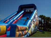
They don't have any pictures of the beautiful 3 choice draft beer and wind trailer, but just so you know, the Fest is Kid friendly :)
They don't have any pictures of the beautiful 3 choice draft beer and wind trailer, but just so you know, the Fest is Kid friendly 🙂

Oh, Don’t forget, next Friday is our Cape Canaveral Friday Fest,  so you get to support our local Artists, Vendors, public schools when you buy their draft beer at the beer-booth 🙂

The next Friday Fest is scheduled for October 7th from 6:00 pm – 10:00 pm.

Activities will include a variety of food vendors, an assortment of novelty & craft vendors, children’s activities including bounce houses, a giant slide & a rock climbing wall, live entertainment along with beer & wine.

Live entertainment will include “Mo Geetz” on Taylor Avenue & “Lonnie & Delinda” on Poinsetta Avenue.

The fun will take place on Taylor Avenue & Pointsetta Avenue.

We have a Southeast swell coming in Saturday night and Sunday morning, bringing strong onshore winds with no visible sign of the winds turning offshore.  It just kind of goes from an incoming ground swell to a lingering windswell (go figure ;).

Sunday should have some size to it, ranging from waist to chest high plus depending on where you surf, but it will be strong onshore winds only.

By Monday the size weakens and then starts to increase Tuesday thru Wednesday, still with strong onshore winds, and with a very low swell period.  So for Tuesday thru Thursday, don’t expect long lines.

Funny thing is, we will still have waves that are rideable, it’s just I am spoiled from all these epic Hurricane Waves with offshore winds.   But I don’t see a dryspell for waves by any means 🙂

A week out, it also looks like another big swell will be coming in, more on that in a day or two.

I will be posting some photo galleries in the next few days,  I’ve been swamped workwise, so my apologies for not getting them up sooner.

Have a great Friday 🙂

oldwaverider
Ophelia update, Photos from today Monday the first day Ophelia in Satellite Beach and Johnson Avenue, Surf Report Monday afternoon (at 4:00 PM) and Surf Forecast for Cape Canaveral n Cocoa Beach (posted Monday September 26, 2011)


This slideshow requires JavaScript.

Full size images below if you want to click on them and see full screen.

Image 1 of 3 shot sequence, Shoulder high backside right at Perkins, Day one of Tropical Depression Ophelia, Satellite Beach, taken by oldwaverider :)
Image 1 of 3 shot sequence, Shoulder high backside right at Perkins, Day one of Tropical Depression Ophelia, Satellite Beach, taken by oldwaverider 🙂


TUESDAY, 7:30 PM UPDATE.  I leave the report below for Wednesday.

IT WAS A FLUKE THING IN REGARDS TO SOME 120 BUOY READINGS, 5 – 30 MINUTE READINGS OF 6 TO 8 SECONDS, BUT THE BUOY WENT BACK UP TO 6 FT AT 12 SECONDS, SO HEAD HIGH DOWN SOUTH AND WAIST TO STOMACH, MAYBE……….CHEST HIGH AT THE CAPE 🙂  

Below is the report from 4 PM earlier on Monday.

Ophelia did downgrade to a Tropical Depression, but that is no need to double your dose of Zoloft or Zanax.  It just means that Tuesday the size may drop a hair, Wednesday and Thursday should have something but not as big either. (that was redundant wasn’t it?)

Image 2 of 3 shot sequence, Shoulder high backside right at Perkins, Day one of Tropical Depression Ophelia, Satellite Beach, taken by oldwaverider

Tonight, if I see anything drastic changing at the 120 buoy, I’ll post an update, as far as a drastic drop in swell size for Tuesday.  I am not expecting it, but I did see 7 feet at 12 or 13 seconds at the 120 buoy, and then a few readings of 7 seconds, but hopefully that’s just fluke data 😉

Alright, so now Tuesday is looking like waist to chest high at the Cape and Shoulder to Head High down South in Satellite Beach, as opposed to Overhead down South.  No big deal.  The winds still look to be SW around 8 mph at daybreak slowing down to 6 or so and WSW until around Noon.  High tide is around 8 AM Tuesday so it could be really perfect from 10 Am till Noon, because of the mid-tide going low that works best for us. (I used Satellite Beach winds on this but they should be close to Cocoa Beach and the Cape)

Image 3 of 3 shot sequence, Shoulder high backside right at Perkins, Day one of Tropical Depression Ophelia, Satellite Beach, taken by oldwaverider

Wednesday,  it still looks to be chest high down South, and waist high here at the Cape.  The winds won’t hang as long, daybreak they should be SW at 4 to 6 mph swinging around to WNW  by 10 Am and NNW by 11 Am so down South the winds bite by 10 AM, whatever 🙂

Thursday we’ll just have to see the impact of Ophelia’s downgrade, but I am sure there will be something rideable, we’ll just leave it at that for now.

Shoulder high backside at Perkins, I think ;)  Tropical Depression Ophelia, Day One
Shoulder high backside at Perkins, I think 😉 Tropical Depression Ophelia, Day One

We have our next Tropical Swell coming in Saturday or Sunday, but we’ll get into that Tuesday or Wednesday.

The photos here I took in Satellite Beach;  Hangers, Hightowers and Perkins.  I got them a little mixed in together, so I’m just gonna call them Satellite Beach photos.  For the most part, Hangers and Perkins were looking the best and Hightowers was looking a little watered down.  That always happens between Hangers and Hightowers, just kind of a 45 minute to 1 hour timing thing.  (I say that because those are my two favorite breaks, and quite often, Hangers will look like it’s holding back and hightowers is going off, and then other times vice-versa)

Image 1 of 3, Hangers (i think or Hightowers), backside left.  by oldwaverider
Image 1 of 3, Hangers (i think or Hightowers), backside left. by oldwaverider
Image 2 of 3, Hangers (i think or Hightowers), backside left. by oldwaverider
Image 3 of 3, Hangers (i think or Hightowers), backside left. by oldwaverider
Image 1 of 3, Satellite Beach, waist high right
Image 2 of 3, Satellite Beach
Image 3 of 3, Satellite Beach, waist high right
Nice shoulder high left at Perkins, Tropical Depression Ophelia, photo by oldwaverider
Image 1 of 3 sequence, Johnson Avenue, Ophelia day 1, knee to thigh high right
Image 2 of 3 sequence, Johnson Avenue, Ophelia day 1, knee to thigh high right
Image 3 of 3 sequence, Johnson Avenue, Ophelia day 1, knee to thigh high right
Contrast...
Contrast...
Image 1 of 2 , Johnson Avenue
Image 2 of 2, Johnson Avenue
Image 1 of 2, waist high right, Johnson Avenue
Image 2 of 2, waist high right, Johnson Avenue

The last few photos, I stopped back at the Cape on Johnson Avenue and snapped a few shots there.  The Cape definitely takes a hit on the swell because of the Bahamas, but we all know the Cape gets blocked out by South and North swells,  aside from an exception once or twice a year.

Get pumped for Tuesday!

Later,

oldwaverider

Tropical Storm Ophelia update, Photos from Lori Wilson last day of Maria, Surf Report Sunday night (at 9:30 PM) and Surf Forecast for Cape Canaveral n Cocoa Beach (posted September 25, 2011)


A fun little thigh high left, taken by Jenna, Sept. 9 2011, Tropical Storm Maria last day.

NOTE AND APOLOGY;  WHEN I DON’T CHANGE OR UPDATE MY BLOG REPORT WHEN WE HAVE A MAJOR SWELL COMING (the last one was Friday), ITS BECAUSE NOTHING HAS CHANGED.  I’LL TRY TO MENTION THAT WHEN I LEAVE A POST UP FOR A FEW DAYS LIKE THAT….oldwaverider

Ophelia says she will be on schedule…the big glassy day still looks like Tuesday, then Wednesday.

The wait...
The wait...

Monday morning ain’t looking as pretty for up North.   The Cape ought to see waist high plus waves in the morning, and chest to shoulder in Satellite.  Winds are whats not pretty.  Expect South winds around 8 to 10 mph at the Cape and Cocoa Beach same, but a 2 or 3 hour window of SSW, surprisingly, Satellite Beach is showing SSW winds from daybreak till 11.  For the Cape, that’s sideshore/onshore, but maybe we’ll get a surprise of a SW gust or two.  By evening it ought to be cranking overhead down South and kicking up maybe chest high plus at the Cape.

A re-entry, photo by Jenna, Sept 9 2011, Lori Wilson Park

Tuesday, ahhhhhh, I hope it holds.  It has been showing head high to overhead for 4 days now for down South, so maybe chest to shoulder high plus at the CapeThe winds look to be SW at daybreak around 8 mph swinging West down to about 3 or 4 mph, and then onshore by Noon or 1.

Wednesday still looks West in the morning, and shoulder high down South, waist to stomach at the Cape.  The winds ought to be pretty light, like less than 6 or 7 mph.

Thursday could also be totally ridable because the animated swell period chart which always follows the swell moving chart with a day of delay, tells me that we will still have a little waist high power.

The pics are taken by my friend Jenna with a water camera, on the last day of Maria at Lori Wilson Park.   It was chest high plus down South, but I figured Lori would be a good place to learn.  Jenna and her brother Travis tried surfing and both got up and rode in numerous times, pretty awesome.  I’ve been wanting to get Jenna to try it for a while, and hoorah, she nailed it 🙂

Anyhow, enjoy Ophelia and take pics and videos and feel free to send em to me.

oldwaverider

Snake update, How the Waves were today (Friday 9/23) in Satellite Beach and Photos from today in Satellite Beach, Update on Tropical Storm Ophelia for incoming waves, Surf Report Friday afternoon (at 12:30 PM) and Surf Forecast for Cape Canaveral n Cocoa Beach (posted September 23, 2011)


This slideshow requires JavaScript.

Full size images below if you want to click on them and see full screen.

Image 1 of 4 shot sequence, longboarder on a perfect glass waist high left.  Definitely a fun cruiser wave for a 3 foot 7 second period wind swell.  We are getting some  from the little NE'ster we've had, along with the first very light push (SSE swell) coming in from 2000 miles away Tropical Storm Ophelia.  Photo by Art
Image 1 of 4 shot sequence, longboarder on a perfect glass waist high left. Definitely a fun cruiser wave for a 3 foot 7 second period wind swell. We are getting some from the little NE'ster we've had, along with the first very light push (SSE swell) coming in from 2000 miles away Tropical Storm Ophelia. Photo by Art

Surf Coming !  Tropical Storm Ophelia is still on track to send us some potentially awesome waves Monday thru Wednesday for now :)…I have some photos I took today for a view at how the Surf was in Satellite Beach.

There was only 2 guys out, I decided to check out Hightowers in Satellite Beach, and it was thigh to waist high, glassy, SSW to SW winds light, and occasionally a stomach high set came in.  I took the shots an hour after mid-tide (like 8:30 AM), high tide going low.  It looked pretty fun and the crowd factor was great, 2 guys out 😉   Okay, now a little about Saturday thru Wednesday surf…

Image 2 of 4 shot sequence, longboarder on a perfect glass waist high left.

Tropical Storm Ophelia should start providing us with some actual long period Tropical Storm waves Monday morning, It appears that Ophelia will not be getting stronger, or at least not by much, but hopefully will at least hold it’s own in the 40 to 45 mph wind range so our swell fetch, remains about the same.

From 2000 miles away, TS Ophelia (an obvious SSE ground swell) is very slowly sending us in some strength to our NE’ster wind swell that’s been lingering for a couple days and until Sunday.  And with this high pressure wind shear up above,  it’s giving us offshore winds in the morning, and when Ophelia gets here,  the shear will also keep Ophelia 800 or more miles off our coast and following Hurricane Alley straight up North with a thank you to God for that 🙂

Image 3 of 4 shot sequence, longboarder on a perfect glass waist high left.  I shot this from the deck at Hightower Park.
Image 3 of 4 shot sequence, longboarder on a perfect glass waist high left. I shot this from the deck at Hightower Park.

So,  Saturday morning, probably the same size as today,  waist high plus down South, and hopefully thigh high at the CapeWinds, SW 4mph at daybreak switching to West before Noon, and onshore probably before 1 PM.

Sunday morning, maybe a foot bigger on the face, maybe, waist to possible chest high, or at least chest high drops in Satellite, and waist high at the Cape.  Right now the winds are looking SSW until 10 or 11 AM, 3 to 5 mph,  so don’t waist your time surfing anywhere North of 6th Street South.  To get the size and best angle on the winds for mirror glass, head to Patrick AFB and toward Satellite.

Image 4 of 4 shot sequence, longboarder on a perfect glass waist high left.  Hightower Park.
Image 4 of 4 shot sequence, longboarder on a perfect glass waist high left. Hightower Park.

Monday morning, too far out to call the winds, but my best guesstimate,  a 12 to 14 second period swell,  is chest high plus down South, waist to stomach at the Cape, SW winds until Noon at best, in the 5 to 10 mph range.

TuesdayI believe to be the biggest day of TS Ophelia, with some 12 second period head high sets down South (may not close out as much as Monday might).  Chest high plus at the Cape with some rogue bigger sets.  Winds,  West to NW winds until Noon or 1 PM , 5 to 10 mph, turning onshore by 1 PM.  *(AGAIN, WINDS ARE IFFY, AND ANYTHING SPECULATED BEYOND 48 HOURS BEFORE SURF-TIME,  IS JUST AN ESTIMATE.  A SOLID PROBABLY 50 % ACCURATE WHEN IT’S HURRICANE/TROPICAL STORMS THAT HAVE BEEN FOLLOWING THE MODELS FOR A COUPLE DAYS IN A ROW)

Nice little thigh high right.  Image 1 of 3 shot sequence.  Satellite Beach.  Friday, September 23 2011, photo by Art :)
Nice little thigh high right. Image 1 of 3 shot sequence. Satellite Beach. Friday, September 23 2011, photo by Art 🙂

Wednesday, could be chest to shoulder high down South, with perhaps the best form of the swell.  waist to stomach at the CapePossibly West winds until Noon in the 5 to 10 mph range.

Thursday, could still have some decent waist high size leftovers, but we’ll stop here.

2011 has been the best year for waves since 2004 in my opinion.  Last year was as consistent, during the Summer and throughout the year, but the Hurricanes last year only gave us one glassy Hurricane (Earl) for a day or two, because all three Canes came a little too soon before the preceding one was able to give us the epic size offshore winds day.

Nice little thigh high right. Image 2 of 3 shot sequence. Satellite Beach. Friday, September 23 2011, photo by Art :)
Nice little thigh high right. Image 2 of 3 shot sequence. Satellite Beach. Friday, September 23 2011, photo by Art 🙂

Enjoy the weekend, and get stoked for Monday thru Wednesday.

PS – About the photos of the snake; it was guarding the Men’s bathroom door when I went to use the facilities at the 16th St. Park.  (NOTE: THE SNAKE IS A HARMLESS CORN SNAKE (RED RAT SNAKE )   Which by the way, the waves were at least a foot smaller than Satellite, and just rideable for a longboard.

Image 3 of 3 shot sequence. Satellite Beach. Friday, September 23 2011.
New Security for the restrooms at 16th street park. (a Harmless Red Rat Snake)
Security shift over ;)  (a Harmless Red Rat Snake)
Security shift over 😉 (a Harmless Red Rat Snake)

Johnson Ave. this morning was clean with some ridable knee to maybe thigh sets.  The Pier will probably or did  have some fun waves for all, is my guess.

oldwaverider

Photos from Thursday Tropical Storm Maria (taken Thursday, 9/15/2011) and How the Waves were, Insane 20 foot overhead barrels Teahupoo video from the BILLABONG PRO TAHITI 2011, Surf Report Saturday afternoon (at 1:00 PM) and Surf Forecast for Cape Canaveral n Cocoa Beach (posted September 17, 2011)


Music by the Fyoogs http://thefyoogs.com

(That’s the kind of music that should be in a surf video, as opposed to rap 😉

This slideshow requires JavaScript.

Full size images below if you want to click on them and see full screen.

Image 1 of 5, MIke on a shoulder high right at 4rth street, Tropical Storm Maria, Thursday September 15, 2011, taken by yours truly :)
Image 1 of 5, MIke on a shoulder high right at 4rth street, Tropical Storm Maria, Thursday September 15, 2011, taken by yours truly 🙂

Okay, you know my obsession with huge wave video…This was the contest that Kelly Slater won (as I mentioned in a post a week ago), where Kelly skipped the J-Bay ASP event to catch the Epic 30 foot plus Fiji surf back in July at Cloudbreak, which gave him the warmup that he wanted or needed to explode at Teahupoo Billabong Pro.  Some of the waves in this video have 20 foot plus overhead barrels, and some brutal looking wipeouts. Okay, my digression is over, back to Maria photos and incoming surf…

Image 2 of 5, MIke on a shoulder high right at 4rth street, Tropical Storm Maria, Thursday September 15, 2011

We have our incoming windswell Nor’easter rolling in, it just hit at 11 AM,  4.5 ft at 9 seconds at the 120 buoy and the 20 mile is showing 3.5 feet at 10 seconds, so we should be seeing some waist high choppy waves at the Cape and some chest high chop down South.  It appears that this wind swell is gonna hang for the next 3 to 5 days, around the same size, and with onshore winds.  At least we’ll have something rideable, though I’m just gonna let my wounds heal from the last two hurricanes/tropicals 🙂

Image 3 of 5, Tropical Storm Maria, Thursday September 15, 2011
Image 4 of 5, Tropical Storm Maria, Thursday September 15, 2011
Image 5 of 5, Tropical Storm Maria, Thursday September 15, 2011
Image 1 of 3, Mike on a shoulder high left, Thursday September 15th, 2011, Tropical Storm Maria, photo by Art
Image 2 of 3, Mike on a shoulder high left, Thursday September 15th, 2011, Tropical Storm Maria, photo by Art
Image 3 of 3, Mike on a shoulder high left, Thursday September 15th, 2011, Tropical Storm Maria, photo by Art

The photos are from Slater Lane/4rth street North on Thursday (9/15/2011) taken by myself of my old surf buddy from Lakeland Mike.  The first set is a sequence of 5 shots of a nice shoulder high right.  The next is a shoulder high left of 3 shots.  Really fun, epic day!

I’ll be posting more photos from the Cape and the neighborhood, and some more photos from Katia down at O’ Club, in the next week.

Later,

oldwaverider

Photos from the 2nd big day of Katia, How Maria’s waves were the second day at the Cape, How Maria will be Thursday and Friday, Sea Lice and Jellyfish Alert, Surf Report Wednesday afternoon (at 3:00 PM) and Surf Forecast for Cape Canaveral n Cocoa Beach (posted September 14, 2011)


This slideshow requires JavaScript.

Full size images below if you want to click on them and see full screen.

This is what we are seeing on the beach and in the water today, when they feel like they weigh 15 pounds while they are filled with water. The images came from the following website:  http://www.asdn.net/asdn/nanotools/afm_in_liquids.shtml
This is what we are seeing on the beach and in the water today, when they feel like they weigh 15 pounds while they are filled with water. The images came from the following website: http://www.asdn.net/asdn/nanotools/afm_in_liquids.shtml

OUCH!  Man, the Sea Lice were absolutely brutal today.  The Moon Jellyfish were also floating around in their 8 inch to 1 foot diameter glory.   After I felt like someone was testing out a low amperage taser inside my boardshorts,  then I was forced to do 3 or 4 reverse dumbell curls with a 15 to 20 pound jellyfish 😉  Overall, it’s pretty funny to think about.  The water at the Cape was not crowded, gee, I wonder why.  (The reason why the 15 or 20 pound jellyfish, is because I guess this type of Jellyfish really holds water while floating)

Dropping in for a sweet left at O' Club, Thursday Sept. 8 2011, Hurricane Katia, photo by Me :)
Dropping in for a sweet left at O' Club, Thursday Sept. 8 2011, Hurricane Katia, photo by Me 🙂

Note:  As I mentioned a week or two ago, the Sea Lice are larvae from jelly fish, and are the little critters that crawl up your shorts.  However, for those that get nailed by a Moon Jellyfish (this text is from http://www.longbeachislandjournal.com/animals/moon-jellyfish; Fortunately the stingers of this species are relatively mild. Most people that come into contact with moon jellyfish have little reaction. Some may feel a bit of a stinging sensation but even this can be relatively mild compared to what can occur with more troublesome jellyfish species. Many moon jellies you find no longer have any stingers attached to them.  Okay, now that that is out of the way, back to surf conditions, Photos, etc.

2nd shot in sequence, Hurricane Katia, Officers Club

The photos I took last Thursday, at O’ Club, September 8th 2011, and as I mentioned in a post a couple days ago,  Thursday morning, it was huge like Wednesday, 1 to 4 foot overhead, not peeling as good, more closeouts, and by 11 ish the size dropped to just overhead, and by the time I took these pictures, it was shoulder to head high, with an occasional overhead wave.  It was the first time I used the camera, so yeah, the lighting bites, the sun was glaring on the LCD screen, so it was almost guesswork  🙂  But it was pretty cool, cause the 16 power zoom brought 250 yard plus surfers in fairly close.

3rd shot in sequence, Guess it closed out :) Hurricane Katia, Officers Club
3rd shot in sequence, Guess it closed out 🙂 Hurricane Katia, Officers Club

How the Waves were today, around 8 AM at the Cape, it was waist to chest high and peeling left and right beautifully.  The winds were NNW around 6, and switched North before 11.  There were more closeouts than yesterday, but if you waited 5 or 6 minutes for a wave there were 100 to 150 yard rides to be had.  I saw Scooter get a few on his 7’2″ inch Quiet Flight board.  I don’t know if his trip to Costa Rica had anything to do with his being all over the face of the waves, but he was definitely having an entertaining rip session.  His wife was having a great longboard session and was tough as nails with the Sea Lice and Jellyfish 🙂

Image 1 of 6 shot sequence, Hurricane Katia, Officers Club , Sept. 8 2011

Thursday, size should be around stomach to chest high at the Cape and close to head high in Satellite Beach.  Winds ought to be WSW at daybreak in the 5 to 8 mph range  (and a few hours before, so there probably won’t be any 7:00 AM morning sickness like there was today).  The winds swing around to NW by 10, NNW by 11 ish, and onshore by noon,  so again, don’t hang out late tonight if that keeps you from a great early morning session.  High tide was around 9:30 AM today so I guess that brings it to 10:20 Thursday.

Image 2 of 6 shot sequence, Hurricane Katia, Officers Club , Sept. 8 2011

Friday the size drops but should still be thigh (Cape) to stomach (down South at Patrick or Satellite) , winds light SW by daybreak swinging to NNW by 11 ish, and then onshore.

We have a Northeaster swell that rolls in on top of the leftover Maria waves Saturday, but it should be brisk NE winds to go with it, so don’t get your hopes up for perfection, if you look at it that way, then maybe it’ll be fun.

Image 3 of 6 shot sequence, Hurricane Katia, Officers Club , Sept. 8 2011
Image 4 of 6 shot sequence, Hurricane Katia, Officers Club , Sept. 8 2011
Image 5 of 6 shot sequence, Hurricane Katia, Officers Club , Sept. 8 2011
Image 6 of 6 shot sequence, Hurricane Katia, Officers Club , Sept. 8 2011

Man we have been blessed with great waves!

Have a great Thursday sesh!

oldwaverider

How Maria’s waves were the first day at the Cape, Photos from Tropical Storm Maria, Maria waves for Wednesday, Sea Lice and Jellyfish Alert, Surf Report Monday night (at 6:00 PM) and Surf Forecast for Cape Canaveral n Cocoa Beach (posted September 13, 2011)


This slideshow requires JavaScript.

Full size images below if you want to click on them and see full screen.

Dr. John pulling a hard right bottom turn, the first real day of Tropical Storm Maria, at the Cape.

The photos here are from the Cape today.  It was thigh to waist high and glassy early at the Cape, but we all got out late…Or at least I did, okay, had some work to do 🙂  Down South I haven’t heard but I assume it hit chest high solid today.  Dr. John for the first two pics, then Ron, followed by Chad.

(My apologies, I left the camera on full zoom from taking 250-300 yards out pictures down South from Hurricane Katia last Thursday,  so the centering got screwed up on a lot of these pics, still learning my friends camera 😉

What is Maria gonna bring us for Wednesday and Thursday ?  Besides Sea Lice and Jellyfish? (actually I didn’t find them to annoying but for some, the reactions to the Lice were more intense)

Wednesday will be close to chest high for the Cape and Head high plus down South.  RC’s will probably have a few one foot overhead drops…yeaaaawwwwwwwww!   The Cape should have 8 mph NNW winds until around 10 AM, then onshore.  Satellite Beach is showing NW winds until 10 AM so actually, Satellite Beach with light NW winds,  that is the place to be.  It will have some overhead drops and shoulder high lines.

Dr. John on a medium size left for the day.  Maria day one at the Cape.
Dr. John on a medium size left for the day. Maria day one at the Cape.

Thursday, about the same, the period of the swell drops a bit and maybe the size 6.4  inch drop, almost chest high Cape, head high down South.  The winds though are better,  4 to 8 mph WNW winds at daybreak so down South will have the size and form.  The winds swing around to NNW by 11 ish so don’t wait around to get out 😉

Friday, who cares?  Just kidding;  Probably waist to stomach at the Cape, and chest to shoulder high down South, and probably a few hours of offshore winds until 10.  Wednesday night I’ll have a fix on the actual wind direction and speed.

We may have a NE’ r wind swell coming in Friday and Saturday but don’t expect much from it.

The pics are from the neighborhood taken late around 9:30 to 10 AM, it was already blowing N, but still fun waves and the shoulders held up great so we may be in for a really sweet session Wed and Thurs if the swell gives us that kind of

Chad on the wave of the day...with no wax on board ;)
Chad on the wave of the day...with no wax on board 😉
Ron on a perfect medium size 'backside' right.

foreshadowing 🙂

oldwaverider

Tropical Storm Maria waves for Tuesday, Hurricane Katia photos from Thursday 9/8/11, Surf Report Monday night (at 9:00 PM) and Surf Forecast for Cape Canaveral n Cocoa Beach (posted September 12, 2011)


This slideshow requires JavaScript.

Full size images below if you want to click on them and see full screen.

This was actually image 1 of a 3 shot sequence.  Officers Club on September 8 2011 from Hurricane Katia, after the swell had dropped a few feet by early afternoon.  Photos by Oldwaverider
This was actually image 1 of a 3 shot sequence. Officers Club on September 8 2011 from Hurricane Katia, after the swell had dropped a few feet by early afternoon. Photos by Oldwaverider
Nice shoulder to head high right.

I have a couple of photos here I took at Officers Club, last Thursday (9/8/11)  afternoon shots…And Maria’s waves are coming in for at least Tuesday thru Thursday, and probably a day longer.

Maria’s first noticeable waves will be in Tuesday morning.  Waist plus at the Cape, and it should be chest high plus down SouthSW winds from daybreak to 9ish, switching to NNW by 10 ish and onshore by 11 or so.

Wednesday could be some head high waves South and chest or less at the Cape.  Winds looking to WNW at daybreak, switching to NNW by 10 ish and then North.  Wednesday looks to be the swell peak mid-day maybe but it shouldn’t drop much on Thursday.

Thursday , possible chest at the Cape and shoulder to head high down South.   Might be slight offshore, but by Tuesday night I’ll have a more accurate wind guess 🙂

Same wave.
Same wave.

The photos were from last Thursday (9/8/11)In the morning it was about the same size as Wednesday but not as many open shoulders. More closeouts.  Size was still 1 to3 foot overhead plus, and started dropping by noonI took these photos around 1 PM, but they were still some really fun looking waves.  I have a lot to learn on camera settings 🙂

Tropical Storm Maria update, Surf Report Monday Morning (at 7:15 AM) and Surf Forecast for Cape Canaveral n Cocoa Beach (posted September 12, 2011)


There may be some chest high surf down South if you’re willing to gamble the drive.  Maria actually came in a little at the 120 buoy last night and even trickled in there late morning yesterday.

We have offshore winds this morning, so at the right spot down South a little, even though it’s high tide at 8:10 AM, at 10 AM you may have some decent size around chest with SSW winds for an hour or so.  We will update this in a couple of hours, but just for those wanting a Monday morning surf adjustment 🙂

September 11th, 2001 remembered, Tropical Storm Maria update, Surf Report Sunday Morning (at 8:30 AM) and Surf Forecast for Cape Canaveral n Cocoa Beach (posted September 11, 2011)


A beautiful resort now on the site of the once desolate surf break of K-38 Mexico.  Taken by a surf buddy Rob in Newport Beach, Ca
A beautiful resort now on the site of the once desolate surf break of K-38 Mexico. Taken by a surf buddy Rob in Newport Beach, Ca
September 11, 2011…10 years passed.   I was in Lakeland, on Sunday morning after the attack on Tuesday.  I heard the most beautiful and incredible version of “Let There Be Peace on Earth” sang in church as a solo by a woman at First Methodist Church, a woman who was in Manhattan 5 days berfore on the day the Planes hit the Towers. Needless to say, she had a fair amount of emotion when she sang the song to her home congregation in Lakeland.  (this is actually a blog and not a surf report so I have to digress once in a while 🙂

Tropical Storm Maria update…Maria models have dropped a bit in size, not much but some.

Wednesday looks to be the biggest day still, with slight NNW offshore winds at North wind breaksProbably overhead by a foot or two down south with sideshore winds, and chest to head high in the Cape through North Cocoa Beach in the semi-glass to maybe glassy wind direction.  By Monday night I should have more accurate wind data.

Thursday is now looking to be the glassiest day, in the chest to head high plus range depending on where you surf.  As we always mention, winds can be iffy, at least until 36 to 48 hours prior to the day.  But it looks as though West winds for the better part of the morning and then onshore by noon.

Friday it looks to drop off, but by Wednesday we should have something more definitive.

We did have something hit the 120 in the 3.5 to 4.3 foot range at 11 seconds, so there could be something ridable at the right tides today, but with slight onshore winds.

Count your blessings with all this great surf we’ve had this year 🙂

oldwaverider