I will share more tonight to see how the swell is coming in.

Monday is looking really fun, early. Rib to chest high down south and glassy !

Keep your eyes out for clean and maybe glassy waist to some chest high waves Friday morning! More later today 🙂
Check out the surf video I posted on my last post, from Hurricane Edouard , from Thursday morning!
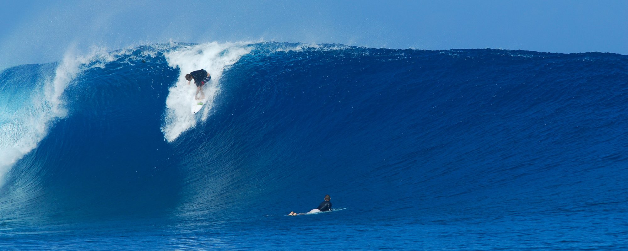
The video below has some really nice talent on 5 on 6 waves from Hurricane Edouard. I shot the footage around 10 AM in the morning, after my session. Location was Satellite Beach and was breaking from Chest high to an occasional 2 foot overhead drop. Beautiful Day, Great Surf, and some nice Eye Candy too 🙂
Three or four surfers trying to beat the wave , with a pretty respectable attempt 🙂
A killer outside set, beautiful set…
The winds will be turning North by late morning, so winds will be offshore North of Minuteman Cswy. Should be Chest high to some overhead sets with West NW to NNW.
Have a Great Surf Day and thank God for Safe Hurricanes!
We were all hoping to see a trace of swell at the beaches tonight before dark. Oh Well ! :<(
It did hit the 120 mile buoy out from the Cape at 4 PM. Just a trace. The swell out there as been 1.4 to 2 feet at 7-8 seconds. At 3:50 PM, it finally hit 2.3 feet at 13 seconds, and then a couple 8 second readings. Anticpation………………………..Below are 3 charts. The first is the Swell at 6 am Wednesday morning, the second is the power of the swell period at 6 am and the third is from today at 3 PM the Swell Period. Notice how the period hit the beaches way before the waves did. Very strange. Low end, 2 foot over head waves. High end for Wednesday, 5 foot overhead (down South and maybe, just maybe the Pier 🙂 My calls are below.

Wednesday at 9 AM, (daybreak should still be chest high or bigger), but by 9 AM, before the scattered thunderstorms are supposed to start around 10 AM, I believe there will be some size. At the Cape, The Pier, head high to 2 foot overhead, with rogue bigger sets. Satellite Beach may show some 1-3 foot overhead sets. By 1 or 2 PM, it could jack up to a consistent 2-4 foot overhead for the big sets. Deep down, I think a 4 or 5 foot overhead rogue wave will not be uncommon at the Rock Reef breaks in Satellite Beach. The winds could blow as hard as 10-16 mph WSW. Those winds should slow down a little thru the day.

Thursday, it should be solid shoulder high to overhead in the morning, with the size dropping thru the day. Offshore winds in the morning, and the winds should be NW turning NNW to North, so Satellite does crank with NW winds, but it you get out late, stay North of Minuteman Causeway, to catch the North wind breaks.

Have fun, be safe, and watch for the Thunderstorms coming from the central part of the state. Those could kick in as early as 9 or 10 am, and should keep coming all day.
Oldwaverider
What does 4.5 feet at 16 seconds really mean? And the swell peaks around 9-12 Wednesday at 5 feet at 15 seconds. Well…see below my Wednesday, Thursday call to see why it could hit close to double overhead for a few hours late morning in Satellite Beach till maybe, 1 pm Wednesday. Leslie in 2012 a month before Sandy was 4.3 feet at 13 seconds and delivered some 11 foot faces at RC’s.
 Wednesday morning, I am calling 2-3 feet overhead at the Pier, with freak sets that are bigger. By noon, I suspect Satellite will have 3 -4 foot overhead big sets, and bigger rogue sets. Winds should be 10 to 15 mph West.
Thursday, shoulder high to 1 foot overhead at the Pier and Satellite, with bigger sets. NW winds until 11ish, then sideshore winds.
Friday, barely leftovers with a new swell coming in for Saturday and Sunday in the thigh to waist high range. Waves for 5 days, yeah!
You have to consider a few things. A swell that comes from Africa, has a chance to develop a great deal of power even when the swell size is smaller than say a Sandy which traveled from the Caribbean. Sandy hit 18-20 feet at 17-19 seconds, but the swell could not travel far and reach the deep ocean depth that a storm from Africa can. Sandy was freak huge due to the power of the hurricane, yeah. And, Sandy did not closeout, hardly at all. Eduard, the fetch of the swell (the width, and height, is much much taller than the U.S. from Florida to Canada. Look at the Period chart. It is so big, and so perfectly uniform like the Nov 10 2011 swell. That swell was 6 feet at 11 seconds, but 5 feet at 15 seconds is a lot of power. We’ll see. I’m rambling kinda 🙂
Anyhow, Eduard could be 3 to 6 feet overhead when it hits the better spots. It will be 1000 miles form our coast, maybe a little less, but it has generated some power. A 15 second period has a wave traveling at you at 45 mph. An 11 second swell, travels at you in the lineup at 33 mph. 50% difference.
Basically the Same outlook as my post on Saturday. Wednesday morning is the big offshore day with West winds most of the day. Size, 5 feet at 15-16 seconds will produce 3 to 5 foot overhead waves.
Thursday , as it stands, is looking over overhead with NW winds early, so get a real early start Thursday.
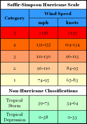
Hurricane Edouard is expected to hit a Category 2 Hurricane on Tuesday.

When does Edouard provide the first great Surf Day? Today marks the 3rd day that Wednesday will be big and offshore winds in the morning. What does big mean. The models for Hurricane Edouard show 5 feet at 15 seconds between 6 & 9 AM Wednesday morning. Note: Hurricane Leslie, was a 4.5 feet at 13 second period swell. Quite a bit less powerful than Edouard so far. See the rest of Forecast below Surf photo. At the bottom of this post is the path of Hurricane Edouard, an image from Channel 13 news Hurricane Tracking.
Below is a photo my friend Mike Melito took of Hurricane Leslie :
So what does the Forecast for Wednesday thru Saturday look like for Hurricane Edouard?
Wednesday is the peak of the swell, with 5 feet at 15 seconds most of the day. Size 5-7 foot swell, produces 2 to 5 foot overhead waves. West winds at 8 to 12 mph, and turns onshore by early afternoon.
Thursday swell size, 4-6 feet early, and 3-5 feet by 10 AM. Should be overhead to 2 foot overhead plus in Satellite Beach, with offshore winds , but only for a few ours in the morning.
Friday swell size, 2-4 foot, so it should be waist to chest high and even bigger sets. It may be offshore, but it’s still too far to confirm what direction.
Eduard should be in Tuesday night, and for two days running Thursday looks overhead and offshore. And now Wednesday looks to be offshore and way overhead, with a Friday chest to head high glassy day of leftovers. But we will see… 🙂