Today was almost Epic! Thursday morning, could be better :) if the offshore winds do happen! , Surf Report and Forecast for Cape Canveral, Cocoa Beach and Satellite beach, posted 4:00 PM 08/27/2014


Wednesday night 9:30 PM update!  THE BUOYS ARE BIGGER AND MORE POWERFUL THAN THEY WERE IN THE LAST 36 HOURS!  120 Mile Buoy hit 9.5 feet at 11 seconds (strongest period yet for this swell),  and the 20 mile buoy hit 6.6 feet at 11 seconds, also bigger and stronger than anything today or yesterday, and the reading I just listed was for 8:50 PM Wednesday night!

Today, was almost Epic! Plenty of 100 yard rides to be had, with lots of power.  And yes, there were plenty of entertaining close-outs, but you could let many of them pass by with good judgement 🙂  The almost perfect form, size and power, did not really kick in until around 10:00 AM.   After 10, size climbed a foot on the face size, and the power increased significantly!

The Video below, is a good example of the form we had today, though the size was perhaps, a foot bigger today for Hurricane Cristobal. (The Video is actually from a November 23, 2012 shoot that I did in Satellite Beach)  I just wanted to share how nice the form looked and worked today.

Thursday morning, we should expect the same size as today, if not 6 inches bigger, and I believe the power will be 20% more punch on Thursday.  Why?  The period of the swell increases overnight.  The winds are expected to be 3 to 5 mph onshore E to NE, but again, we could have an hour or so of offshore winds.  Either way, it should be pretty good form and long rides Thursday!

Friday, size drops to waist high with light onshore winds, which will give the NKF Rich Salick Pro/Am Surf Festival/contest something to make it worthwhile to have a contest.
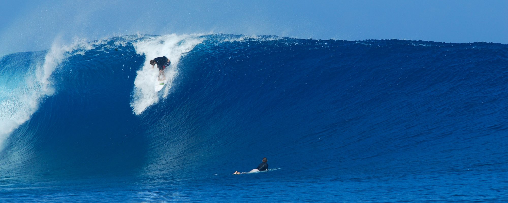
Thursday 8/28 still looking Great, and if the offshores come true then Epic! Check out our Hurricane Bertha Video , plus a Kilometer long Barrell ride video, plus Update on Tropical Storm Cristobal, Surf Report and Forecast for Cape Canveral, Cocoa Beach and Satellite beach, posted 5:45 PM 08/26/2014


Thursday is still looking like the Crystal Ball could be an Epic reading for us…  But then, watch out for Wednesday!  I am re-posting our Hurricane Bertha surf video here:

Video by: http://www.walkonwaterproductions.biz

Wednesday should be slight offshore for the Cape and head high to overhead between the Cape, and some North CCB breaks.   Winds should be North in the 6 to 8 mph range at daybreak till around 10 AM.  That is slight offshore for the Cape.  And with the old land, cooling down faster than Sea scientific fact, it could blow NNW Wednesday morning for an hour.

Thursday, still looks to be chest to overhead, with winds from the models showing offshore till maybe 10 AM, but Weather.com shows 3-4 mph onshore at daybreak.  We’ll wee.

Benji Brand in a 1 Kilometer long barrell ride

Friday with leftovers for the contest, waist to stomach high maybe offshore, we’ll see.

Tropical Storm Cristobal Update plus the NKF Labor Day Surf Festival at Cocoa Beach Pier August 29 through September 1, 2014


Will we see Tropical Storm Cristobal Monday morning?  Yep!

It hit the 120 mile buoy at 12 Noon today, around 3 feet at 10 seconds, and just hit 4.6 feet at 11 seconds at 6:50 PM reading.  At 8 am this morning, the swell that was out there was 2.3 feet at 6 or 7 seconds.

Monday morning, it should be around waist high, because the winds will be onshore, but maybe under 10 mph up until 8 am, then pickup up to 10 to 15 mph my guess by noon.  It most likely will be raining with thunder storms around in the morning too. By Monday at 6 PM, it should be solid head high down south, maybe overhead, and chest to shoulder high at the Pier.  Tuesday, size should jack up another foot on the fact, with head high onshore chop at the pier with bigger sets, and head high to a foot or two overhead down south.

Wednesday morning should be shoulder to head high with 8 to 12 mph onshore winds, with the winds possibly backing off a little all day.  So , if you can get out, wait till 9:30 or 10 (high tide at 9:30), and catch it to mid tide high going low, with the winds slowing down a bit.  Swell size starts to drop after 3 or 4 pm, as the models show right now.  Wednesday should be a lot of fun.

Thursday, size drops off quite a bit, but still may have some chest high waves with even lighter onshore winds, like 4 to 8 mph, so it should be lots of fun Thursday.   Friday should have some fun leftovers for the Surf contest, in the waist high plus range, light onshores, maybe offshore early.  Saturday, will most likely be longboard only with offshore winds.

We’ll post more accurate winds Monday night to see what to expect for Wednesday.  All these forecasts could change if the storm weakens, picks up speed.  (disclaimer done 🙂

Want something to do next weekend?  Here ya go,  the NKF Labor Day Surf Festival, and here is a screenshot of the website, check out all the events! Follow the link to check it out at their website here:


29th Annual NKF (National Kidney Foundation) Rich Salick Pro/Am Surf Festival at Cocoa Beach Pier and other locations

Big Storm Waves Coming! Thursday looks to be the Potential Epic day, for now. Surf Report and Forecast for Cape Canveral, Cocoa Beach and Satellite beach, posted 6 PM 08/23/2014


Sunday afternoon late, we should see some of the swell rolling in with waist high waves.  The Groundswell/Windswell model, appears to build from Sunday thru Wednesday, peaking in the 5 to 8 foot range.  Thursday, if the storm holds together, could be the big glassy day with overhead waves and offshore winds in the morning.  The video below is of Hurricane Bertha in Cocoa Beach, 4rth street, from August 5 2014, shot around 10 AM that Tuesday morning. (it is still processing at YouTube, so by 7 PM or before, it should be ready)

For now, expect Sunday to have something around waist high late afternoon.  Monday builds all day with probably some head high faces before dinner timeOnshore winds.  Tuesday more of the same, but building.

Wednesday, could be the crazy day, anywhere from Overhead to 3 foot overhead with onshore winds.  The fetch (diameter of the storm), is not that large, maybe 500-700 miles, and it cruises from a hug the Bahamas on the East side very close, parallels the coast, and if it holds together, as it passes Brevard by a 100 miles or so, we could have epic overhead waves with brisk offshore winds Thursday morning, or whenever the storm passes by and holds together of course.

Get excited folks, get some exercise, sunscreen and make sure your boards are prepped!

Oldwaverider

Ground swell coming! Starts rolling in late Sunday August 24th, with some size Monday, Tuesday lasting thru Thursday perphaps, Surf Report and Forecast for Cape Canveral, Cocoa Beach and Satellite beach, posted 10 AM 08/22/2014


Actually, I shall wait until Saturday afternoon.  Since the swell appears to be rolling in Sunday afternoon, Monday may be the big day, big chop of course, but it appears that Tuesday, Wednesday, should have some size, with maybe a glassy waist high leftover Thursday 🙂  Updated 10:41 PM Friday night

I will give a full updated report, a little later today, but know, we do have a Ground/Windswell coming!

Oldwaverider

Bertha Surf Video, Bertha delivered big, both Tuesday and Wednesday :) Thursday evening Surf report at 8:30 PM, forecast for Cape Canaveral , Cocoa Beach and Satellite Beach , posted 08/07/2014


A Small Southeast swell is rolling in, during the day Friday and will be here through Saturday.  We could have some knee to waist high waves with offshore winds both mornings.

The video below is an unknown surfer at 4rth street in Cocoa Beach on Tuesday.  I hope to have a 2 to 4 minute video of Big Tuesday in the next week.  Wednesday had some waist high plus waves too, at O Club and south, however, no video from Wednesday.

video by WalkonWaterProductions.biz

Oldwaverider

Is Bertha Gonna Deliver? 6 days the models say yes ! Tuesday August 5th is still on track for Chest high waves plus ! Monday afternoon Surf report at 4:30 PM, forecast for Cape Canaveral , Cocoa Beach and Satellite Beach , posted 08/04/2014


I shot this photo in Satellite Beach around 1:30 PM,  the afternoon of Hurricane Sandy, right after my session. October 28, 2012, by Oldwaverider :)
I shot this photo in Satellite Beach around 1:30 PM, the afternoon of Hurricane Sandy, right after my session. October 28, 2012, by Oldwaverider 🙂

Is Bertha going to give us Size and Perfection tomorrow morning?

Well, we should see Chest high plus sets Tuesday morning, with offshore winds in the 8-12 mph WSW direction until after 1 or 2, then SW.  High tide is 2:36 am, CCB and the Cape.

The swell just hit the 120 mile buoy at 3.9 feet at 13 seconds at 4:50 PM Monday , well today 🙂  It should take around 6-7 hours to hit the beaches.  At 13 seconds, it should travel around 20 mph toward the beach.  11 seconds travels around 17 mph, so yeah, I interpolated 🙂

This photo is from Sandy, a photo that I shot right after my surf session, and no, it won’t be this size, but I just wanted to let my Adolescence run rampant with enthusiasm and optimism…

Tuesday still on track for Chest high waves plus ! Tropical Storm Berth has held it’s strengthening, and offshores for Tuesday Swell August 5 2014. Sunday morning Surf report at 9:15 AM, forecast for Cape Canaveral , Cocoa Beach and Satellite Beach , posted 08/03/2014


Any changes on Tuesday morning?  Nope!  Still looks to be chest high waves, and head high plus drops on some of the set waves , with offshore winds till noon or past 🙂

Tuesday-08-05-14-6am-Swell-Chart-on-08-03-14-at-9am-Thanks-MagicseaweedWednesday morning should be rideable ,  probably in the knee to thigh high range w bigger sets.

Crazy thing is, Outer Banks/Cape Hatteras is going to have an 8 foot at 13 second period swell Tuesday at noon, when we are having a 3-4 foot swell at 10 seconds.

We’ll take what we can get, and give thanks!

Oldwaverider


Tuesday-08-05-14-6am-Period-Chart-on-08-03-14-at-9am-Thanks-Magicseaweed

Storm has strengthened slightly! Tropical Storm Bertha our named storm for our Tuesday Swell August 5 2014. Chest high ground swell now I predict now, Saturday morning Surf report at 9:15 AM, forecast for Cape Canaveral , Cocoa Beach and Satellite Beach , posted 08/02/2014


Tuesday morning, for 4 or 5 days running, appears to be the big and offshore day folks 🙂   and…

Mike Melito - a nice right - TS Maria-Sept-2011-DSC03722Tuesday, We are looking at stomach to chest high waves, with bigger sets during the unexpected moments, haha !  Offshore winds appear to be from daybreak until noon.  I’ll give you a Sunday night update on the winds, when our favorite online news source can provide that for us, in the required 48 hour window.  Wednesday looks fun too, thigh to maybe waist high, and glassy, but the swell drops off fast after lunch perhaps.

The photo could be indicative of some of the set waves that we will be getting Tuesday, August 5 2013 with Tropical Storm Bertha.

The surfer is my friend Mike Melito, and is a shot of him surfing behind his Cocoa Beach home away from home, at fourth street North.

Track the storm on Tuesday morning here on our site.

Oldwaverider