Ground Swell still on track for Monday , 04-22-17 , waist to chest glass, posted 04-22-17 around 2:30 PM


Okay, I stopped surfing for 5 months, but Rip Van Winkle is alive again…

Here’s the challenge, Monday 04-24-17, we have a nice ground swell in the 2-3 foot range at 12-13 seconds, which could produce some head high faces on the biggest sets.  But, we do have high tide at 6:40 AM, for Satellite Beach,  we also have a front coming in from the Gulf it appears that will be sending powerful off shore winds cranking over the 10-15 mph range by perhaps as early as 10 or 11 AM Monday morning, and then increasing throughout the day.

It may be fun all day, but along with powerful west winds, there is also a 50% call for Scattered Thundershowers at 10 AM.

So, get out early, and find the best high tide break, and hopefully we’ll get 2 hours of really fun chest high surf 😉

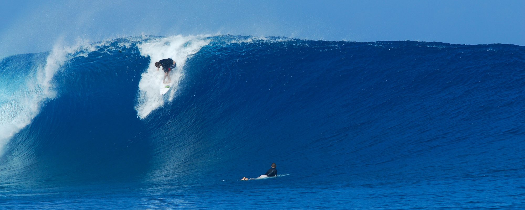
I just love this feeling of making it, just barely over the top, compliments of magicseaweed.com, the article if you haven’t read it, about Grant Twiggy Baker is here:

One of those moments...Grant Twiggy Baker, at the maiden Nazare event, compliments of magicseaweed.com

Oldwaverider

Hurricane Gaston to be, could play out to be medium big and glassy for Us! Posted 11:00 AM Tuesday August 24 2016


Gaston-Only-Intensity-Model-08-24-16-at-11am-EST-compliments-wunderground.comCould Gaston actually bring us Big Glassy Waves?

I believe so, and here’s why:

First, Fiona is gone, so that takes away more onshore winds from 3 storms back to back.  Then, Storm 99TL, is expected to fizzle out, while Gaston intensifies.  (I added this part around 3:15 PM Wednesday, and that is, that I shouldn’t say, Storm 99TL fizzles out, because it actually will be the reason why the offshore winds that I hope arrive on Wednesday & Thursday, that is why they are so strong and adding winds out of the South to the offshores coming from Gaston.  With Fiona gone, that is why we can at least have some offshore winds.  But if 99TL is 45 mph winds and grazing over the Caribbean,  even though it doesn’t take a Northern climb, that is still enough to send a Southernly breeze up toward our coast.  I sure hope it does fizzle out though, not only for our surf, but also, more important, so people don’t have harm or damage around Cuba, Haiti & the Bahamas)

Storm details say that Gaston turns hurricane on Saturday.  But still not far enough North of us to have offshore winds by then.  However, then an upper wind shear (a low I believe) will weaken Gaston a little, and then by day 5, Monday,  it is expected to intensify up to perhaps 100 mph winds.  That is probably why the Magicseaweed.com models show such good waves for Wednesday thru possibly Friday.  This makes sense, because by Monday sometime, the storm is expected to head North as opposed to it’s current WNW bearing, and once it is a couple hundred miles North of us, wallah, those offshore winds.

Big-Wundermap-Models-99TL-n-Gaston-Storms-for-Saturday-08-27-16-at-6am-prediction-compliments-wunderground.comKeep in mind, that this storm is much further out than our normal hurricanes from Africa.  This one will be about 2000 miles offshore.  So that is why the models show a 3 or 3.5 foot swell at whatever, 13 to 15 seconds.  But remember, Hurricane Leslie of 2012 was 4 feet at 12 seconds and gave us some 11 foot face waves in Satellite Beach 🙂

It’s still far out, but I think we will get 2 glassy days (Wed & Thurs perhaps next week), maybe the first a late afternoon glass, but nonetheless, 2 days of chest to 1 foot overhead, and glassy, at least down south.  And the typical 20-40% smaller up North but still perhaps awesome.

Oldwaverider
Will Tuesday morning be the sweet spot?


The swell for this weekend has been acting like a Black Friday shopper, not making up it’s mind, so is it going to deliver?  I have the 2 charts below, Swell and then Period chart for Monday at 6 am (although, tuesday looks to be the best surf day), but the Monday Period chart, shows that it is a fairly organized swell, very close to a ground swell with a fetch that goes much wider than the map of the U.S.

Swell-Size-Chart-for-Mon-06-20-16-6am-EST - Compliments of Magicseaweed.com for imageryI believe Tuesday is going to the most fun day.  Not the glassiest, but nice size and semi-clean.

The model has finally been holding for 2 days in a row now.  It’s pretty strange to have a NE swell this time of year, let alone a NE swell with this steep of a North angle to it.


Period-Chart-for-Mon-06-20-16-6am-EST - Compliments to Magicseaweed.com for imagery :)The Cape and the Pier will be blocked out quite a bit, but by Tuesday, we should all have something to ride, and I believe down South , in Satellite Beach, we can expect solid chest to head high waves, with winds which are hard to call yet, but probably slower than the charts say.  For now, I’m calling 5-10 mph ENE winds, and pretty decent form.  There is only one 2ndary swell behind the major swell, and it is aiming straight East, with less than a foot at 10 seconds, so it shouldn’t be doing anything funky to the form 🙂

Incoming Swell for Friday and Saturday looks fun ! Posted Thursday March 31 at 11:15 AM.


Our incoming windswell for Friday and Saturday should give us some fun clean waves, maybe glassy.

SWELL-PERIOD-CHART-MAGICSEAWEED.COM-FOR-FRIDAY-04-01-16-6AM

Friday morning,  I give a better than 70% chance of being waist to chest high and semi-glass to glass.  Winds , see wind chart below, should be blowing 5-7 mph SSW from 2 in the morning till daybreak, so it should clean things up, and be semi-glass to glassy , for down south only.  Up at the Pier, it should clean, and if the winds clock SW instead, then it would be glassy everywhere 🙂

Saturday morning, looks to be thigh to waist high, and semi-glassy down south with some texture, as the winds are looking stronger now, then they were the last 3 days for Saturday AM.

To the left is the SWELL PERIOD CHART (not size chart), just to show you the direction and size of the low system.  It is mostly an Easterly swell, with a little south 2ndary, and a weird NE 2ndary swell.  My hope, is the two mini swells will even each other out, LOL.

WINDS-FRIDAY-APRIL-01-2016

The next chart is the Weather.com WIND CHART for Friday morning.

Satellite Beach Surf video, plus Powerful Swell Sunday, BUT SHORT WINDOW OF SURF TIME, posted Saturday 6:40 PM March 05 2016


A 9:10 PM update from the post I made earlier today.  The 120 buoy hit 5.6 feet at 10 seconds at 2 pm, and now at 8 pm reading, it was 5.6 feet at 13 seconds.  The 20 mile buoy was 3 feet at 8 seconds at 6 pm, and now is 3.6 feet at 13 seconds, and the near shore buoy hit 2 feet at 13 seconds around 7 pm.  So it looks like the swell moved in a lot quicker , like 7 hours quicker.  Hope the NW winds are still going to be with us, but at least the swell is here 😉  End 9:10 PM update.

If you get out at 10 or 11, there may be some size, but it may be choppy or heavy N winds.  If you get out at daybreak, it may only be waist high , but glassy 🙂  Why?

Sunday, it should be waist to rib early, and maybe chest high while it’s still semi-glassy, then hard North winds. There is a short window, where the winds are NW in the 6-10 mph range, from daybreak till maybe 8 or 9.  Then they go NNW around 9 or 10 in the 10-15 mph range.  And North by as early as 11 am.  High tide is at 5:20, Air Temp is 59 at daybreak, but warms up to 65 by 9.  Water temp should be 67-68 degrees, so you can vest it or spring it, or just full suit it 🙂

The video below is two short clips of a couple nice little lefts at Hightowers, late in the afternoon on February 8th, 2016.


Enjoy Sunday !

Oldwaverider

Powerful NE Swell, coming in for Sunday ! plus, a Warm Up video from the Summer, posted 03/03 Thursday at 10:20 AM


Will it be big, glassy, warm or cold air for Sunday’s incoming ground swell?  Check it out below !  ………and,  for the Old , well and for the Young, I share a Longboarders video I did the summer of 2014, with photos I brought in from others of Piers, Beachs, all over the US , for variety, and a bunch of talented longboarders surfing a nice rib to shoulder high day in Satellite Beach.  I hope you like the Beach Boys, cause they seemed appropriate for a Longboard and Beach Ladies video array!


Well, we’re 3 days out, but for Sunday it looks like rib to chest high with a nice chance of offshore winds for the Northern end of the county.  (Not Playalinda, but for the Cape and North Cocoa Beach.  Winds could be offshore till mid-morning.  It is a one day swell , but a 2ndary wind swell comes in right behind to bring size on Monday, but the chances of big chop on Monday are pretty good.  High tide is 5:20 AM for Satellite Beach, so by 7:30 a good portion of the deep water should be back in the faucet.  Air temp is only 60 low, and 74 for a high, and the weather shows “SUNNY” 03-03-16-clip-art-pictures-of-the-sun-100w for Sunday !

We’ll give a couple updates on the wind and swell, as Sunday comes closer.

Have a Great Thursday, and we hope to have a new Website for you by sometime in March , early April.

Oldwaverider 😉

Surfing video clip from last Monday, 2/08/2016. Glassy and chest high plus surf coming for Tuesday, Feb 16. Posted Monday 02/15/2016 at 3:15 PM


Can we expect some fun glassy surf tomorrow, on Tuesday?

Tuesday morning, We should have some chest high glassy wind swell out there, that ought make the chilly water worthwhile 🙂  Winds should be offshore till at least early afternoon, and at daybreak, SW winds, brisk, in the 10-12 mph range, low tide around 8:30 am.

Check out the video clip from last Monday, a nice 14 second rib to chest high left (excuse, I couldn’t.  Every 20 minutes, a head high set would come through which actually had more juice and held up better, but only the longboarders were taking advantage of them.  Why?  The shortboarders would have fallen asleep waiting 🙂

Oldwaverider

Big Ground Swell is here, but with strange, opposite winds from Sebastian to the Cape. Posted Tuesday 5:45 AM 01/26/2016


1:20 PM Tuesday update. Ouch, this swell, deceived us all !  My bad !  But it is offshore right now at 2nd light as of the 12:58 PM reading, 4 mph NW winds.   This morning, is was all warbly , variable disjumbled winds that did start out offshore.  Get it now, while it’s chest high down south and offshore 🙂

End of 1:20 PM Update, Tuesday.

At 5 AM and 5:45 AM, Tuesday morning, here is what we have: The Winds are really strange (almost opposite of what weather.com said last night, MSW winds I don’t usually use, the day of) but I think they’re gonna work out.  At Sebastian Inlet buoy, they were SSW at 5 AM and are now SW, so perfect down there.

At the 2nd light wind gage (on the Patrick AFB), the winds show North at 4 mph (at 4:58 AM).

At the Trident Pier (the onshore buoy at the Cape n Jetty Park) shows NNE at 1.9 mph.

So I think, that at surf time, daybreak, winds will be NW and turn more West by 9 am, at the North end of county, and 2nd light I think will come around NW, so at very light 2-5 mph, so we could have our epic surf this morning 🙂

If it does go offshore as I believe, we should have waist to maybe, chest high with bigger sets at the Pier, and Shoulder high to 1 foot overhead plus sets in Satellite Beach.  High tide at 9:13 Am in Satellite, but with a 4 foot at 12-14 second period swell, I think the swell will break right thru high tide wherever you surf.

It will be cloudy, so skinning it may be chilly 🙂  Water temp is 62.6 and will hit 63 today.  Air temp is 57 at 5:45 but will hit 64 by 10 am.

The waves will only be offshore till 10 am I believe, so get it early !

Oldwaverider 🙂

Big Glassy surf, maybe Thursday, maybe yes for Friday and Bethany Hamilton on huge wave at Peahi Challenge, posted 5:00 PM January 06 2016


Remember Bethany Hamilton, the one arm Gutsy Surf Warrior?  She’s a new Mom this year, and she hit her dream of surfing 40-50 foot (faces) Jaws, Peahi. The video has privacy settings, so you’ll have to click Bethany’s name, just under the video message below, so you can watch it on Vimeo.

 the Surf big and glassy for Thursday morning?  Maybe.  The winds are still NNE,  so I believe we will have some NNW winds before 9 am, turning North pretty strong Thursday morning. Down south may not be so hot, since that’s side shore to almost offshore winds.  But up North here that is offshore.  Should be head high and glassy to semi-glassy at the Pier with some texture on it, due to strong offshore NNW winds.  Down south should be a lot bigger, but not so hot on wind.  It’s high tide early, like 5:40 am in Satellite, or a little earlier at the Pier.  So it maybe be smokin early, or with the heavy sand deposits on the bottom, it could have problems.  Let’s hope the heavy sand bottom has cleared out some !  🙂

Friday looks big and just barely glassy, as it now looks to be SSW, but pretty light, like 6-8 mph light.  If the period of the swell was a little more consistent, I be saying almost double overhead waves.  But with the fetch a little inconsistent, I believe it will be 2-4 foot overhead on the bigger sets down south, and 1-2 overhead at the Pier on the bigger sets.

Saturday will still be some head high size, but the winds are iffy right now.

Bethany Hamilton Tows Jaws from STAB on Vimeo.

Sunday has a strong chance of being waist to chest high and glassy in the morning, with increasing high winds after mid-morning. Posted Saturday 11/21/2015 at 8:50 PM


The 120 buoy has had some 6 foot readings in the 11 second period range as of 5:00 PM today and around 8 PM, with some 9 second readings mixed in.  So this is part two of the swell we have had,along with a new swell rolling in.

It should be offshore , turning NW in the 4-8 mph range Sunday morning.  High tide around 4:08 am, so by 7:30 it should start having some juice to it, provided no morning sickness is upon us.  I think it will be waist to rib high and fairly glassy down south.  The size up North should be more like the waist high range.

A few photos below of Hurricane Ida and Oldwaverider, shot by my buddy Mike Melito, the big day, but in my old age, some days, I don’t want to battle the 8-12 foot face days paddle out, and in this case, I headed back North to Canaveral, skipping my favorite Satellite Beach Breaks.  So i went soft a few days, 🙂

A Railgrabber backside left, getting ready to lip up


A Railgrabber backside left, getting ready to lip up


Perfect line right


One of the thick lip cleanup sets, that kept us inside a while :) There were some 6-9 foot faces, even up North for us at the Cape with Hurricane Ida