The Question, Should I do Tuesday morning or afternoon? We know Wednesday morning is perfect offshore. Posted Monday Evening 8:45 PM 09/28


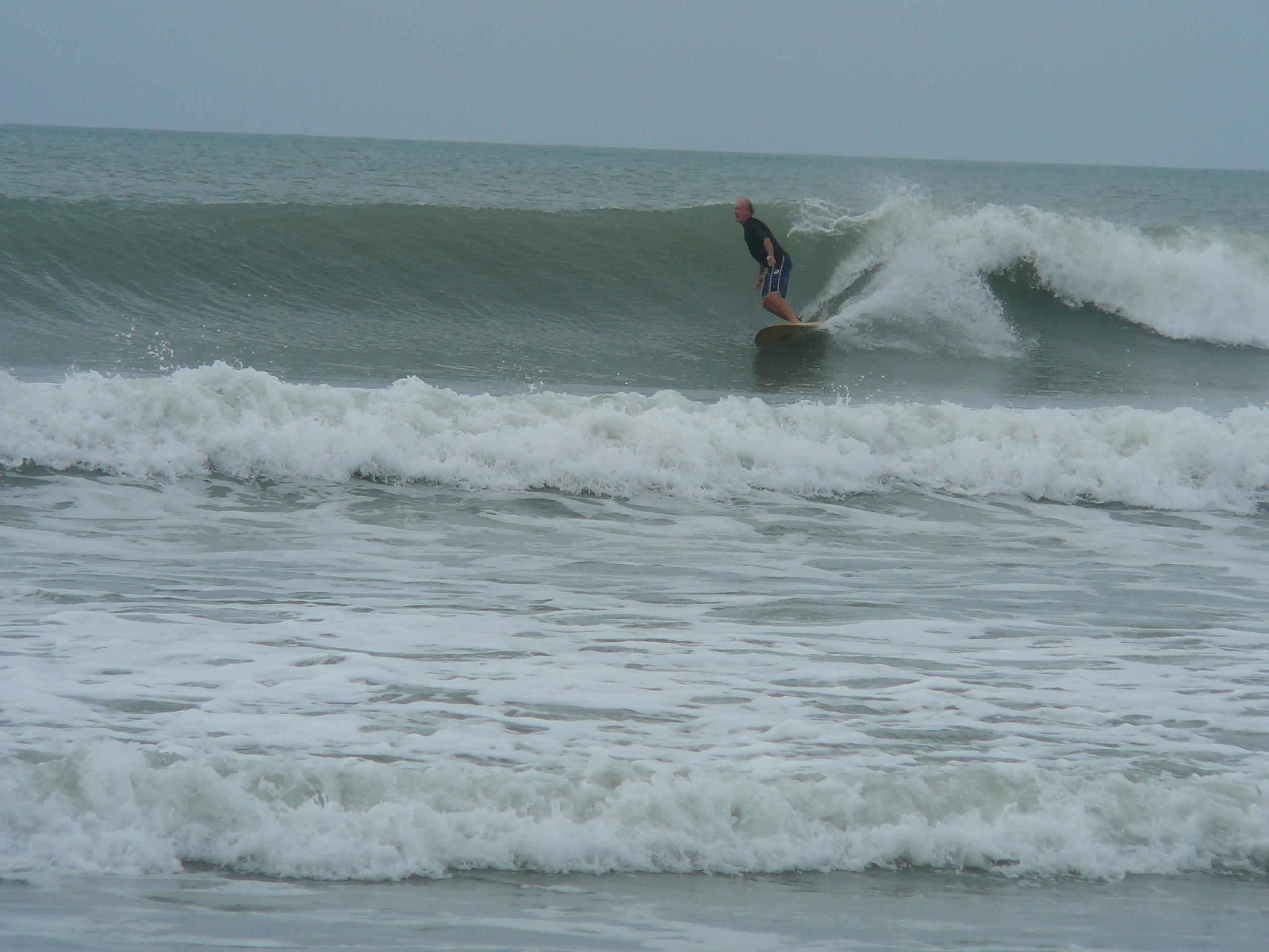
Is Tuesday morning going to be the best offshore time, or is late afternoon, which is also low tide?  The swell is holding it’s own at the 120 buoy as of 7 PM.  The swell climbed back up to 8.5 feet @ 11 seconds.  Probably either or.  It was big and calm , turning 4 mph onshore this morning with up to 2 foot overhead sets in Satellite Beach.

Below, is another video sample of what we could see on Tuesday, and Wednesday morning.  I shot these videos from Hurricane Gonzalo last year in early October, within 2 weeks of Tuesday and Wednesday.

Tuesday AM,  the winds show mostly light SSW which is sideshore in N CCB and the Cape, and if light, then it can be a nice offshore wind for Satellite Beach.  Weather.com shows 2-5 mph SSW up until 10 AM and then increasing to maybe 8 or 10.  But by 1 PM, it looks to be blowing SW and with a Northeast swell, this is generally  the best conditions for Satellite Beach.  Well, except straight west or NW, depending on the swell.  The point is,  will it be clean and perfect in the AM, or mirror glass and perfect in the afternoon?  Either way,  we should see waist to chest high in the Cape,  chest to shoulder high plus at the Pier with perhaps a few overhead sets.  And 2 to 3 foot overhead sets in Satellite Beach throughout the day.

Wednesday still looks epic all day.   It still looks to be about the same as Tuesday and perhaps better, unless we see the swell comes in early and peaks on Tuesday. For now, the models show to be increasing for Wednesday morning to 5 feet @ 11 seconds.  So a swell that size has the ability to throw double overhead waves.  2 to 3 foot overhead for sure.

Thursday and Friday still look incredible with at least chest high and glassy both mornings.  Gotta love that upper level windshear.

Tuesday afternoon could be Epic! Wednesday morning looks Epic! Swell hits today/evening. Posted Sunday afternoon 3:50 PM 09/27


Will we see some of Ida hit this afternoon?  I believe so.  It officially hit the 120 buoy at around 4 feet @ 1 1 seconds at 10 AM this morning, and hit 6.6 ft @ 13 seconds at 2:50 PM at  the 120 mile buoy!

I believe it’s time to re-circulate, the Hurricane Gonzalo video, (from October of last year:)  to share what Wednesday morning and Tuesday night could hold for us 🙂

So It should hit the 20 mile buoy partial I hope at the 3:50 PM reading.  Hopefully over 4 feet at 12 seconds.  Why do I care?  Because, I would like it to hit something at our beaches before 6 pm so we can get a taste of the storm tonight.

Monday morning it will be chest to head high with light onshore winds.  5% chance of offshores for one hour early, but most likely 2-6 mph easterly in some fashion.

Tuesday, it will be slight offshore in South CCB and Satellite Beach (meaning south winds), but by late afternoon Tuesday, it could be 4-6 foot swells, or 4 to 7 foot faces on the biggest sets, with a sneaker big one, in Satellite Beach and glassy close to dark and maybe glassy as early as 2 or 3 pm.  The swell angle isn’t too step NE, so it should be waist high at least at the Cape by Tuesday afternoon/eveving.  NOTE: THE WINDS ARE SHOWING SW for Tuesday late afternoon/evening,  which is full offshore down south, and sideshore or slight offshore at the Cape. SW is offshore at the Cape but SSW is sideshore.

Wednesday morning should be the Epic big glassy day everywhere if the models hold up for the 4rth day in a row.   4-6 foot swells early,  5 to 8 foot plus faces and  in Satellite Beach with maybe bigger sets on a rogue basis 🙂  See video above for possible size …

And there is waves all week, and a new big swell coming in next weekend!

Be safe, and be balsy!

Oldwaverider

Friday morning, should be solid head high to 1 or 2 foot overhead drops, maybe even in Central and South CCB and Satellite. Posted Thursday, 09/24/2015 at 9:30 PM


Today, was the best waves I surfed all year, better than the February 12 double overhead swell;  Why?  Because from 7 to 9, the form was perfect, it was top to bottom, all got barrels, and there were plenty of 100 plus yard rides for short board and long board.

Friday morning, I believe will be chest to head high, with some 1 to 2 foot overhead drops.  I belive the winds will be NNW to maybe, just maybe NW offshore from daybreak till around 8:30 AM  . If it is NW, the Satellite Beach will be the best .  If its NNW or North, than north Cocoa Beach, north of the South streets.  North and NNW is onshore for Satellite Beach

The swell is powerful, as you could see some 2 foot overhead drops by 6 PM tonight.

Wednesday could be Waist high and glassy for an hour or two in the early morning. Thursday and Friday more on that below. Posted Tuesday, 09/22/2015 at 10:30 AM


What can we expect for surf on Wednesday, Thurs and Friday?

Now,  it looks like our NE steep angled swell, could hit our Pier (the Cape will be blocked out Wednesday AM probably and for half the size on Thursday), by as early as 6-9 AM Wednesday morning it could land on our beaches.

So Wednesday, with a prayer, could be waist high at the Pier, and waist plus in Satellite, with NW winds.

Thursday, the model has dropped for the NE swell that comes in,  from my post yesterday, but still looks like it could hit chest high on Thursday, with perhaps NNW to NW winds, very light , like 3-6 mph.  So it could be awesome, not powerful, but not mushy either 🙂

Friday, as I shared yesterday is a totally different swell, and is a solid 2.5 feet at 12 second ground swell, so it depends on the winds for size.  If it does blow NW, we could see waist to chest high plus at the pier, and waist to shoulder high in Satellite Beach, with some semi-rogue 🙂 much larger sets in both places once in a while.  NOTE: 3 feet at 12 seconds has produced 6-9 foot faces before, back during Hurricane Leslie in 2012, in Satellite, but not much smaller at the Pier.  These 5 photos were shot of Hurricane Leslie, 3 foot @ 12 seconds swell in September by my friend Mike Melito, so, 2.5 at 12 seconds could easily produce chest high plus, if the winds are offshore.  Just Sayin …

Photos by Mike Melito, a 3 foot at 12 second period swell, the one coming Friday is 2.5 feet at 12 seconds, so I like to show this for optimism that it could be big :) sept 2012 hurricane 029 Photos by Mike Melito, a 3 foot at 12 second period swell, the one coming Friday is 2.5 feet at 12 seconds, so I like to show this for optimism that it could be big :) sept 2012 hurricane 032 Photos by Mike Melito, a 3 foot at 12 second period swell, the one coming Friday is 2.5 feet at 12 seconds, so I like to show this for optimism that it could be big :)   sept 2012 hurricane 042 Photos by Mike Melito, a 3 foot at 12 second period swell, the one coming Friday is 2.5 feet at 12 seconds, so I like to show this for optimism that it could be big :)   sept 2012 hurricane 047 Photos by Mike Melito, a 3 foot at 12 second period swell, the one coming Friday is 2.5 feet at 12 seconds, so I like to show this for optimism that it could be big :)     sept 2012 hurricane 053 Photos by Mike Melito, a 3 foot at 12 second period swell, the one coming Friday is 2.5 feet at 12 seconds, so I like to show this for optimism that it could be big :)   sept 2012 hurricane 057

Two fairly Big Swells coming this Week for Thursday and Friday, 09/24 & 09/25 . Posted Monday, 09/21/2015 at 2:30 PM


We had some really fun surf on Friday 09/18 and Saturday 09/19.  Friday has a little more juice, and was thigh to rib.  Saturday had less juice but was waist to rib high.

Thursday morning 09/24 this week could bring us some waist to shoulder high surf , maybe even glassy at first light.  We’ll know better on the winds by Tuesday night.  The swell coming in for Thursday is an entirely different swell than the one coming in Friday.  Thursday is a steep NE swell, almost a ground swell due to the size of the fetch, but not quite.  But due to the distance it is traveling, I am expecting some decent punch to it.  The Cape may be blocked out quite a bit from the Thursday morning swell, but not Satellite Beach.  The Pier should feel it though.  The photo below could be indicative of Thursday or Friday morning surf this week.

My buddy Ken from Melbourne, going left at 4rth street North, at the Melito resort.  Hurricane Maria, 2011

Friday morning, the next new swell is a solid ground swell coming straight from the East.  As it stands right now, it looks to be 2.5 feet at 12 seconds, with offshore winds maybe at first light.  Again, too early to confirm the wind.  But, if it is offshore at that size swell, we should expect rib to shoulder high waves, with possibly bigger sets, in Satellite Beach.

We should have something rideable Wednesday morning, with maybe clean conditions with North winds at 5-8 mph in the AM.  Clean up North here.  Down in South CCB and Satellite, that would be onshore.

Today was really fun, for a 7 second windswell ! Saturday should be thight to waist and NW to West offshore . Posted 09/18 at 9:20 PM


Tomorrow may even have a little more punch size for size.  The size, well yeah that will be maybe a foot smaller.  But Saturday till noon ought to be some solid waist high sets still on the sets.  Winds more offshore, probably in the 4 to 8 mph NW to W back to NW, North, etc. 🙂 range.  Possibly offshore till noon or so. Low tide is around 6 am, so that’s also working for us.  Have an awesome Saturday !  The reason why it could have more punch to it, is the Fetch of this wind swell, which may have actually been out 800-1000 miles which is maybe why it looked like a weak groundswell today with the lines instead of peaks, but anyhow, the fetch moves North and gets a second on the swell period, stronger and thicker on the rim of the moving period chart, as it pushes closer to shore Saturday, then it did today.

Actually a shot in Cape Canaveral in 2011, September, but the size Saturday could be the same. Photo by Oldwaverider.

This morning wind swell should be bringing solid waist to probably chest high glass for Friday morning September 18th! Posted Thursday 09/17 at 8:47 AM


What are the probabilities of waist to chest high glassy waves coming true Friday morning?  The images I clipped from Magicseaweed.com below are a 6 am swell size reading for both this morning Thursday at 6 am , and also for the projected 6am swell and its closeness to shore for Friday morning.

Thursday-6am-09-17-15-6am-Swell-position-compliments-Magicseaweed.comExcellent I’ll say,  Why?  Yes, it is a wind swell, so yes, as you look at the Fetch of the swell, the lighter blue moving swell section only covers maybe a 500 mile fetch distance, but it does have a greater body of fetch then just that lighter blue significant part approaching our local coast.  And for 4 days now, the models have predicted this swell with glass.  (yes, it could have light 2-4 mph onshore winds Friday morning, but I believe it will be at least calm to offshore till 9am, and then God’s choice from there) The only variance, has been the swell for Satellite Beach has fluctuated back and forth from waist hight , then up to chest, and back to waist, but today, at 9 am , Sept 17th, it now shows a strong chart of chest high for even a daybreak till late afternoon interval.  So I’m excited!

Friday-6am-09-18-15-6am-Swell-position-compliments-Magicseaweed.comSaturday, has also been even more consistent, at its thigh to rib high model with straight offshore glass till mid-morning.

What’s also great?  Is the tide is perfect, with a 5:09 am low tide Friday morning, and a 6:00 am low tide for Saturday morning.

Tropical Storm Erika update. Posted Wednesday August 26 2015 at 1:30 PM


When can we expect Waves from Tropical Storm Erika?

Friday, we could have some waist high and glassy waves at daybreak, which would be the first touch of Erika, perhaps combined with the other departing SE swell.  The winds are looking offshore, at daybreak for Friday.  See Saturday and Sunday surf report below images. And, See image below for T.S. Erika daily status:

Tropical-Storm-Erika-08-26-15-11am-EDT-Wunderground


See Wunderground.com forecast here for Erika report: Wunderground.com website for TS Erika report

Saturday morning surf should be 3-5 feet swell size, meaning 4-7 foot faces, but starts out smaller in the morning and builds to this size during the latter part of the afternoon.  Winds, expect  8-12 mph SSE winds at daybreak, changing more East after mid-morning.  If you like to surf Playalinda, Sebastian Inlet or Spanish House,  at daybreak the winds , if they are SSE, can be offshore at Playalinda and Sebastian Inlet.  Why?  Because direct South winds are 32 degrees offshore at Playalinda, whereas at say Officers Club, direct South winds are only 6 degrees offshore, and 10 degrees offshore at say RC’s.  South for some of you, it’s worth the drive.

Sunday swell size is probably the same, maybe a foot bigger on the face on the bigger sets.  12-16 mph East onshore winds, so driving to South wind breaks will be pointless.


Tuesday August 25th 2-3 foot ground swell still on track, but delayed 6 or so hours. Posted Monday 08/24 at 11:00 AM


The Tuesday incoming groundswell for 2 feet at 12 seconds,  is still on track according to the models; however it appears to be delayed by 6 or 8 hours.  It has not hit the 120 mile buoy as of 10 AM EST today Monday 08/24.

A 12 second period swell travels between 15-20 mph, so when it does hit, providing there are no strong westerly winds out there (and there shouldn’t be), it should take about 7-9 hours to hit the beaches.  It is a Southeast swell,  so Satellite Beach should get a great angle on the swell in addition to Cocoa Beach.

Size should be waist to rib, with maybe a few chest high sets at the reef breaks down south, with wind models for Tuesday right now at weather.com showing 4-6 mph SSW at daybreak turning SW and back to SSW to onshore by around Noon.  NOTE:  I don’t believe their models have updated for wind since yesterday, which I don’t know why.  It they do change significant for tomorrow, as MSW.com is showing brisk offshore, then I will update this post.

Check out Sobe Surf for all your SUP training and supplies !Sobe Surf website

Tuesday August 25th brings in a solid waist high Ground Swell finally ! , posted Saturday 08/22 at 2:30 PM


What kind of swell do we have coming Tuesday through possibly Thursday this week?

Incoming Hurricane Maria swell from 2011 at Johnson Avenue, by OldwaveriderTuesday, for the 2nd or 3rd day running, the models show 1.8 to 2 feet at 12 second period swell, which starts at about 2-3 foot waves, or 3 to 4 foot faces.  It should be glassy for a couple hours Tuesday morning at daybreak till maybe 8 or so.

Wednesday through Thursday, maybe Friday show more of the same 🙂

And the swell could even look like the photo below:

camera with surfing 519