Snake update, How the Waves were today (Friday 9/23) in Satellite Beach and Photos from today in Satellite Beach, Update on Tropical Storm Ophelia for incoming waves, Surf Report Friday afternoon (at 12:30 PM) and Surf Forecast for Cape Canaveral n Cocoa Beach (posted September 23, 2011)


This slideshow requires JavaScript.

Full size images below if you want to click on them and see full screen.

Image 1 of 4 shot sequence, longboarder on a perfect glass waist high left.  Definitely a fun cruiser wave for a 3 foot 7 second period wind swell.  We are getting some  from the little NE'ster we've had, along with the first very light push (SSE swell) coming in from 2000 miles away Tropical Storm Ophelia.  Photo by Art
Image 1 of 4 shot sequence, longboarder on a perfect glass waist high left. Definitely a fun cruiser wave for a 3 foot 7 second period wind swell. We are getting some from the little NE'ster we've had, along with the first very light push (SSE swell) coming in from 2000 miles away Tropical Storm Ophelia. Photo by Art

Surf Coming !  Tropical Storm Ophelia is still on track to send us some potentially awesome waves Monday thru Wednesday for now :)…I have some photos I took today for a view at how the Surf was in Satellite Beach.

There was only 2 guys out, I decided to check out Hightowers in Satellite Beach, and it was thigh to waist high, glassy, SSW to SW winds light, and occasionally a stomach high set came in.  I took the shots an hour after mid-tide (like 8:30 AM), high tide going low.  It looked pretty fun and the crowd factor was great, 2 guys out 😉   Okay, now a little about Saturday thru Wednesday surf…

Image 2 of 4 shot sequence, longboarder on a perfect glass waist high left.

Tropical Storm Ophelia should start providing us with some actual long period Tropical Storm waves Monday morning, It appears that Ophelia will not be getting stronger, or at least not by much, but hopefully will at least hold it’s own in the 40 to 45 mph wind range so our swell fetch, remains about the same.

From 2000 miles away, TS Ophelia (an obvious SSE ground swell) is very slowly sending us in some strength to our NE’ster wind swell that’s been lingering for a couple days and until Sunday.  And with this high pressure wind shear up above,  it’s giving us offshore winds in the morning, and when Ophelia gets here,  the shear will also keep Ophelia 800 or more miles off our coast and following Hurricane Alley straight up North with a thank you to God for that 🙂

Image 3 of 4 shot sequence, longboarder on a perfect glass waist high left.  I shot this from the deck at Hightower Park.
Image 3 of 4 shot sequence, longboarder on a perfect glass waist high left. I shot this from the deck at Hightower Park.

So,  Saturday morning, probably the same size as today,  waist high plus down South, and hopefully thigh high at the CapeWinds, SW 4mph at daybreak switching to West before Noon, and onshore probably before 1 PM.

Sunday morning, maybe a foot bigger on the face, maybe, waist to possible chest high, or at least chest high drops in Satellite, and waist high at the Cape.  Right now the winds are looking SSW until 10 or 11 AM, 3 to 5 mph,  so don’t waist your time surfing anywhere North of 6th Street South.  To get the size and best angle on the winds for mirror glass, head to Patrick AFB and toward Satellite.

Image 4 of 4 shot sequence, longboarder on a perfect glass waist high left.  Hightower Park.
Image 4 of 4 shot sequence, longboarder on a perfect glass waist high left. Hightower Park.

Monday morning, too far out to call the winds, but my best guesstimate,  a 12 to 14 second period swell,  is chest high plus down South, waist to stomach at the Cape, SW winds until Noon at best, in the 5 to 10 mph range.

TuesdayI believe to be the biggest day of TS Ophelia, with some 12 second period head high sets down South (may not close out as much as Monday might).  Chest high plus at the Cape with some rogue bigger sets.  Winds,  West to NW winds until Noon or 1 PM , 5 to 10 mph, turning onshore by 1 PM.  *(AGAIN, WINDS ARE IFFY, AND ANYTHING SPECULATED BEYOND 48 HOURS BEFORE SURF-TIME,  IS JUST AN ESTIMATE.  A SOLID PROBABLY 50 % ACCURATE WHEN IT’S HURRICANE/TROPICAL STORMS THAT HAVE BEEN FOLLOWING THE MODELS FOR A COUPLE DAYS IN A ROW)

Nice little thigh high right.  Image 1 of 3 shot sequence.  Satellite Beach.  Friday, September 23 2011, photo by Art :)
Nice little thigh high right. Image 1 of 3 shot sequence. Satellite Beach. Friday, September 23 2011, photo by Art 🙂

Wednesday, could be chest to shoulder high down South, with perhaps the best form of the swell.  waist to stomach at the CapePossibly West winds until Noon in the 5 to 10 mph range.

Thursday, could still have some decent waist high size leftovers, but we’ll stop here.

2011 has been the best year for waves since 2004 in my opinion.  Last year was as consistent, during the Summer and throughout the year, but the Hurricanes last year only gave us one glassy Hurricane (Earl) for a day or two, because all three Canes came a little too soon before the preceding one was able to give us the epic size offshore winds day.

Nice little thigh high right. Image 2 of 3 shot sequence. Satellite Beach. Friday, September 23 2011, photo by Art :)
Nice little thigh high right. Image 2 of 3 shot sequence. Satellite Beach. Friday, September 23 2011, photo by Art 🙂

Enjoy the weekend, and get stoked for Monday thru Wednesday.

PS – About the photos of the snake; it was guarding the Men’s bathroom door when I went to use the facilities at the 16th St. Park.  (NOTE: THE SNAKE IS A HARMLESS CORN SNAKE (RED RAT SNAKE )   Which by the way, the waves were at least a foot smaller than Satellite, and just rideable for a longboard.

Image 3 of 3 shot sequence. Satellite Beach. Friday, September 23 2011.
New Security for the restrooms at 16th street park. (a Harmless Red Rat Snake)
Security shift over ;)  (a Harmless Red Rat Snake)
Security shift over 😉 (a Harmless Red Rat Snake)

Johnson Ave. this morning was clean with some ridable knee to maybe thigh sets.  The Pier will probably or did  have some fun waves for all, is my guess.

oldwaverider
JOHN L. GALLERY – Cape Canaveral Surfing photos from Tropical Storm Maria Day 1 on Monday September 13 2011, Tropical Storm Ophelia update, Surf report and surf forecast for Thursday (9/22/11) thru Saturday (7:30 PM) for Cape Canaveral n Cocoa Beach (posted 09/21/11)


JOHN L. – Photo Gallery  

This slideshow requires JavaScript.

Full size images below if you want to click on them and see full screen.

Image 1 of 3 sequence, John on a nice waist to stomach high right, first day of TS Maria at the Cape, September 13 2011
Image 2 of 3 sequence, John on a nice waist to stomach high right, first day of TS Maria at the Cape, September 13 2011 , photo by Art

WE HAVE MORE WAVES COMING! … I’ll give the update down below after a couple words about the photos here.

The first actual day of Tropical Storm Maria brought some pretty fun thigh to waist high waves around the Cape and Johnson.  I got out late, did a quick sesh, and then wanted to get some pics of Dr. John and some others.

I hope ya enjoy the pics, it was a good time taking the photos, and I do apologize again, I left the zoom on to high, oops, my bad 😉

Dr. John was having a good day, with both great lefts and rights to even out the morning.

Friday surf is the first day I’ll talk about.  Thursday,  small wind chop, go south if you want waist high or bigger chop.  Save your energy.  Friday,  may get a small additional push of a SE swell, very small push, but…it could very well be waist to some chest high sets depending on where you go.  The wind should be West , 4 to 6 mph at daybreak switching to SW before Noon, and then onshore.  Could be a fun day, maybe not much power, but a fun morning sesh.

Image 3 of 3 sequence, John,  first day of TS Maria at the Cape, September 13 2011
Image 3 of 3 sequence, John, first day of TS Maria at the Cape, September 13 2011

Saturday and Sunday may be similar to Friday.   Offshore in the morning, remants of a lingering wind, non-ground swell. I could be way off base thinking this little wind swell that came down as a NE’ster could be hanging like this, but it seems to be coupling up with a little SE swell being pushed ahead of Tropical Storm Ophelia.  It’s not actually part of Ophelia, but it seems to be keeping a constant low pressure working out there just enough to push in some mild wind swell waves.

A nice left cruiser, Image 1 of 2 sequence, John on a nice waist high left, first day of TS Maria at the Cape, September 13 2011 , photo by Art

Sunday, late,  TS Ophelia, starts really making it’s push from the SE, and should be around 1000 miles East/Southeast of Miami by Monday afternoon.   Sunday may have some weird waves from both swells, with offshore winds so it could be fun for most of the day.

Monday morning, could be chest high plus down South, and maybe waist plus at the Cape with offshore winds in the morning until maybe mid-morning.  BUT…WINDS ARE IFFY THIS FAR OUT TRYING TO CALL, UNTIL WE ARE 48 HOURS BEFORE THE DAY OF SURF, AND THEN THEY ARE ONLY ABOUT 80% ACCURATE!

Image 2 of 2 sequence, John on a nice waist high left, first day of TS Maria at the Cape, September 13 2011

Tuesday could be some shoulder to head high waves and possibly Wednesday. This all could change easily, but I just wanted to share what the models are showing right now.

A sweet large set wave for the day and Dr. John driving a nice hard right.  Image 1 of 3 shot sequence.  Tropical Storm Maria Day one at the Cape.  Photo by Art
A sweet large set wave for the day and and Dr. John driving a nice hard right. Image 1 of 3 shot sequence. Tropical Storm Maria Day one at the Cape. Photo by Art
Image 2 of 3 shot sequence. Tropical Storm Maria Day one at the Cape.
Image 3 of 3 shot sequence. Tropical Storm Maria Day one at the Cape.

We’ll stop there.  Ophelia as the models show right now, may never become a Cane, but it could give us the same beautiful waves that Maria did.

Keep your fingers and prayers up for a good day Friday, and then especially Monday and Tuesday.

Later,

oldwaverider

Photos from Thursday Tropical Storm Maria (taken Thursday, 9/15/2011) and How the Waves were, Insane 20 foot overhead barrels Teahupoo video from the BILLABONG PRO TAHITI 2011, Surf Report Saturday afternoon (at 1:00 PM) and Surf Forecast for Cape Canaveral n Cocoa Beach (posted September 17, 2011)


Music by the Fyoogs http://thefyoogs.com

(That’s the kind of music that should be in a surf video, as opposed to rap 😉

This slideshow requires JavaScript.

Full size images below if you want to click on them and see full screen.

Image 1 of 5, MIke on a shoulder high right at 4rth street, Tropical Storm Maria, Thursday September 15, 2011, taken by yours truly :)
Image 1 of 5, MIke on a shoulder high right at 4rth street, Tropical Storm Maria, Thursday September 15, 2011, taken by yours truly 🙂

Okay, you know my obsession with huge wave video…This was the contest that Kelly Slater won (as I mentioned in a post a week ago), where Kelly skipped the J-Bay ASP event to catch the Epic 30 foot plus Fiji surf back in July at Cloudbreak, which gave him the warmup that he wanted or needed to explode at Teahupoo Billabong Pro.  Some of the waves in this video have 20 foot plus overhead barrels, and some brutal looking wipeouts. Okay, my digression is over, back to Maria photos and incoming surf…

Image 2 of 5, MIke on a shoulder high right at 4rth street, Tropical Storm Maria, Thursday September 15, 2011

We have our incoming windswell Nor’easter rolling in, it just hit at 11 AM,  4.5 ft at 9 seconds at the 120 buoy and the 20 mile is showing 3.5 feet at 10 seconds, so we should be seeing some waist high choppy waves at the Cape and some chest high chop down South.  It appears that this wind swell is gonna hang for the next 3 to 5 days, around the same size, and with onshore winds.  At least we’ll have something rideable, though I’m just gonna let my wounds heal from the last two hurricanes/tropicals 🙂

Image 3 of 5, Tropical Storm Maria, Thursday September 15, 2011
Image 4 of 5, Tropical Storm Maria, Thursday September 15, 2011
Image 5 of 5, Tropical Storm Maria, Thursday September 15, 2011
Image 1 of 3, Mike on a shoulder high left, Thursday September 15th, 2011, Tropical Storm Maria, photo by Art
Image 2 of 3, Mike on a shoulder high left, Thursday September 15th, 2011, Tropical Storm Maria, photo by Art
Image 3 of 3, Mike on a shoulder high left, Thursday September 15th, 2011, Tropical Storm Maria, photo by Art

The photos are from Slater Lane/4rth street North on Thursday (9/15/2011) taken by myself of my old surf buddy from Lakeland Mike.  The first set is a sequence of 5 shots of a nice shoulder high right.  The next is a shoulder high left of 3 shots.  Really fun, epic day!

I’ll be posting more photos from the Cape and the neighborhood, and some more photos from Katia down at O’ Club, in the next week.

Later,

oldwaverider

Photos from the 2nd big day of Katia, How Maria’s waves were the second day at the Cape, How Maria will be Thursday and Friday, Sea Lice and Jellyfish Alert, Surf Report Wednesday afternoon (at 3:00 PM) and Surf Forecast for Cape Canaveral n Cocoa Beach (posted September 14, 2011)


This slideshow requires JavaScript.

Full size images below if you want to click on them and see full screen.

This is what we are seeing on the beach and in the water today, when they feel like they weigh 15 pounds while they are filled with water. The images came from the following website:  http://www.asdn.net/asdn/nanotools/afm_in_liquids.shtml
This is what we are seeing on the beach and in the water today, when they feel like they weigh 15 pounds while they are filled with water. The images came from the following website: http://www.asdn.net/asdn/nanotools/afm_in_liquids.shtml

OUCH!  Man, the Sea Lice were absolutely brutal today.  The Moon Jellyfish were also floating around in their 8 inch to 1 foot diameter glory.   After I felt like someone was testing out a low amperage taser inside my boardshorts,  then I was forced to do 3 or 4 reverse dumbell curls with a 15 to 20 pound jellyfish 😉  Overall, it’s pretty funny to think about.  The water at the Cape was not crowded, gee, I wonder why.  (The reason why the 15 or 20 pound jellyfish, is because I guess this type of Jellyfish really holds water while floating)

Dropping in for a sweet left at O' Club, Thursday Sept. 8 2011, Hurricane Katia, photo by Me :)
Dropping in for a sweet left at O' Club, Thursday Sept. 8 2011, Hurricane Katia, photo by Me 🙂

Note:  As I mentioned a week or two ago, the Sea Lice are larvae from jelly fish, and are the little critters that crawl up your shorts.  However, for those that get nailed by a Moon Jellyfish (this text is from http://www.longbeachislandjournal.com/animals/moon-jellyfish; Fortunately the stingers of this species are relatively mild. Most people that come into contact with moon jellyfish have little reaction. Some may feel a bit of a stinging sensation but even this can be relatively mild compared to what can occur with more troublesome jellyfish species. Many moon jellies you find no longer have any stingers attached to them.  Okay, now that that is out of the way, back to surf conditions, Photos, etc.

2nd shot in sequence, Hurricane Katia, Officers Club

The photos I took last Thursday, at O’ Club, September 8th 2011, and as I mentioned in a post a couple days ago,  Thursday morning, it was huge like Wednesday, 1 to 4 foot overhead, not peeling as good, more closeouts, and by 11 ish the size dropped to just overhead, and by the time I took these pictures, it was shoulder to head high, with an occasional overhead wave.  It was the first time I used the camera, so yeah, the lighting bites, the sun was glaring on the LCD screen, so it was almost guesswork  🙂  But it was pretty cool, cause the 16 power zoom brought 250 yard plus surfers in fairly close.

3rd shot in sequence, Guess it closed out :) Hurricane Katia, Officers Club
3rd shot in sequence, Guess it closed out 🙂 Hurricane Katia, Officers Club

How the Waves were today, around 8 AM at the Cape, it was waist to chest high and peeling left and right beautifully.  The winds were NNW around 6, and switched North before 11.  There were more closeouts than yesterday, but if you waited 5 or 6 minutes for a wave there were 100 to 150 yard rides to be had.  I saw Scooter get a few on his 7’2″ inch Quiet Flight board.  I don’t know if his trip to Costa Rica had anything to do with his being all over the face of the waves, but he was definitely having an entertaining rip session.  His wife was having a great longboard session and was tough as nails with the Sea Lice and Jellyfish 🙂

Image 1 of 6 shot sequence, Hurricane Katia, Officers Club , Sept. 8 2011

Thursday, size should be around stomach to chest high at the Cape and close to head high in Satellite Beach.  Winds ought to be WSW at daybreak in the 5 to 8 mph range  (and a few hours before, so there probably won’t be any 7:00 AM morning sickness like there was today).  The winds swing around to NW by 10, NNW by 11 ish, and onshore by noon,  so again, don’t hang out late tonight if that keeps you from a great early morning session.  High tide was around 9:30 AM today so I guess that brings it to 10:20 Thursday.

Image 2 of 6 shot sequence, Hurricane Katia, Officers Club , Sept. 8 2011

Friday the size drops but should still be thigh (Cape) to stomach (down South at Patrick or Satellite) , winds light SW by daybreak swinging to NNW by 11 ish, and then onshore.

We have a Northeaster swell that rolls in on top of the leftover Maria waves Saturday, but it should be brisk NE winds to go with it, so don’t get your hopes up for perfection, if you look at it that way, then maybe it’ll be fun.

Image 3 of 6 shot sequence, Hurricane Katia, Officers Club , Sept. 8 2011
Image 4 of 6 shot sequence, Hurricane Katia, Officers Club , Sept. 8 2011
Image 5 of 6 shot sequence, Hurricane Katia, Officers Club , Sept. 8 2011
Image 6 of 6 shot sequence, Hurricane Katia, Officers Club , Sept. 8 2011

Man we have been blessed with great waves!

Have a great Thursday sesh!

oldwaverider

How Maria’s waves were the first day at the Cape, Photos from Tropical Storm Maria, Maria waves for Wednesday, Sea Lice and Jellyfish Alert, Surf Report Monday night (at 6:00 PM) and Surf Forecast for Cape Canaveral n Cocoa Beach (posted September 13, 2011)


This slideshow requires JavaScript.

Full size images below if you want to click on them and see full screen.

Dr. John pulling a hard right bottom turn, the first real day of Tropical Storm Maria, at the Cape.

The photos here are from the Cape today.  It was thigh to waist high and glassy early at the Cape, but we all got out late…Or at least I did, okay, had some work to do 🙂  Down South I haven’t heard but I assume it hit chest high solid today.  Dr. John for the first two pics, then Ron, followed by Chad.

(My apologies, I left the camera on full zoom from taking 250-300 yards out pictures down South from Hurricane Katia last Thursday,  so the centering got screwed up on a lot of these pics, still learning my friends camera 😉

What is Maria gonna bring us for Wednesday and Thursday ?  Besides Sea Lice and Jellyfish? (actually I didn’t find them to annoying but for some, the reactions to the Lice were more intense)

Wednesday will be close to chest high for the Cape and Head high plus down South.  RC’s will probably have a few one foot overhead drops…yeaaaawwwwwwwww!   The Cape should have 8 mph NNW winds until around 10 AM, then onshore.  Satellite Beach is showing NW winds until 10 AM so actually, Satellite Beach with light NW winds,  that is the place to be.  It will have some overhead drops and shoulder high lines.

Dr. John on a medium size left for the day.  Maria day one at the Cape.
Dr. John on a medium size left for the day. Maria day one at the Cape.

Thursday, about the same, the period of the swell drops a bit and maybe the size 6.4  inch drop, almost chest high Cape, head high down South.  The winds though are better,  4 to 8 mph WNW winds at daybreak so down South will have the size and form.  The winds swing around to NNW by 11 ish so don’t wait around to get out 😉

Friday, who cares?  Just kidding;  Probably waist to stomach at the Cape, and chest to shoulder high down South, and probably a few hours of offshore winds until 10.  Wednesday night I’ll have a fix on the actual wind direction and speed.

We may have a NE’ r wind swell coming in Friday and Saturday but don’t expect much from it.

The pics are from the neighborhood taken late around 9:30 to 10 AM, it was already blowing N, but still fun waves and the shoulders held up great so we may be in for a really sweet session Wed and Thurs if the swell gives us that kind of

Chad on the wave of the day...with no wax on board ;)
Chad on the wave of the day...with no wax on board 😉
Ron on a perfect medium size 'backside' right.

foreshadowing 🙂

oldwaverider

Tropical Storm Maria waves for Tuesday, Hurricane Katia photos from Thursday 9/8/11, Surf Report Monday night (at 9:00 PM) and Surf Forecast for Cape Canaveral n Cocoa Beach (posted September 12, 2011)


This slideshow requires JavaScript.

Full size images below if you want to click on them and see full screen.

This was actually image 1 of a 3 shot sequence.  Officers Club on September 8 2011 from Hurricane Katia, after the swell had dropped a few feet by early afternoon.  Photos by Oldwaverider
This was actually image 1 of a 3 shot sequence. Officers Club on September 8 2011 from Hurricane Katia, after the swell had dropped a few feet by early afternoon. Photos by Oldwaverider
Nice shoulder to head high right.

I have a couple of photos here I took at Officers Club, last Thursday (9/8/11)  afternoon shots…And Maria’s waves are coming in for at least Tuesday thru Thursday, and probably a day longer.

Maria’s first noticeable waves will be in Tuesday morning.  Waist plus at the Cape, and it should be chest high plus down SouthSW winds from daybreak to 9ish, switching to NNW by 10 ish and onshore by 11 or so.

Wednesday could be some head high waves South and chest or less at the Cape.  Winds looking to WNW at daybreak, switching to NNW by 10 ish and then North.  Wednesday looks to be the swell peak mid-day maybe but it shouldn’t drop much on Thursday.

Thursday , possible chest at the Cape and shoulder to head high down South.   Might be slight offshore, but by Tuesday night I’ll have a more accurate wind guess 🙂

Same wave.
Same wave.

The photos were from last Thursday (9/8/11)In the morning it was about the same size as Wednesday but not as many open shoulders. More closeouts.  Size was still 1 to3 foot overhead plus, and started dropping by noonI took these photos around 1 PM, but they were still some really fun looking waves.  I have a lot to learn on camera settings 🙂

Tropical Storm Maria update, How the Waves were Friday morning with Hurricane Katia leftovers, Surf Report Friday night (at 7:30 PM) and Surf Forecast for Cape Canaveral n Cocoa Beach (posted September 09, 2011)


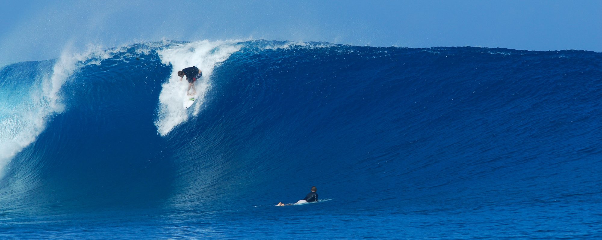
Clay in a sweet barrel in Punta Mango, El Salvador.  Photo provided by my buddy Rob in Newport Beach, Ca.
Clay in a sweet barrel in Punta Mango, El Salvador. Photo provided by my buddy Rob in Newport Beach, Ca.

TS Maria updateHow the Waves were today;   The Cape and Cocoa Beach got blocked out today, big time.   😦

I surfed Lori Wilson Park, and it was fun for awhile, thigh to occasional waist high, glassy.   Definitely less closeouts than the last 3 days.

O’ Club was solid chest high and there was some shoulder high sets according to a couple of friends that surfed there.

TS Maria is now following the familiar cane alley as the last few.  Definitely not a reason to get complacent 🙂  (a natural alarmist thing maybe)

Wednesday appears to be the biggest day.  The image here shows the model at Stormpulse.com with Maria East and slightly North of Jacksonville, 650 miles out as a Category 2.  Based on that position, Wednesday morning could be the big day with offshore winds.   The storm generally needs to be east of us and slightly North to have more Westerly than NW’ly winds.  (Grammar and Spell check is not an option.  These posts take an OCD person 45 minutes 🙂

Hurricane Maria, the Friday 5 PM 9-9-11, projected model position for this Wednesday.  The arrow I drew, shows the hopeful position on Wednesday morning so the winds would be offshore.  Image compliments of Stormpulse.com
Hurricane Maria, the Friday 5 PM 9-9-11, projected model position for this Wednesday. The arrow I drew, shows the hopeful position on Wednesday morning so the winds would be offshore. Image compliments of Stormpulse.com

Thursday could be the second , but smaller glassy day.

The storm is moving WNW at 16 mph, not that that is interesting data, but it is moving faster than Katia, so thus less days of glassy waves, but we’ll see.

Anyhow, I hope y’all got some of the best waves of your Florida surfing life.  I got my best Florida ride at O’ Club Wednesday.

The photo is a guy named Clay, a friend of a friend Rob, who lives in Newport Beach, Ca.  Punta Mango, El Salvador, I believe in 2009.

Rest up, another Cane is on the Way…

oldwaverider

How the Waves were Thursday, Tropical Storm Maria, Hurricane Katia update, Surf Report Wednesday night (at 8:45 PM) and Surf Forecast for Cape Canaveral n Cocoa Beach (posted September 08, 2011)


A nice waist high line in K-38 Mexico.  My buddy Rob surfing in March of this year.  A surf break that myself and a buddy Cliff surfed many years ago, camping on the Cliff's 150 feet above the beach.
A nice waist high line in K-38 Mexico. My buddy Rob surfing in March of this year. A surf break that myself and a buddy Cliff surfed many years ago, camping on the Cliff's 150 feet above the beach.

The Waves Thursday at O’ Club kept trying to hit double overhead today, just like Wednesday, but only made it to the 3 foot overhead, with an occassional bigger set wave.  I don’t think that it was as good as yesterday.  The closeouts were a little more dominant, but because of the size, at least 100 yard rides were to be had, unlike the 1 and half to 2 football field rides that were for the taking if you waited 30 minutes for “That” wave on Wednesday at O’ Club.

Johnson Avenue was similar for closeouts and had some head high plus waves early, the Pier a little bigger.  The considerable size difference we had both yesterday and today (Thursday) from the Cape on one end of the spectrum to Patrick and Satellite Beach allowed for the waves down South to hold up much longer for some really nice shoulders and some pretty intense power.

Katia is delivering it’s last real day of surf for us Friday.  We should see waist-high at Canaveral , IF, it’s not blocked out by the Cape’s point sticking out into the Ocean.  It ought to be chest to shoulder-high as you work your way toward Satellite Beach.  The winds should be West switching to SW around noon or one, and then to SSW to onshore.

Maria looks to be sending us some swell Sunday thru Thursday, but keep in mind the models are still developing, and it is heading West so until it becomes a Cane, the models can diminish quite a bit.

Fun waves we’ve had huh, between Irene and Katia.

If you make it out Friday morning, have fun and take pictures and feel free to send them to me.

Thanks and have a great weekend!

oldwaverider

Great Waves on Wednesday thru Friday probably, Sea Lice Alert, Hurricane Katia update, Last day of the Labor Day 26th Annual NKF Surf Festival, Surf Report Sunday night (at 8:30 PM) and Surf Forecast for Cape Canaveral n Cocoa Beach (posted September 04, 2011)


Clay riding a Punta Mango El Salvador perfection.

Katia will have some waves for us in the morning.  They kind of sent something our way a few hours ago, but the real strength won’t start till the morning.  (Monday morning) Sea Lice are pretty bad again, so get out and buy and try SeaSafe Jellyfish and Sea Lice repellent.  Supposedly it works for before the fact, not after.  See photo of Lice below.

Sea Lice photo, blown up 1000 percent, I believe

Monday should have some chest high waves for us and growing thru the day.  The angle of the swell, it’s hard to tell how it will come in for the Cape until another day or so, but I think we’ll see chest high down south for sure, and by the end of the day, chest at the Cape and bigger down south.   South winds from 8 to 15 mph with maybe stronger gusts.

Tuesday, a little bigger, shoulder high and growing, South winds also, but maybe a few hours of SSW winds.  Need I say,  South winds mean first Playalinda (32 degrees offshore) , 2nd Spanish House/Sebastian Inlet (26 degrees offshore).  Definitely, go south of Minuteman Causeway for your best chase for semi-glass or minimal chop.

Wednesday, we should have some overhead waves, probably head high to slight overhead at the Cape, and a couple feet overhead down southSW winds for a few hours in the morning, so get out early.  (though the winds call is iffy, until I check them out Monday night or Tuesday morning for a 75 to 80 % accuracy call for Wednesday morning.

Thursday chest high to overhead as the models look with possible NW winds the first few hours in the morning.

Friday, strangely enough the size looks to increase a foot over Thursday with WNW winds possible in the morning.

Beyond Friday is getting real iffy to try and call.   It is not confirmed that that is a true sea lice photo above, perhaps someone can let me know.

Monday is the last day of the NKF 26th Annual Surf Festival, so get down there and check it out, with the additional thrust in waves from Katia.

The photo above is my buddy from Newport Beach Rob’s friend Clay surfing a classic day at Punta Mango , El Salvador a couple years ago.

Get pumped for Wednesday thru Friday.

oldwaverider

Hurricane Katia update, Gulf Coast Disturbance headed NW, Labor Day weekend 26th Annual NKF Surf Festival, Hurricane preparation, Cape Canaveral Friday Fest, Surf Report Thursday afternoon (at 4:00 PM) and Surf Forecast for Cape Canaveral n Cocoa Beach, Uncle Joe got a new rocking chair (posted September 01, 2011)


This slideshow requires JavaScript.

Full size images below if you want to click on them and see full screen.

Maybe a 2nd chance at a barrel?  Photo by Mike Melito, an old surf buddy. Hurricane Irene, the 2nd day. Pic 1
Maybe a 2nd chance at a barrel? Photo by Mike Melito, an old surf buddy. Hurricane Irene, the 2nd day. Pic 1

FRIDAY NITE UPDATE (from this original Thursday afternoon surf report book 😉  Wind swell coming in late Saturday with waist high size and onshore winds; nothing exciting but something ridable somewhere 🙂

Sunday, the same wind swell, small, persists until late afternoon, when the first dribble of Cane Katia starts sending in waves.  Playalinda and Spanish House could have some nice chest high size and slight offshore winds (SSE to SE; S winds are 32 degrees offshore at Playalinda and 26 degrees at Spanish House).  2nd light to RC’s will have sideshore SSE to SE winds.

Monday and Tuesday will be growing from chest to overhead by Tuesday , right now looking onshore winds in the 15 to 20 range.


Wednesday and Thursday will be pushing the 2 to 4 foot plus overhead range, also with onshore winds, but………….Thursday and or Friday (or both days),  could be the big and offshore wind days.  So we will keep you updated on that mostly, once Tuesday and Wednesday night roll around when I can get more accurate wind data.

Oh, Katia is still a Cat 1 Hurricane, but it still shows to be a Cat 3 by Wednesday, and should be about 850 East of Daytona at that point, so if the wind sheer models hold, it should start aiming some Northward, and if the wind sheer models don’t hold,  then start packing…………just kidding, but listen close to the weather.

Here endeth the Friday , Sept. 2nd update for surf coming our way.  Below is my post from Thursday afternoon…

I just don’t know if the title of this post is quite long enough…

There’s a lot going on 😉

Katia went Hurricane Category 1 hurricane late last night or this morning.  Should be a Cat 3 by Monday, and by Tuesday it will only be 1100 miles from us, though the general consensus is that an upper wind sheer with keep it diverted off our part of the coastline anyhow.  As the general consensus goes.   Still,  like I mentioned the other day,  consider doing your Boy Scout stuff like water, canned goods, extra cat and dog food, batteries, fans and if you really wanna get anal, some water purification tablets…okay, I’m slipping into Alarmist syndrome here, my bad 🙂

Before we get into Katia and forecasts, we have some Hurricane Irene pics here from Saturday (the day after the big day 🙂  down around Slater Lane, mid-morning chest high waves, pretty much perfection. 

It did turn into some coverage.  Mike Melito photographer.  Hurricane Irene, glassy day two. Saturday
It did turn into some coverage. Mike Melito photographer. Hurricane Irene, glassy day two. Saturday

The photos were taken by a surf buddy and high school friend Mike Melito.  (He also did my Hurricane Earl and Danielle pics last year)

It was head high down by Satellite Beach, but I couldn’t make it down there. In between in North Cocoa Beach (as shown in these pics it was still pretty sweet)  But I did surf some incredibly fun waist to stomach high waves at Johnson Ave,  so needless to say, I was happy.

Also, Ross at CFLsurf.com has an incredible array of photos from Irene at his site (Picasa Web gallery) , check him out too.

Nice waist to chest high left.

The 1st Friday of the month Friday Fest of Cape Canaveral is September 2nd, this Friday.  The band Vilifi, whom I heard before is awesome, 3 piece band with incredible guitar player, drummer and bass.  (Obviously, those would be the 3 instruments for a 3 piece band, but my point is, each musician is incredible 🙂  If the link takes long to load, then just click on Cape Canaverals city website, and go to the 7th menu link for Friday Fest.

Hard to tell if it would be a good longboard day ;)  Photos by Mike Melito.
Hard to tell if it would be a good longboard day 😉 Photos by Mike Melito.

It still appears that Katia will start throwing us some waves Sunday night after dark,  with some waist to chest high waves building Monday, onshore winds.  The swell may provide some huge stuff, may last for 3 to 5 days.

The models are showing some possible offshore winds on Tuesday, which I would imagine that has to do with the storm in the Gulf which may become a cane also, heading toward Houston, cause it’s too early for Katia to be going offshore.

In Summary,  aside from a little wind swell we may have in the next couple days,  Monday starts Katia, and Tuesday it should be about 1100 miles offshore.  If it goes North with at least 600 miles off the coast we could have some killer waves by Wednesday or Thursday.

All alone...
All alone...

Don’t forget to have a blast and at the same time support the 26th Annual  NKF (National Kidney Foundation)  Surf Festival, check out their site for this year here.  The event takes place at the Cocoa Beach Pier starting Thursday Sept.1st.

Waitin on a duck diver to get in a good place :)  Hurricane Irene , the day after photos by Mike Melito
Waitin on a duck diver to get in a good place 🙂 Hurricane Irene , the day after photos by Mike Melito

We’ll keep ya posted.  If you don’t have a long leash for your cat or dog, get one, and a cage, just in case.  (what’s this guy so obsessed about pets for ?)

Later,

oldwaverider