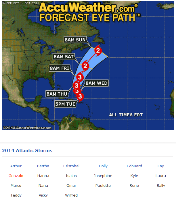
When will the Groundswell part of Hurricane Gonzalo hit our beaches? It appears to hit Thursday morning at daybreak, but we have a windswell that may bring some waves Wednesday afternoon in the thigh to waist high range.
 Below are first an image with the stats of Gonzalo, which has now hit a Category 3 Hurricane. Pray for Bermuda folks!
The second image shows a clearer path and schedule of the storm.
Thursday, Gonzalo waves will be building all day and could reach in the chest to head high by 5 PM or so. Winds should be NW or WNW in the 8 – 12 mph range. Could make for some incredible lip spray for the challenge of dropping in fast to beat the blindness, LOL 🙂
Friday, noon to afternoon could be the biggest size of the swell. We could see head high to 2 foot overhead sets as you head south to Satellite Beach. With stiff NNW winds probably some NW (3 days out, is a 50% accuracy guess, based upon obsessive compulsive desires for storm tracking for Hurricanes :), but these winds could be slowing down all afternoon to the 10 mph range abouts by 4 or 5 PM.

Saturday looks fun chest to head high and glassy.
Sunday looks a lot smaller but still rideable and glassy.
GET EXCITED FOLKS! THIS COULD BE THE MOST ENJOYABLE SWELL OF THE YEAR 🙂
Old-optimistic-waverider 🙂
