Final Video of Epic surf in Satellite Beach from Saturday morning of Hurricane Gonzalo :) Posted 12:00 PM Wednesday morning, 10/29/2014


Saturday Morning and Hurricane Gonzalo was so Epic at day break, when most of the Walls were peeling fast but makeable.  Saturday, October 18 2014 that is.  Not until 9:30 Am or so, did it be come more challenging to choose a wave 🙂  The video below is the second and probably last long one from Gonzalo.  I shot about 250 clips that day, 150 in Satellite and 100 at the Pier. (Note: the video is still uploading at YouTube and should be done by 1:30 PM or before)


Those of you that were there at our Awesome Rock Break in Satellite Beach, know who you are, and where this was shot.  Thanks for all your great surfing, and footage for me to devour!

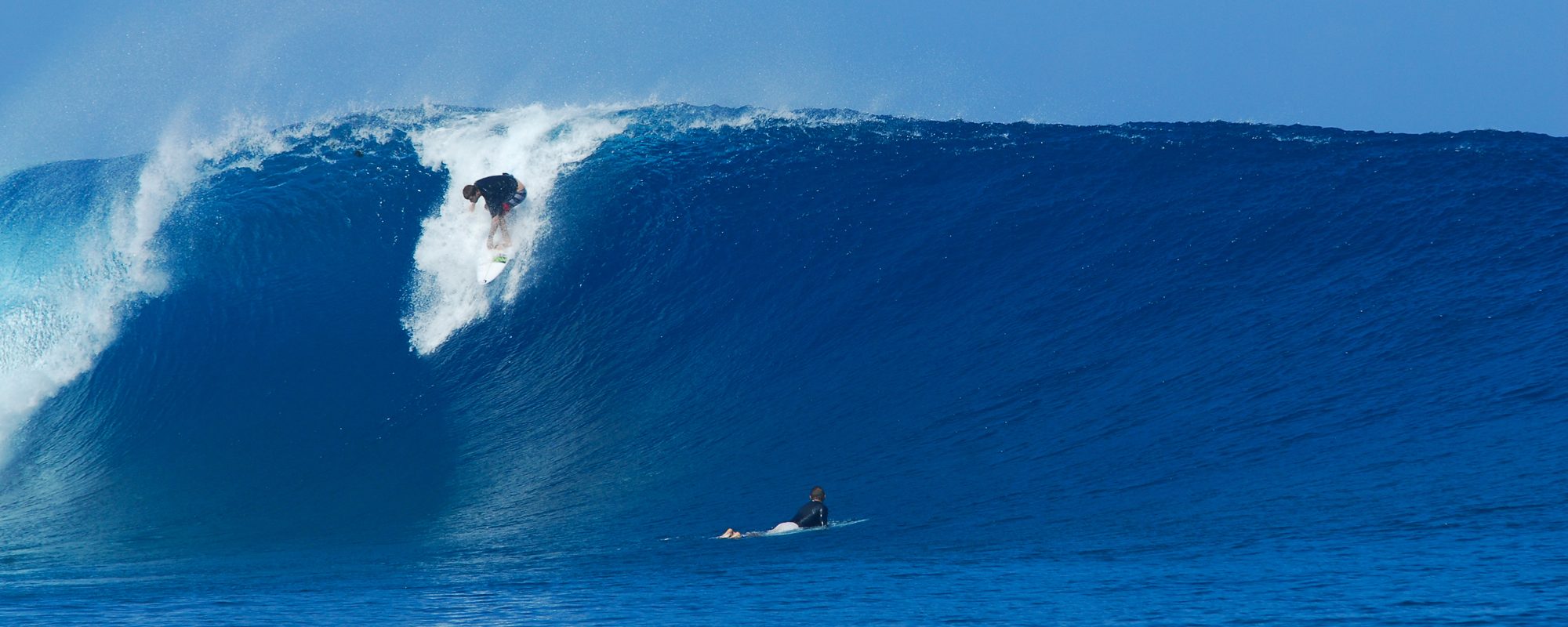
And I would like to note, that the biggest wall/wave that came in, was caught by a young lady, and she made the most perfect drop (the wave was peeling fast, but perfect), and I may slow motion that clip by itself, to upload to Magicseaweed.com at the Satellite Beach location, where I have most of my photos and videos posted.

So I had to toss a couple barrels in here in kind of a slow motion (yeah I did take two from last video),  just to show the insides of the barrel, and this one guy with an excellent off the lip on an Epic wave in form and size.

There were quite a few 10 foot faces to show that morning, though the common sets were 6-8 foot faces.  The video is about 4 minutes long, and I did it in 1080P, cause the 720P version annoyed me, LOL 🙂

I hope you enjoy.  AND THANK YOU YOU TUBE FOR PERMITTING ME TO UPLOAD 1080p VIDEO!

Oh, and we do have 3 -5 days of big chop surf coming by Sunday night, Monday morning.

And there is a Surf contest at Spessard Holland Park in Melbourne Beach for Groms, by Gnarly Charlie!.  Details are here: https://www.facebook.com/events/1483099941961312/

Have a Great Hump Day folks, and let me know what you think of video!

Oldwaverider (Art)
Be Patient, it’s coming, just late afternoon. Strong NW winds out there too slowing it up :) as Category Three Hurricane Gonzalo still looking awesome for Thursday through Sunday…Thursday Noon Surf Report and Forecast for Cape Canaveral, Cocoa Beach and Satellite beach, posted 12:15 PM 10/15/2014


10-16-14-Image-1-Swell-Period-Chart-9AM--from-Magicseaweed
10-16-14-Image-1-Swell-Period-Chart-9AM–from-Magicseaweed

Finally it hit the Ft. Pierce buoy 2.6 feet at 13 seconds.  First 13 second reading. As of 12:25 PM Update.  As I said earlier , The swell is coming in, the power swell I should say, but it maybe 4 PM till we fully feel it and see it!
(Note:  The Ft Pierce buoy is only 9 miles offshore vs our 20 mile buoy which the 13 second nor even 11 second part of the swell has not hit ours.  But now that it has hit the Ft Pierce buoy, by 1:30 or 2:30 latest, we should start to see some size and power.  Also note,  It also hit the Fernandina Beach buoy at 13 seconds like 3 different readings since 9 AM this morning.  But they don’t have the Bahamas and a Cape Island that sticks out and blocks us like we do)

It hit the 120 buoy last night at 1 AM, in the 11-14 second range.   Take a look at the 4 images below and it will make sense, well, kinda 🙂

10-16-14-Image-2-Swell-Period-Chart-12PM--from-Magicseaweed
10-16-14-Image-2-Swell-Period-Chart-12PM–from-Magicseaweed

Today, we may only see head high before darkBut don’t be surprised if late morning Friday, we see some 2-3 foot overhead faces on the big set waves.    Remember, Hurricane Leslie in 2012 was only like 4.3 feet at 12 seconds and we had some 11 foot face wave sets)

So Friday, I believe head high to overhead will happen and with 1-3 foot overhead sets in Satellite Beach, and maybe some at the Pier.  Winds offshore till late morning, NNW to maybe NW winds.

Saturday, chest to head high with offshore winds all day.

Sunday, waist to stomach plus with offshore winds most of the day.

The first 3 images are the moving Period chart of the swell (which shows the fetch or width of the storm and it’s relative strength at each of the different colors).  The first is 9 Am this morning, then 12 Pm followed by 3 Pm.   Notice the bright Green does not fully wrap our coast at the Cape until 3 Pm.   Now this model is from 6 AM this morning.  The fourth image is the swell size at 3 Pm which just shows us the size to expect and what the power should be based on the period.   This is why we are waiting.  And maybe cause the winds are a lot stronger West out at the 120 and the 20 mile buoy, so that may be slowing it down some.  a 14 second period swell travels across sea at over 20 mph (11 second travels about 17 mph, so just interpolate 🙂

10-16-14-Image-3-Swell-Period-Chart-3PM--from-Magicseaweed
10-16-14-Image-3-Swell-Period-Chart-3PM–from-Magicseaweed
10-16-14-Image-4-Swell-Size-Chart-3PM--from-Magicseaweed
10-16-14-Image-4-Swell-Size-Chart-3PM–from-Magicseaweed

Tropical Storm Gonzalo soon to be Hurricane Gonzalo creating big waves for Thursday night thru Saturday and more…Monday morning Surf Report and Forecast for Cape Canaveral, Cocoa Beach and Satellite beach, posted 11:00 AM 10/13/2014


Hurricane-Gonzalo-Swell-Chart-for-Friday-10-17-14-at-6AM-as-of-Monday-10-13-14-6AM, Image compliments of Magicseaweed.comWhat can we expect from Tropical Storm, soon to be Hurricane Gonzalo?

Overhead Waves!  More on Tuesday , allowing for another day for the model to build.  We may have two Big , Offshore wind days and Overhead, between Thursday and Sunday, since the storm is nicely,  600-800 miles offshore 🙂

Tropical-then-Hurricane-Gonzalo-Columbus-Day-morn-1030-AM-10-13-14, Image, compliments of Magicseaweed.com

Incoming Tropical Storm Fay Windswell almost groundswell, could provide for a clean waist high Sunday morning :) ,Saturday morning Surf Report and Forecast for Cape Canaveral, Cocoa Beach and Satellite beach, posted 11:00 AM 10/11/2014


Swell-Chart-for-Sunday-10-12-14-6AM-from-magicseaweed Compliments of Magicseaweed.comSunday morning could be fun before the rest of the easterly winds bringing in the rest of the swell start picking up.  Could be waist high and clean at the Cape.  With winds in the 2-5 mph range, then picking up by 10 or 11 am or so into the 8-12 mph range

Tropical Storm Cristobal Update plus the NKF Labor Day Surf Festival at Cocoa Beach Pier August 29 through September 1, 2014


Will we see Tropical Storm Cristobal Monday morning?  Yep!

It hit the 120 mile buoy at 12 Noon today, around 3 feet at 10 seconds, and just hit 4.6 feet at 11 seconds at 6:50 PM reading.  At 8 am this morning, the swell that was out there was 2.3 feet at 6 or 7 seconds.

Monday morning, it should be around waist high, because the winds will be onshore, but maybe under 10 mph up until 8 am, then pickup up to 10 to 15 mph my guess by noon.  It most likely will be raining with thunder storms around in the morning too. By Monday at 6 PM, it should be solid head high down south, maybe overhead, and chest to shoulder high at the Pier.  Tuesday, size should jack up another foot on the fact, with head high onshore chop at the pier with bigger sets, and head high to a foot or two overhead down south.

Wednesday morning should be shoulder to head high with 8 to 12 mph onshore winds, with the winds possibly backing off a little all day.  So , if you can get out, wait till 9:30 or 10 (high tide at 9:30), and catch it to mid tide high going low, with the winds slowing down a bit.  Swell size starts to drop after 3 or 4 pm, as the models show right now.  Wednesday should be a lot of fun.

Thursday, size drops off quite a bit, but still may have some chest high waves with even lighter onshore winds, like 4 to 8 mph, so it should be lots of fun Thursday.   Friday should have some fun leftovers for the Surf contest, in the waist high plus range, light onshores, maybe offshore early.  Saturday, will most likely be longboard only with offshore winds.

We’ll post more accurate winds Monday night to see what to expect for Wednesday.  All these forecasts could change if the storm weakens, picks up speed.  (disclaimer done 🙂

Want something to do next weekend?  Here ya go,  the NKF Labor Day Surf Festival, and here is a screenshot of the website, check out all the events! Follow the link to check it out at their website here:


29th Annual NKF (National Kidney Foundation) Rich Salick Pro/Am Surf Festival at Cocoa Beach Pier and other locations

Big Storm Waves Coming! Thursday looks to be the Potential Epic day, for now. Surf Report and Forecast for Cape Canveral, Cocoa Beach and Satellite beach, posted 6 PM 08/23/2014


Sunday afternoon late, we should see some of the swell rolling in with waist high waves.  The Groundswell/Windswell model, appears to build from Sunday thru Wednesday, peaking in the 5 to 8 foot range.  Thursday, if the storm holds together, could be the big glassy day with overhead waves and offshore winds in the morning.  The video below is of Hurricane Bertha in Cocoa Beach, 4rth street, from August 5 2014, shot around 10 AM that Tuesday morning. (it is still processing at YouTube, so by 7 PM or before, it should be ready)

For now, expect Sunday to have something around waist high late afternoon.  Monday builds all day with probably some head high faces before dinner timeOnshore winds.  Tuesday more of the same, but building.

Wednesday, could be the crazy day, anywhere from Overhead to 3 foot overhead with onshore winds.  The fetch (diameter of the storm), is not that large, maybe 500-700 miles, and it cruises from a hug the Bahamas on the East side very close, parallels the coast, and if it holds together, as it passes Brevard by a 100 miles or so, we could have epic overhead waves with brisk offshore winds Thursday morning, or whenever the storm passes by and holds together of course.

Get excited folks, get some exercise, sunscreen and make sure your boards are prepped!

Oldwaverider

Ground swell coming! Starts rolling in late Sunday August 24th, with some size Monday, Tuesday lasting thru Thursday perphaps, Surf Report and Forecast for Cape Canveral, Cocoa Beach and Satellite beach, posted 10 AM 08/22/2014


Actually, I shall wait until Saturday afternoon.  Since the swell appears to be rolling in Sunday afternoon, Monday may be the big day, big chop of course, but it appears that Tuesday, Wednesday, should have some size, with maybe a glassy waist high leftover Thursday 🙂  Updated 10:41 PM Friday night

I will give a full updated report, a little later today, but know, we do have a Ground/Windswell coming!

Oldwaverider