Epic Surf, Sea Lice alert, Moon Jellyfish alert, Hurricane Irene Surf Report Thursday afternoon (at 1:00 PM) and Surf Forecast for Cape Canaveral n Cocoa Beach (posted August 25, 2011)


Quick Update at 8:45 PM Thursday nightMost will assume that I am on, or was on some form of a hallucinagenic, and I’m okay with that 🙂 , however, I just got to watch 45 minutes of surf shortly before dark,  and I saw one individual catch 4 rides, the 1st witch was 6 solid feet over his head, when he made his bottom turn, and he still had 2 or 3 further to the bottom, not of the typical slopey Florida wave.  The 2nd epic wave out of his 4 that we watched, which was also glassy, was he dropped in, on the same but maybe an inch taller wave 😉 and after a rentry, slipped right into a barrel, standup, but only have of the wave covered him to the waist, but he did disappear, pulled out, and preceded to get 3 or 4 rentry that required at least 30 yards coverage for each top to bottom, it was like in slow motion.  We estimated that it was about 200 yards, (2 football fields, based on the fact that it was around 10 seconds ride, but also, since it was about 400 yards out paddle to get out, and he made it most of the way in except for the inside section…which by the way, his wave kept on going when he kicked out. It was really breathtaking for Florida ( I could care less how corney it sounds, but I love guessing numbers, stats, financial data and trends, finding changes in treands, plus distance when I run 3 to 4 times a week, so am I anal , you make the call, and this site to see was awesome , especially for Northern Brevard County.  The original post from today continues below starting with the Teahupoo video which is breathtaking again…a little poetic sounding, but my bad 😉  Last comment, I believe my numbers for 6:30 – 7 AM session made in this afternoons post earlier today at 1  PM, is still accurate, so take it or leave it 🙂

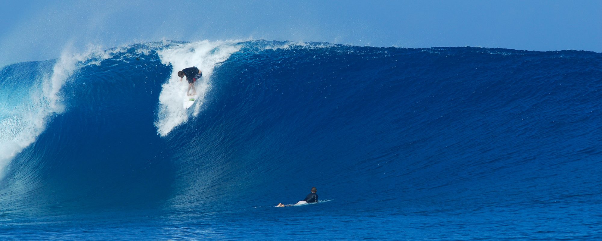
Friday morning surf report in a minute…I had to drop this video of Teahupoo  (cho-pooh), from The Billabong Pro in Tahiti.  It is absolutely incredible taken from a helicopter.

Friday morning, On the high side, with the models for Satellite Beach at daybreak,  10.5 feet at 13 seconds, in Satellite Beach we could see 15 foot plus faces.  The winds are still looking 25 to 30 mph NW until noon and then WNW.  There will be gusts over 35 mph, but that’s still less than TD Hanna in “09”.  But by then the size has dropped 4 feet in face size.

Friday morning, Our models show 6 feet at 15 seconds climbing to 8 feet at 11 seconds at 9 AM At the Cape and Cocoa Beach,  the Cape should see 10 to 12 foot faces with a rogue set every now and then, glassy, lots of spray with 25 to 30 mph NW winds, and gusts a little higher.  The lefts should be incredible. High tide is 5:45, which is the best condition we could ask for, high going low.  The size will probably kick up from daybreak to 9 AM a couple feet, and then start dropping fast by noon,  but not to fast 🙂  By noon, we’ll probably have 8 to 10 foot faces and then lose a foot every couple hours.

The rain should be pretty significant in the morning so be ready for that, and also, for you old guy surfers, 2 guys, both 49 years old, very competent surfers drowned in the surf during Hurricane Florence in Sept of 2006.  In fact the waves that day were 6 to 10 foot overhead, and this barrell taken shows that at Satellite Beach were this photo, this one taken just before one of the guys Rob drowned.  He was a 15 or 16 year old surfers father.

Watch the  Sea Lice stings “sea lice” which are actually the larvae of Thimble jellyfish.  And also watch the big big Moon Jellyfish.  I walked the beach at 8 this morning, and I saw one that was about a foot in diameter.  I believe they are “Moon Jellyfish”  They are clear, round, and inch or more thick, with 4 purple membranes if you will in the center.  I will try to update later today with a photo of these large Moon Jellyfish.

South of Minuteman, with those winds, should produce slight offshore to sideshore winds.

North of Minuteman, we take a size hit but have the glass.

Saturday, shoulder to head high , 20 mph west winds and epic, anywhere.

Sunday, probably some leftovers but who cares 🙂
Hurricane Irene Surf Report Wednesday night (at 9:00 PM) and Surf Forecast for Cape Canaveral n Cocoa Beach (posted August 24, 2011)


The model for 6 AM Friday morning looks to be a glitch, and my guess is it will be around 8.5 feet at 13 or 14 seconds, but we'll see.  The storm picked up some speed and now will share it size while its dark.  Compliments of magicseaweed.com
The model for 6 AM Friday morning looks to be a glitch, and my guess is it will be around 8.5 feet at 13 or 14 seconds, but we'll see. The storm picked up some speed and now will share it size while its dark. Compliments of magicseaweed.com

Friday is the day.  For 36 hours the models have been consistently telling me this.  The chart shows 6 AM Friday morning.  The Hurricane once it gets a little past us, will give us the morning offshore winds,  Irene should be around 250 miles east of us,  so we should still have some heavy rain Friday morning, no lightning, just rain and wind.

Friday morning, the swell is looking to be 10.5 feet at 13 seconds at 3 AM, but,  it has gotten weird and the models show a really fast drop to 6 feet at 15 seconds at 6 AM.  I believe that to be a glitch,  the 10.5 feet at 13 seconds translates from probably 12 to 16 foot faces, depending on the break you go to.  But, if it has dropped to even 8 feet at 13 or so seconds, then the size should be 10 to 12 foot faces.  The winds for 24 hour have been pointing at NNW winds before light and maybe till 8, and NW winds by 8 AM in the 22 to 25 mph range. There will probably be gusts in the 30 or 35 range.

This should be totally epic.   Anywhere North of Minuteman Causeway is your best bet if you want offshore winds.  Satellite Beach would be sideshore to slightly offshore with NW winds.

Thursday, will be bigger than today in the morning, as the Hurricane rolls in and peaks between midnight Thursday and 6 AM Friday morning.  In the morning on Thursday it will be overhead but probably weaker than today, but by 6 or 7 PM, the full size should be here and some pretty huge chop with around 15 mph ENE to NE winds all day, probably some higher gusts in there.

Saturday, I think we’ll have some chest to shoulder high epic leftovers with 20 mph West offshore winds. Surf anywhere,  with West winds, down South should be great.

Sunday, who cares 🙂  Well I do, but I’d like to see some more charts by Friday before I make an educated guess. Hah, this stuff is all guesswork after your face turns blue from looking at data 5 times a day, 7 days a week 🙂

Have a great epic session Friday and Saturday.

oldwaverider

Hurricane Irene Surf Report Tuesday morning (at 8:00 Am) and Surf Forecast for Cape Canaveral n Cocoa Beach (posted August 23, 2011)


Hurricane Irene position as of 6 Am Tuesday morning, compliments of stormpulse.com, 100 mph winds, and on its way to a category 4 hurricane.

Update; 6:30 PM Tuesday night, from the 8:00 Am report this morning.

Now the storm has slowed enough to give us back the 8.5 feet at 12 seconds at daybreak.  What’s that mean? Friday morning it ought to give us double overhead waves at the pier and at least in Satellite Beach. Plus, the wind models are showing NW at daybreak instead of N or NNW, and the winds have slowed down to the NW in the 30 mph range with some stronger gusts, but at least they’re not in the 40’s.  Even at 9 Am we could still see some 5 to 6 foot overhead sets.

Saturday morning, looks like shoulder to head high with strong but reasonable offshore winds around 20 mph out of the west.

If this model could hold, we would have our huge epic day, and a head high epic day on Saturday.

Also, Irene model projections have shifted slightly. As of 5 PM tonight, instead of a direct path toward Wilmington, NC, it appears to be heading for a brush with Cape Hatteras and then toward New York.  The storm Friday morning looks like it will be about 230 miles east of us.  BUT,  YA NEVER KNOW WHAT CAN CHANGE SO KEEP SOME EXTRA BATTERIES, CAN FOOD, CAT OR DOG FOOD AND SOME CANDLES AND A BATTERY FAN AROUND 🙂

Below, is the forecast I gave at 8 AM this morning.

Irene is a Cat 2, 100 mph winds as of early this morning.  Pray for the folks at Wilmington, N.C.

Surf; The storm model has moved up its time frame, so the main power and size of the surf will be while we sleep Thursday nite.  But for those that felt it would be too big, now it will be perfect for you.

Friday morning, the winds (this is a weak model on winds, but Wednesday night I will have 62.6 to 80% accurate winds for Friday morning once I can use weather.com models)  anyhow as it stands the winds turn NNW by 8 Am ish, are still holding in the 35 to 45 mph range, so there’s no reason for dawn patrol except to beat the crowds 🙂

The models show that at 2 Am Friday morning, where Irene should be, and the arrow I placed is to show where we want the Hurricane to be after the Friday 2 Am model, so that it provides offshore winds.  Compliments of stormpulse.com
The models show that at 2 Am Friday morning, where Irene should be, and the arrow I placed is to show where we want the Hurricane to be after the Friday 2 Am model, so that it provides offshore winds. Compliments of stormpulse.com

Size,  now I’m calling 4 to 5 foot overhead at daybreak, and by NW wind time, after 9 Am anyhow,  I believe at the pier it will still be 3 to 4 foot overhead on the sets.

Remember, TS Hannah,  which at daybreak until 10 am had some 10 foot overhead sets, it was about 60 miles or 100 miles offshore.  (I sat in Marlins and had breakfast so I could see people dropping in and how many bodies could be stacked on their shoulders to establish wave face size.  And it was almost 2 bodies, almost triple overhead on the big sets, but not quite.)  But Hannah, had 35 NNW winds until noon at least.

My point, is , don’t think the 35 mph plus winds will make it unsurfable.  Just bring your heaviest board, and duck your head until you catch that wave, and pounce on the front of your board, and you’ll have a great sesh.

Down south it should be a foot bigger or so.

The swell bar chart model shows that it peaks from midnight to 3 Am Thursday night or early Friday morning, but we still should expect a 6 to 7.5 foot swell (not wave size) by the time the winds turn offshore for us here at the cape.  Magicseaweed.com model provided.  As you can see, we should have some chest high waves even on Saturday.
The swell bar chart model shows that it peaks from midnight to 3 Am Thursday night or early Friday morning, but we still should expect a 6 to 7.5 foot swell (not wave size) by the time the winds turn offshore for us here at the cape. Magicseaweed.com model provided. As you can see, we should have some chest high waves even on Saturday.

The cape ought to be great because of the wind direction, N to NW winds until the size really drops after lunch, and then anywhere will be good, south of Minuteman.

The first picture is stormpulse.com’s 6 Am animation of Irene, and the 2nd picture is the projection of where it should be on Friday at 2 Am.  The arrow I placed is where we want the storm to be so the winds are offshore.

As the 3rd picture (swell chart from magicseaweed.com or any other model) might show, is we may have some nice waves in the chest high range on Saturday morning also, with 25 mph plus offshore winds.

We’ll give an update later to see how the cane has slowed or sped up.

oldwaverider

Hurricane Irene Surf Report Monday morning (at 8:30 Am) and Surf Forecast for Cape Canaveral n Cocoa Beach (posted August 22, 2011)


Just kidding, this is Dungeons , S. Africa from yesterday, Sunday, Aug. 21,2011 compliments of magicseaweed.com


Hurricane Irene now has a great chance of giving us waves Friday morning in a big way!

I have 3 shots here, the first I’m just kidding…

The 2nd is the chart of Hurricane Irene.

The third is the swell report, which shows a possible of 15 foot or bigger wave face size.

TS Hannah on Sept 5, 2009 was about 100 miles provided us on the big sets, 10 foot overhead waves at the Pier, though I didn’t paddle out until they were in the 6 to 8 foot overhead range.

So Irene could be a little bigger. I will update tonight.

oldwaverider


Hurricane Irene as of Monday at 2 Pm, 8-22-11, stormpulse.com provided


Swell size chart for Thursday thru Saturday, on 8-22-11 Monday, magicseaweed.com and all other model providers

Tropical Storm Emily update plus Surf Report Wednesday morning (at 8:45 Am) and Surf Forecast for Cape Canaveral n Cocoa Beach (posted August 03, 2011)


Emily looks to be best positioned for offshore winds and overhead for Sunday.  Compliments of Stormpulse.com
Emily looks to be best positioned for offshore winds and overhead for Sunday. Compliments of Stormpulse.com

Okay, Emily in brief.

Thursday morning, possible late morning ground swell, but that may be iffy.  It is not really from Emily, but it could be waist to chest, ssw offshore winds.

Friday morning, this is part of Emily, and should be chest high (down south of course), ssw to sw winds.  Emily stalls out here and size does not build until afternoon Saturday.

Saturday morning Emily is building , it may be waist to chest with light onshore winds early and sloppy strong onshore winds in the afternoon, and by late afternoon and evening it will get big probably overhead a little down south but be choppy all day, cause when a hurricane or TS is straight off our coast the winds have not come around offshore yet.  (SEE PICTURE TO SEE STORM LOCATION)

Sunday morning, should be offshore, overhead, probably west winds offshore brisk in the 8 to 15 mph winds, but my guess, 2 foot overhead down south and head high plus at the Cape.

The winds I can’t accurately predict until 36 hours ahead of the predicted time period I’m talking about.  So tonight I will give you some more accurate winds for Friday and Thursday and also if the first ground swell does actually hit the 120 buoy, or if we can only expect real waves for Sunday (offshore) and Saturday late afternoon big and onshore.

oldwaverider

Surf report Monday night and surf forecast (8:00 Pm) for Cape Canaveral n Cocoa Beach (posted July 4rth or 07/04/11), Halloween 2007 big Cocoa Beach Pier Waves


Halloween Day 2007, Another picture I took with an old, 35 mm camera, which I had no practice or knowledge of using, but I did get some poor quality shots of a huge Halloween 2007 swell that we had. This was smaller than the 12 foot plus face wave on the 6/27 post, but this was probably a 10 foot face that I shot from the back of Cocoa Beach pier.

Another swell coming in after this………undefineable wind swell that has given us thigh high plus waves thru the July 4rth weekend, if you caught it at the right tides.

Lori Wilson has been looking good every day.

The new swell,  again its a cross between a wind swell and a wannabe ground swell.  We should see some lines with it. It trickles in starting Tuesday and just kind of keeps rolling in thru Thursday and then kind of hangs Friday and into the weekend.  The biggest size of the swell is possibly 3.5 feet at 9 seconds,  which can translate to chest high with some larger sets, depending on the break you surf.

Thursday is the first day we may see some size to speak of, onshore winds as it looks now, but some chest high waves should be around at least down south.

Friday, it shows possible offshore winds for a few hours around daybreak, with some chest high waves. The Cape may see some waist high waves.  Saturday looks possible offshore also.

oldwaverider

July 4rth weekend possible waves, Surf report Monday night and surf forecast (8:00 Pm) for Cape Canaveral n Cocoa Beach (posted 06/27/11)


A picture I took with an exhumed 35 mm camera with not prior practice, just to get some pitiful shots of a huge Halloween 2007 swell that we had.  This was a 12 foot plus face wave that I shot from the back of Cocoa Beach pier.  It was about a 2 1/2 board stacked end to end face so the guy had a pretty good fall.
A picture I took with an exhumed 35 mm camera with not prior practice, just to get some pitiful shots of a huge Halloween 2007 swell that we had. This was a 12 foot plus face wave that I shot from the back of Cocoa Beach pier. It was about a 2 1/2 board stacked end to end face so the guy had a pretty good fall.

We have a small swell approaching what seems to be Thursday night after midnight, on our beaches Friday morning.  It’s an east/southeast swell, oh what a surprise ! for the direction,  that is looking to bring some waist high waves Friday morning with offshore winds as the models show right now, and a bump up to stomach or chest high on Saturday with offshore winds in the morning also.   When I see the 4-5 feet at the 120 buoy Thursday evening and winds only out of the east to bring it to the shores for Friday morning, then I’ll get real excited…….

It actually looks to be between a simple wind swell, and a wannabe ground swell.  By Friday morning, the fetch of the swell has one big solid blue stretching out about twice the length of Florida out eastward, so this seems to represent a small low pressure system, but definitely small.

Since this swell doesn’t stretch out the desired 1000 to 2000 miles in width,  the models and arrival of said swell can change drastically, but since this is the wave dry time of the year,  I feel like getting excited about it.

The picture to the left was humorously taken with a 35 mm camera that I dug out of a closet back in 2007 for a huge Halloween swell that we had.  I had no zoom on it, didn’t remember how to use it,  but I had taken a few pictures of Kevin, owner of Cape Surf, but this particular pic I took because the guy riding the wave wiped it pretty good, and the wave face height was 2 1/2 times the length of his board so he had a pretty good fall when this wipe out was done.  Yeah I know the quality of the pic is hard to see the wave size, but it’s easy enough to add at least two board lengths to get the minimum face height.

Anyhow, fingers crossed for Friday and Saturday.  Waves for July 4rth weekend would be nice.

oldwaverider

How the Waves were today (Fri. morn) and then Big Swell Surf report Friday morning and surf forecast (11:30 Am) for Cape Canaveral n Cocoa Beach (posted 05/13/11)


Our swell chart at 7 Am this Friday morning, compliments of magicseaweed.com

It was great this morning !  The Cape was totally blocked out by this part of the swell.   In Satellite it was shoulder  high on the drop w chest high shoulders and glassy until around 7:30 Am!   Then it dropped off to waist high for an hour and then kicked back up to waist to chest.  Still glassy when I left about 8:30 Am.

The next punch of the swell will kick in some throughout the day today (Friday) , in fact it just hit 6 feet at the 120 buoy at 9 Am this morning at 11 seconds which travels about 18 to 19 mph which would take 7 hours approx. to actually hit the beach.   Last night at 9 Pm it was 4 feet at 10 seconds. So by 4:00 Pm today, the new surge will hit.   The final punch of the swell coming in will be between 10 Pm and 1 Am tonight.  It should hit between 7 and 8 feet at the 120 buoy.

I believe in Satellite Beach it will have some 1 foot overhead drops at least with shoulder high maybe head high shoulders down the line.  The winds will be SW around 8 mph and by 11 or so turn WSW on into the afternoon.  The period will have it’s main punch from dinnertime tonight throughout Saturday morning.  It will have way more punch than it did this morning.

Saturday 1 Am morning swell chart size, looks to be around 7 to 8 feet at the 120 mile buoy.  Magicseaweed.com
Saturday 1 Am morning swell chart size, looks to be around 7 to 8 feet at the 120 mile buoy. Magicseaweed.com

Sunday, it should be waist high plus down there, strong strong offshore winds, and then dropping throughout the day Sunday.

The moving swell chart pics here (frozen at 7 Am for this morning and the 2nd one frozen at 1 Am tonight), show how the swell will still be coming in until around 1 or 2 Am.

I believe the size will be as I said, the winds will be blowing offshore at 8 to 10 mph for 4 or 5 hours but I don’t think it will drop the size any yet since the swell period is still coming in.

Have a great session Saturday morning!

oldwaverider

Big Swell Surf report Thursday night and surf forecast (7:30 Pm) for Cape Canaveral n Cocoa Beach (posted 05/12/11)


Friday's 7 Am swell period chart.  Compliments of magicseaweed.com
Friday's 7 Am swell period chart. Compliments of magicseaweed.com

This is one powerful swell!

It’s going to be building too, all day Friday and even throughout Friday night until just before daybreak Saturday. But that’s not why I’m saying it’s powerful.

The period of the swell is pushing between 11 and 14 seconds between the beach and the 120.    Then you might say,  oh crap,  an 11 or 12 second period swell for us is all closeouts.  Well you’d be wrong!  Just kidding with the intensity.  But you would be wrong 🙂  The quality of the low pressure system is what makes or breaks the swell, and it does help if you surf one of our reef breaks that can hold it better when it gets hollow.

This swell has a fairly uniform set of period bands in it.  Not anything as good as the Nov. 14th, 2010 swell (see the 2 links below) with perfect waves, but……….when I looked at the rock breaks in Satellite Beach today,  even with the onshore winds in the 10 to 15 mph range, there was some sweet shoulders holding up, so imagine a South wind break with a quality swell.  After looking at the Satellite Rock break, then I looked at 2nd light and O’club, and then a block south of 16th street, and the beach breaks were not holding up well, were at least a foot or two smaller.

Saturday morning 7 Am swell period chart for May 14, 2011.  Compliments of magicseaweed.com
Saturday morning 7 Am swell period chart for May 14, 2011. Compliments of magicseaweed.com

Alright,  I’m long-winded 😉   Friday morning rock breaks south of 2nd light should be solid head high waves, with 5 to 7 mph South winds, but I believe we could see a little SSW or with a gift from above possibly SW until 8 Am or so.   These waves have lots of power, and are very hollow.

Saturday morning,  I see the swell being a foot bigger at the daybreak,  very possibly a foot overhead on the huge sets, with SW winds at daybreak, hollow, plenty of makeable waves and some sweet barrells.   If you have a camera, bring it.    The drift will probably be gone by Saturday too.   The tides are perfect.  Friday high tide is around 4:15 Am,  and as you know high going low is best for us.    So get out by 6:30 or 7 at the latest Friday to catch the slight offshore wind window.

Saturday,  High is at 5:20 so anytime after 7:30 should rock!   Unless the storm suddenly moves, Saturday should be epic.   For 3 or 4 days straight, the models have been showing SW winds for Saturday,  so I would bet $ 20 that it will be SW till at least 10, and probably pushing till past 12.  Strange thing is,  I don’t think it will hit 8 feet at the 120 buoy, I believe more like 7 feet Friday night, and yet we could have 7 foot face waves Saturday morning before the swell starts dropping a little in the afternoon Saturday.

Take a look at the swell period chart (the first image) for 7 Am Friday morning, and notice the fairly uniform period bands, instead of little dots of color all over the place, it is one solid blue with the mega period coming in late Friday nite for Saturday morning.  The next pic is Saturday morning which is getting to 75 % of perfect storm.  (Nov. 14th was thee perfect storm)  The last picture was from today with plenty of power but the wrong winds, and the swell was still coming in even though the period was high.

Thursday morning (today's) swell period chart at 7 Am.  Compliments of magicseaweed.com
Thursday morning (today's) swell period chart at 7 Am. Compliments of magicseaweed.com

Today,  it was thigh high at the end of Johnson with onshore winds but some fun drops, some shoulders and a little power.    I saw Scooter get an awesome and long left, and his wife got are really long, to the beach right.

Saturday morning is almost a perfect storm but not quite.  Not like Nov. 14th, 2010.  Go back and take a look at the pictures from Satellite Beach on that day, and look at the swell period chart I placed there I think the day before.   It was a bigger swell,  but they are similar in their perfection.

Okay, have a great Friday sesh,  and have really mega-sesh on Saturday, God willing he keeps the conditions on target.

Later,

oldwaverider

Surf report update, Saturday morning for Cape Canaveral n Cocoa Beach (posted 02/05/11), with leftover Hurricane Earl photos.


Hurricane Earl, Sept. 2nd, 2010, nice clean right, taken by Mike Melito.

Asleep at the wheel.  Nahhhh, it’s not this good today, but we do have a small small ground swell happening.   This photo is Hurricane Earl!

A small ground swell crept in and I wasn’t paying attention.  It came in from the east, but the winds delivering it were from the south, so it’s just barely hitting the beaches.

The good thing is, there may be a few thigh to waist high waves at mid-tide, high going low, around 12 Noon, I can’t guarantee it, but I am going to take a drive down there with my board.  The winds are SSW right now, pretty strong so it may keep it from even breaking, but then again, it may back off to 10-12 mph SW, hopefully earlier than 4 or 5 o’clock.

Satellite Beach, O’club again, should sport the most size, so I figure to head down there after we get the photographer of these leftover Hurricane Earl pictures moved into his new Condo in Cocoa Beach.

I figured, we’ve had kind of a lull here for a while, so I’d post the rest of the Sept. 2nd, 2010 Hurricane Earl photos that Mike took at the pier. Enjoy the photos and hopefully the brief

I believe this is our local 'Noah",  8 year old perhaps, often out with Dad.  This kid has No Fear.  The stuff he paddles for and tears it up too.
I believe this is our local 'Noah", 8 year old perhaps, often out with Dad. This kid has No Fear. The stuff he paddles for and tears it up too.
Perfect wall and all alone.
Breakin out.
Breakin out.

swell/surf today.

Tale end of a nice left.
A late drop right, but he made it.
Perfect backside right.
A nice slopey Florida right.
Grazing a perfect wall with his hand.
Milking it for all it's worth...
Perfect left, with an even fatter looking one outside.
A nice foamy late drop with plenty of makeable wave left.
Almost a bowl there, certainly a little overhanging lip there.
Setting up shop.  Apparently distracted our photographer :)
Setting up shop. Apparently distracted our photographer 🙂
The adrenaline of a nice clean face...and no one else on it.