Big Glassy surf, maybe Thursday, maybe yes for Friday and Bethany Hamilton on huge wave at Peahi Challenge, posted 5:00 PM January 06 2016


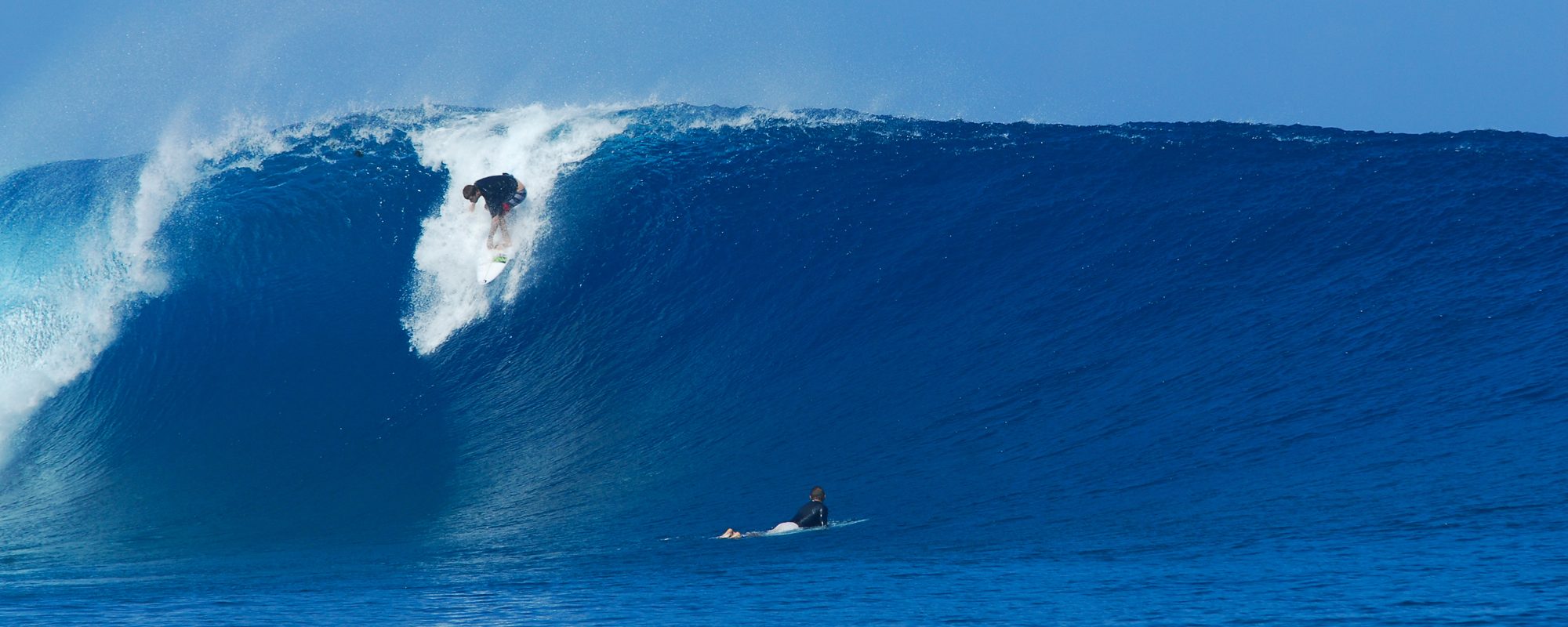
Remember Bethany Hamilton, the one arm Gutsy Surf Warrior?  She’s a new Mom this year, and she hit her dream of surfing 40-50 foot (faces) Jaws, Peahi. The video has privacy settings, so you’ll have to click Bethany’s name, just under the video message below, so you can watch it on Vimeo.

 the Surf big and glassy for Thursday morning?  Maybe.  The winds are still NNE,  so I believe we will have some NNW winds before 9 am, turning North pretty strong Thursday morning. Down south may not be so hot, since that’s side shore to almost offshore winds.  But up North here that is offshore.  Should be head high and glassy to semi-glassy at the Pier with some texture on it, due to strong offshore NNW winds.  Down south should be a lot bigger, but not so hot on wind.  It’s high tide early, like 5:40 am in Satellite, or a little earlier at the Pier.  So it maybe be smokin early, or with the heavy sand deposits on the bottom, it could have problems.  Let’s hope the heavy sand bottom has cleared out some !  🙂

Friday looks big and just barely glassy, as it now looks to be SSW, but pretty light, like 6-8 mph light.  If the period of the swell was a little more consistent, I be saying almost double overhead waves.  But with the fetch a little inconsistent, I believe it will be 2-4 foot overhead on the bigger sets down south, and 1-2 overhead at the Pier on the bigger sets.

Saturday will still be some head high size, but the winds are iffy right now.

Bethany Hamilton Tows Jaws from STAB on Vimeo.
Happy New Year my Surfer, and Non Surfer friends :)


Cross-Sunrise
Cross-Sunrise


Oldwaverider

Video of The Return to Nazare of Maya Gabeira after drowning, possible Glassy chest high surf at the Pier Monday morning 12/07, posted Sunday 12/06 at 6:20 PM


Maya Gabeira actually went unconscious in the waters of Nazare, back in 2012 or 13.  Carlos Burle rescued her.  She snapped an ankle, and passed out a couple times.  In this video, she faces her fears head on, by getting back in the water in Nazare.  After having two hernias in her back repaired also.  See the video below:

Monday morning should be chest high glass at the Cocoa Beach Pier.  I don’t know how this swell is breaking, as Johnson Avenue is not, even though it has size.  We got a lot of sand dumped here, and even in Hightowers which has been breaking really poorly on a number of swells, including last week.  But hopefully, Monday am at the Pier will be fun 🙂

Surf video, and Beautiful Waves today in Satellite Beach today, Sunday 11/22/2015, posted 5:50 PM


Check out the video below of one of the beautiful waves in Satellite Beach:


granted, the video wasn’t from today, but it was a fantastic waist to rib high day with really long lefts, oh it was fun!  Wished I could have surfed more than an hour 🙂

We have huge 6-11 foot waves come for the next week, and maybe , just maybe we will have a day of glass …

Sunday has a strong chance of being waist to chest high and glassy in the morning, with increasing high winds after mid-morning. Posted Saturday 11/21/2015 at 8:50 PM


The 120 buoy has had some 6 foot readings in the 11 second period range as of 5:00 PM today and around 8 PM, with some 9 second readings mixed in.  So this is part two of the swell we have had,along with a new swell rolling in.

It should be offshore , turning NW in the 4-8 mph range Sunday morning.  High tide around 4:08 am, so by 7:30 it should start having some juice to it, provided no morning sickness is upon us.  I think it will be waist to rib high and fairly glassy down south.  The size up North should be more like the waist high range.

A few photos below of Hurricane Ida and Oldwaverider, shot by my buddy Mike Melito, the big day, but in my old age, some days, I don’t want to battle the 8-12 foot face days paddle out, and in this case, I headed back North to Canaveral, skipping my favorite Satellite Beach Breaks.  So i went soft a few days, 🙂

A Railgrabber backside left, getting ready to lip up


A Railgrabber backside left, getting ready to lip up


Perfect line right


One of the thick lip cleanup sets, that kept us inside a while :) There were some 6-9 foot faces, even up North for us at the Cape with Hurricane Ida

Thursday or Friday should provide something awesome! Posted Tuesday, morning, 10:48 AM 11/17/2015


Friday morning update.  First, we did have sneak offshore winds in Satellite Beach from like 8 to 10 am yesterday, with 1 to 2 foot over head waves, so whoever was there probably caught some great fun.  But it was not offshore at daybreak.

Today, Friday morning, 5:21 AM as I share this, we should have 8-10 mph N winds that may still have a NNW spin at daybreak, so only in CCB are the winds slightly offshore.  NNW to N winds are sideshore to onshore in South CCB and Satellite Beach.  But it should be rib to I hope chest high at the Pier.  Sunday morning, the 9-11 second period part of the swell roles in with offshore winds, so early Sunday morning should be waist high plus at pier, and chest high in Satellite Beach!

We will wait to update tomorrow.  The last swell update from the models, shows Friday back into slight onshores in the AM.  We’ll just keep watching it, as Wednesday night or Thursday morning should give us a clear picture 🙂  (updated around 4:36 PM Tuesday)

I will update later today, but Thursday was looking like the offshore day, and now the swell has varied, to show Friday morning, instead of Thursday afternoon, to be the offshore and epic day!

As it stands, Friday looks to be another nice size windswell in the chest to shoulder high range, and fortunately, the tide works for us with this swell, unlike “Kate” last week 🙂

More late, plus some shameless self photos from “Ida” 🙂

Oldwaverider

Surf video of TS Ida at the Pier, plus, Sunday morning 11/08, could be clean, waist to chest, maybe glassy and fun, but early early … Posted Saturday afternoon, 11/07/2015 at 5:20 PM


Surf video of TS/Hurricane Ida at the Cocoa Beach Pier, with Dennis of Core Surf and a couple others.  Beautiful leftovers of Ida 🙂

Nice little wind swell moving in for Sunday morning, with perhaps waist to chest high clean, and maybe, just maybe glassy for an hour or so near daybreak Sunday morning.  Satellite Beach is your best bet to get the size.  If it blows offshore, probably from daybreak , for an hour , then light SE to East winds in the 3-5 mph range, building in speed as the morning grows older 🙂  (hopefully it won’t be a scattered thundershower to throw the winds whacko)

We may have a chest high plus and glassy day between Monday and Wednesday, so watch the wind charts, or check back here.

Fun waves coming for Thursday morning 10/29 and Friday morning, and a chance of this afternoon. Posted Wednesday morning, 10/28/2015 at 10:20 AM


We have almost a ground swell rolling in today.  As the swell period approaches 9 and 10 seconds, we should start to see longer lines.

It may be disorganized this afternoon, even if the winds turn offshore after 3 pm, because there is a 2nd , and 3rd swell pushing from the south that is fighting against the ENE wind/groundswell rolling in.

Thursday morning at daybreak, should be waist high plus, with some solid chest high sets in Satellite Beach and glassy!.  Winds look to be offshore, from the West until late morning at least.

Friday morning could be 6 inches bigger and glassy.

If you’re lucky, this afternoon could be fun when it starts to turn offshore.  And Even now, with the winds straight South, well that is 32 degrees offshore at Playlinda, and 26 degrees offshore at Sebastian Inlet.  But only 10 degrees offshore in Satellite Beach, so with 15 mph South winds, Satellite will still be bumpy.

More Surf Video of Big Wednesday w/ Soundtrack – T.S. Ida – Satellite Beach – Big Day Sunday expected for Hurricane Joaquin, posted Saturday night 10/03 , 10:50 PM


Sunday morning should be the day!  Saturday was a dissapointment, except maybe for folks at the pier.  But there was still some 50 yard rides for all, in other North breaks.  The problem was caused by a secondary swell, that was aiming North to South from 3 am Saturday till maybe 3 Pm , a swell that was 3.5 feet at @ 6 seconds.  So that was putting the bump in the middle of the swell in the morning , more noticeable down south, but took the juice out of much of the swell even up North.

Here’s a video compilation of Big Wednesday of Ida, with a nice soundtrack by Guerilla Jazz, called “One Day We’ll Be gone”, they are from Maui, Hi.

Sunday , the Hurricane Joaquin has dropped a little in size models, and now it also looks like the “size” arrives at it’s Peak, by around Noon to maybe 2:30 Pm or so.  We have a secondary swell, but a very minimal one pointing south again, but I don’t think it will cause much issue, not like today anyhow. We do have West winds at the 120 buoy, so that could hold back some of the swell.  I think we can look for Shoulder high plus at the Pier, with some bigger sets, and Satellite Beach should see some 10 foot rogue sets, with a lot of 6-9 foot sets.  The winds shoudl be WNW at daybreck around 8 to 10 mph, switching to West down to around 6 to 8 mph.

Monday and Tuesday look big and fun also.  Enjoy, and watch out for the bait fish predators!

Oldwaverider

Surf Video from Big Wednesday, plus, Friday morning should be really nice head high with NW winds in Satellite Beach for a couple hours. Posted Thursday night, 10/01 9:30 PM


Friday should be really nice, with waist high plus at the Pier, and Head high plus in Saturday in Satellite Beach.  Winds should be around NW, in a brisk 8 to 12 mph at daybreak.

Here’s another short video clip from Big Wednesday in Satellite Beach.  It started as a near double overhead face, tapering off quick, but made for a nice , perfect ride without almost a coverup.

Saturday, as the Easterly swell begins to piggyback this powerful NE swell we’ve had, and it should start arriving by noon or 1 PM Saturday morning, and all through the night. It should be 2 feet overhead by mid-afternoon, getting close to double overhead by dark.  Winds look to be offshore most of the day.

Sunday morning could be massive, and hit double overhead for the entire morning.  It has a chance of reaching the status of Hurricane Sandy, with Very strong offshore West winds, perhaps in the 12-20 mph range.

Get excited, and grab your best big wave gun!

Oldwaverider