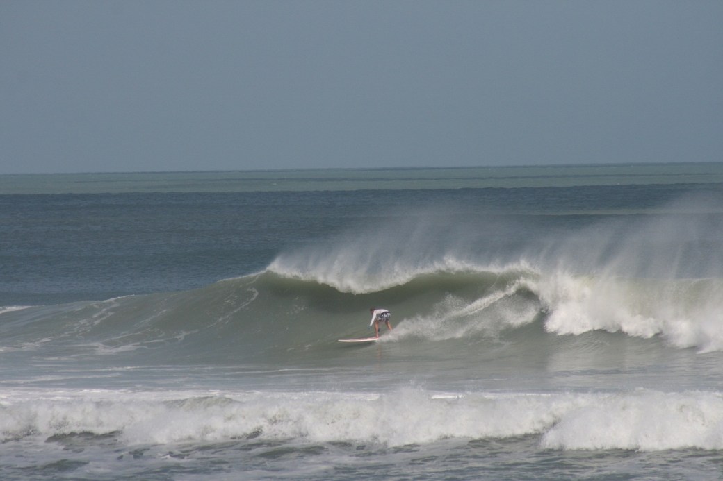
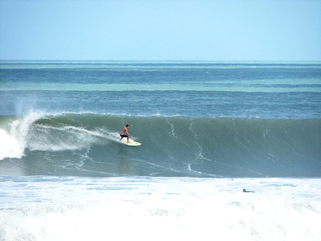
Friday night, 7 PM update, Surf update Report for Saturday November 17, 2012 12:15 PM,


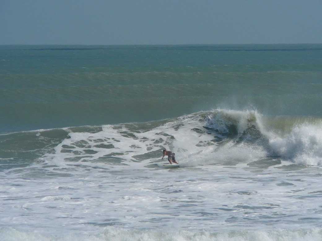
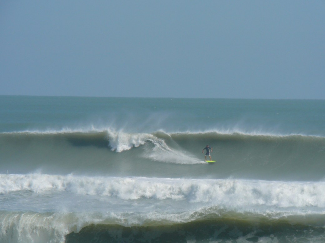
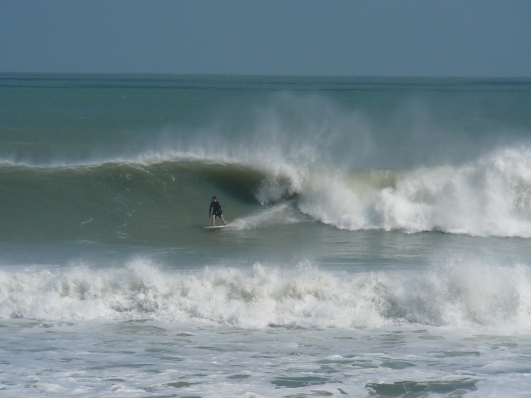
Saturday Surf…Now looks to be chest high at the Cape and some Shoulder to Overhead down South, toward Satellite Beach.  Winds should have some “slight” offshores until 9 or 10 AM Saturday morning,  NNW in the 12 to 15 mph range, then turn North, Winds are now looking straight North at daybreak 5 to 10 mph and turning NNE by mid-morning, and increasing some throughout the day.  (We may get a bit of NNW for an hour , but doubtful now) For 3 days, it did look like Saturday was going to be the perfect offshore head high epic day,  but now it still looks fun if you surf up North, and get out there early.  At daybreak,  Low going high tide will be around 6-6:30 AM,  with NNW winds, so it should be really fun then. Today was fairly glassy and in the rib to chest high range, with long rides at the Cape, and couple feet bigger down south , but not as clean 🙂

The photo below, is from Don Hansen, who had a Birthday on Wednesday, Hansen Surfboards in California.
don-hansen-hansen-surfboards-facebook-from-wednesday-11-14-2012

And it appears to be a full head high surf window for the next 7 days, when it looks serious offshore, we’ll share that of course.

Have a great weekend!

Oldwaverider
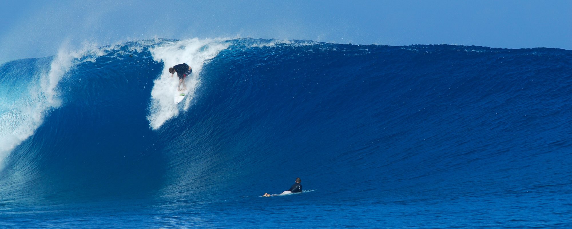
Wednesday night Surf Report update on November 14 2012 for Thursday thru Saturday


Swell update!  The 120 mile buoy is rockin, jumping from 7 feet at 9 seconds at 5 AM this morning, to 8.5 or 9 feet at 11 seconds (solid ground swell now), so expect bigger size and more power than the great waves we had today, see video here from Tuesday November 13 at the Cape.  (yeah, down south was 2 foot bigger, but it was nice to be only 1000 feet from the paddle out today after lunch 🙂

Thursday, size should be chest to shoulder high at the Cape and some overhead sets down south in Satellite Beach. Offshore winds Thursday AM,  NW at daybreak for the Cape in the 4 to 6 mph range, switching to WNW and back to NNW by 11 or 12 and by 1 or 2, NNE or NE (onshore)

Friday Am, should be comparable size as Thursday, maybe biggerlooks like NNW winds in the 7 to 12 mph range, so we should have glass, but some texture, but hey, it sounds great!

Saturday still has the best chance of being head high to overhead and epic with perfect offshore winds, but we’ll let ya know Thursday night, if the winds still look favorable.

Water temp is around 71 ° so a spring suit felt good today (though last year I would have done just a rash guard, I think I’m finally gettin older 🙂

Surfing Video from today at Johnson Avenue a nice chest high day n fairly glassy, Chest to Head high waves for a week maybe, Monday evening Surf Report Update 11/13/2012 6:00 PM, Surf forecast for Cape Canaveral , Cocoa Beach and Satellite Beach (November 13, 2012 posted)


SURFING VIDEO FROM JOHNSON AVENUE TODAY

Surf with waves every day for a Week, Chest to Head High, with a few glassy days.

Tuesday is looking to be chest to head high, clean with North winds light at day break, turning NNE by 8 AM so get out early.

Wednesday is showing chest to overhead, and Weather.com shows NNW light winds until 11 AM which means glass for the Cape and clean down South, the models at Magicseaweed.com show onshore Wednesday morning, so for now I go with Weather.com.

Thursday morning looks chest high plus, clean, maybe early glass

Friday looks like a chance of glass similar size

Saturday, looks like definite offshore winds and head high. (which means, we will have a big glassy epic day on Sat or Sun, unless the swell bumps up early)

We’ll update later tomorrow with a wind update.  I missed the glassy wind report for this morning, oops, my bad 😦

Thanks for your forgiveness 🙂

Oldwaverider

Chest high plus Ground Swell incoming for late Friday morning, more Surfing Photos from Hurricane Sandy 9 to 12 foot faces (with a maybe 16 foot face at Boynton Inlet), Thursday afternoon Surf Report Update 11/08/12 2:30 PM, Surf forecast for Cape Canaveral , Cocoa Beach and Satellite Beach (November 08, 2012 posted)


Photo Gallery from Hurricane Leslie, photos by Mike Melito, and one anonymous Boynton Inlet, FL massive wave.

Incoming ground swell for Friday morning should be bringing in some Chest high plus waves.  Maybe not at the Cape, but the Pier or a couple miles South of the pier should see increased size the further South you go.  The swell angle is so steep, at 9 AM Friday, 49 °, and straight offshore is 90, so our launch pads may block out a lot of this swell, at least the first day. (see rest of update, below photos)

Boynton Inlet, Florida, Hurricane Sandy, either Saturday or Sunday, October 27 or 28 2012, photo by Anonymous
Surfer Girl at Hightowers, photo by Mike Melito
Me (Oldwaverider) doing pushups before the paddle out, unbeknownst to me the photo was being taken :), by Mike Melito
Perfect medium size right at Hightowers in Satellite Beach, Hurricane Sandy, Sunday around 12 PM, October 28 2012, by Mike Melito
South Cocoa Beach, Hurricane Sandy, solid 12 foot face (3 feet above and below the surfer), photo by Mike Melito
South Cocoa Beach, Sunday , October 28 2012, Hurricane Sandy, photo by Mike Melito
Nice big left in South Cocoa Beach, Hurricane Sandy, by Mike Melito
Almost in the pocket, South Cocoa Beach, Hurricane Sandy, by Mike Melito

We should see chest to shoulder high ground swell type power surf with onshore winds most of the week thru Saturday, and Sunday and Monday, more of the same but less power and a wind swell, however;

Friday morning , the winds switch from NNW at daybreak, toNorth at 8 to 12 mph until around 10 AM, so we could have some semi-glassy waves, thigh to chest high in the morning, at least somewhere between the Cape and 4rth Street North.  South of Minuteman CSWY, North winds are onshore.

Incredible double overhead Video footage from RC’s on Sunday October 28 2012, Hurricane Sandy, by Pure Ocean TV, 28 2012, Thursday night Surf Report Update 11/01/12 8:15 PM, Surf forecast for Cape Canaveral , Cocoa Beach and Satellite Beach (November 01, 2012 posted)


DOUBLE OVERHEAD FOOTAGE VIDEO , BY PURE OCEAN TV FILMED AT RC’S, HURRICANE SANDY ON SUNDAY

We had a small but powerful ENE groundswell coming for Friday thru Sunday. Expect almost no waves because the swell that is out there is further than the 120, and the NW winds at the 120 won’t let the swell in anyhow 😦

Shameless photos of Oldwaverider :), Photos from Hurricane Sandy at Hightowers October 28 2012, at Satellite Beach , Monday afternoon Surf Report Update 10/29/12 2:15 PM, Surf forecast for Cape Canaveral , Cocoa Beach and Satellite Beach (October 29, 2012 posted)


ART HANSEN (OLDWAVERIDER) – PHOTO GALLERY, Hurricane Sandy overhead photos

Oldwaverider at Hightowers for Hurricane Sandy on epic Sunday October 28 2012, Image 1 of 4 shot sequence. Photos by a kind Lady :)
Oldwaverider at Hightowers for Hurricane Sandy on epic Sunday October 28 2012, Image 1 of 4 shot sequence. Photos by a kind Lady 🙂

Being in the right place at the right time, and a prayer.  This photo sequence was one of the small to medium size sets from Epic Sunday at Hightowers, with face heights jumping up to 14 every so often. My friends Mike and Cathy, were talking to a woman taking pictures of the perfect swell, and she asked the woman if she would take some shots of me if I paddled out for a few minutes.  So we were defintely in the right place at the right time.

I wasn’t going to paddle out, because I am old :),  but  a young friend (Seth) I met in the water there a couple months ago in a rib high day, said he would paddle out if I did, so with some perspiration and Old age prayer, I decide to go for it, just to get one wave, and try and avoid the clean up sets (14 to 15 foot faces) on the paddle out, that came thru every 15 or 20 minutes.

Hurricane Sandy delivered some epic waves on Sunday.  Image 2 of 4 shot sequence.
Hurricane Sandy delivered some epic waves on Sunday. Image 2 of 4 shot sequence.
Oldwaverider (Art Hansen), enjoying an epic right at Satellite Beach, Sunday October 28 2012, Image 3 of 4 sequence.
Image 4 of 4, Oldwaverider at Hightowers.


I got very lucky with my timing, made it out in 7 minutes with my hair dry, paddled for 2 or 3 waves, but to far out, so I came in a bit, and found one that looked like it was lining up, and then just started the crazy laugh 🙂  It was about a 10 or 11 foot face, I took off more parallel, cause straight bottom turns were almost a guaranteed pounding.  I tried to get ahead of the lip, and eventually, just carved up thet wall to get a boost of speed , shot out in front after it broke, and belly boarded in, and back up to the boardwalk in 22 minutes.  What a fun Ride, thank God for delivering perfect Hurricanes 🙂

Surf for Tuesday, there should be a little left, waist to chest high from the Cape and going South to Satellite Beach. Winds should be West in the 15 to 20 mph range, thanks to this wonderful cold front.

8 to 12 foot faces with 14’s (but you had to be there to believe) at Satellite Beach today, Photos from today, Sunday October 28, 2012, Sunday night Surf Report Update 10/28/12 8:00 PM, Surf forecast for Cape Canaveral , Cocoa Beach and Satellite Beach (October 28, 2012 posted)


12 foot plus face in Satellite Beach, beautiful form, but lots of offshore winds. Epic Sunday from Hurricane Sandy, October 28 2012, photos by Art Hansen
Double overhead perfection, nice left in Satellite Beach around 2 PM, Sunday , October 28 2012, Hurricane Sandy, Image 1 of 4 in sequence
Image 2 of 4 shot sequence. Epic left on Sunday.
Epic left continued, image 3 of 4 sequence, photos by Oldwaverider
Image 4 of 4, Satellite Beach, Hurricane Sandy, Sunday October 28 2012 around 2 PM, Photos by Oldwaverider


Monday should be overhead glass down South, and the Cape and CCB are very hard to predict.  This swell today was 41 degrees, so the Cape was blocked out from half the swell, and Monday, the angle goes 38 degrees with the falling swell, so I will go with, waist to chest high at the Cape, maybe shoulder high at the Pier.  The winds should be around 15 to 20 mph WNW at daybreak and kick up to 25 mph by noon, so get out early. Satellite Beach ought to see some 2 foot overhead sets.

Awesome waves everywhere today, Epic surf for J-Ave,  this afternoon for me was amazing fun with nothing but sick long rides from chest to head high, and Chilly!  (with only a rash guard, though some crazies were skinning it)

Satellite Beach was the most perfect I have seen it in size and form.  High tide this morning, was solid 9 to 12 foot with 14 foot sets, I got 2 video clips of rides, one was double overhead, and doubled on the guys head, but I’ll share that another day.

At low tide Satellite was slamming around noon,  solid 8 to 12 foot faces, with 14 foot plus sets, showing up every now and then, so I had to go out for just one wave, since it was the biggest and cleanest I have ever seen by RC’s and Hightowers.  A-frames, in the morning with 200 yard ride shoulders,  and at low tide, just as clean, but with a lot more closeouts.  But I got my one wave 🙂

The photos are of a guy on a double overhead wave (thought he’s hanging at the top but you can see his own body height under him and a spare 2 feet up top, so maybe more than 12 foot face), and the other is just an insane wall towering over 3 guys.

Thursday night update at 9:45 PM, October 25, 2012 , regarding Hurricane Sandy


We still have a great chance at having 20 foot face size at the Pier (but it may not be until 3 AM Friday going Saturday), w North winds at 30 to 35 mph, which would be about 6 degrees offshore, so it could be semi-clean, and decent shoulders 🙂  The full swell period of 15 seconds hits around 3 PM Friday,  so we could have the 18 to 20 then, yeah, I am jumping around a bit, but if it gets bigger than that, it will be in the middle of the night, early Saturday morning.

My final call at daybreak, is 10 to 15 foot faces between the Cape and the Satellite Beach (RC’s), and by 3 PM, from 15 to 18 foot faces.  I don’t care if I get egg on my face, the biggest hurricane swell I have seen was 12 foot at 17 seconds, in the 15 foot plus face range, so this swell being 18 at 15 seconds, the only thing that may hold back the size is that it is moving almost direct North without a big enough fetch to generate the expected size.  This will be a learning swell for me.

I would say since the winds on weather.com say it turns North at 8 AM from NNE, that by 11 AM, about 5 hours after high tide, it could turn clean.  Winds in the 30 plus mph range is rideable, TS Hanna had 35 mph winds with 15 foot face heights at the pier and bigger at RC’s.

The TV cams will be at the pier I am sure, so it could be an awesome spectacle! and the safest place to surf.

Our ocean floor here is so shallow , unlike around the Bahamas, only until you get to Hatteras does the water get deep, but…………since this swell is so powerful and big,

it could provide a 1 to 1 ratio or 1.2 to 1 ratio on the wave that hits the beach.  In Hawaii, an 18 foot 15 second period swell that we will have by mid-day Friday, would produce 50 foot plus faces sizes at Jaws, Maui, but for us, if it gives a 1 to 1 ratio, then maybe 18 foot faces.  I’ll take it.

Have fun, be safe, and take a look at the epic size that God provides 🙂

Oldwaverider

Wednesday 10/24 2 PM update for Friday still shows 17 to 18 foot swell from Hurricane Sandy now at 15 seconds as Freeman shares 10-12 foot backs south of Cocoa Beach which means 18-20 foot plus faces…if the swell continues in size, plus, a video of Kelly Slater wave of the day tow-in in Nazarre , Portugal, maybe a 30 foot face hanging with Garrett Macnamara, Cape Canaveral and Cocoa Beach Surf Report and Satellite Beach Surf Report and Forecast, October 24, 2012 at 2:00 PM


kelly-on-the-bomb-of-the-day-oct-2012-nazarre-portugal-from-magicseaweed.com

Friday still on track for 18 to 20 plus foot faces according to the models.  That means 10 to 12 foot backs of the waves, afternoon.  With 50 plus mph onshore winds 🙂

Magicseaweed shows the same swell model size here (not the face size, not the wave back size, but the swell size) check Magicseaweed here.

Bob Freeman’s report shows 10 to 12 foot backs for Friday, down by Satellite here.

PLAN ON HURRICANE WEATHER FRIDAY AND LOTS OF FLOODING!  THIS ONE WILL BE WITHIN 200 MILES OF SHORE AND MAY HAVE A LOT OF SURGE.

Saturday is still looking like 12 to 16 foot faces depending on where ya go and it does drop from daybreak till afternoon fairly fast , with semi-glass NNW winds, but unless ya wait till mid-afternoon, you won’t have winds less than 30 mph.

Sunday, looks like 10 to 12 foot plus faces and semi-glass winds with bigger sets of course.

The Video above is 3 people getting towed into Nazarre, Portugal, Kelly Slater caught the wave of the day, looks like a 30 foot face drop, really nice wall.

This was the place that Garrett caught last year a 9 foot 16 second period swell that produced an 80 foot face wave.  (they get a phenomena called refraction from other effects coming from other breaks North and South of Nazarre)  So normally, the biggest sets would come in at twice the swell size, but Nazarre’s 9 foot swell becomes like a 36 foot swell, and doubles the face heights on the biggest sets.

Start jogging, paddling, eating, sleeping, this could be the biggest waves we have had in years.

Oldwaverider

All Models show, 18 foot at 14 second period ground swell from Storm Sandy for Friday Noon on 10-27-2012, which will change…but it’s cool :) Posted Cape Canaveral and Cocoa Beach Surf Report and Satellite Beach, October 23, 2012 at 12:45 PM


This is the largest model for a storm that I have seen, and of which for 3 days straight has been at 12 and increasing in model size and intensity.

Sunday-10-to-15-foot-faces-w-model-asof-10-23-12-at-12PM

The Epic day is shaping up to be Sunday October 29, 2012, with the models showing a drop to 12.5 feet at 14 seconds.  The wave size for Sunday, would be a minimum of double overhead, most likely in Satellite Beach in the 12 to 16 foot face size with side-shore winds in the 20 mph range, NNW.  It could be as much as 12.5 degrees offshore if it is true NNW if you will.  Offshore but very strong for the Cape.  Keep in mind, that when I surfed TS Hanna, in 2009,  we had 12 to 14 foot faces at the pier with 25 to 35 mph NW winds, and I got one epic ride!

Monday is the next epic day also with double overhead waves and strong 12 to 18 mph NNW offshore winds for the Cape and North CCB only, based on the models right now 🙂

Obviously, models change, but his is exciting, and the Cape, and North of 4rth Street North is the only logical place to surf if you want winds that are offshore 🙂

Friday, with the models showing 18 foot at 14 seconds, we would see a few 20 foot faces roll in like on the October “91”  halloween swell !

The screenshots above and below are the swell size progression for the week in bar charts  and the second chart shows the size and swell direction and wind direction as the models now show.

18-feet-14-seconds-as-of-10-23-12-at-12PM

NOTE: In the photo I took below, the swell was an ENE swell granted, that was 6.5 feet at 12 seconds that produced a 12 foot face at least in one photo I took in this series,

and the swell we have coming shows 18 foot at 14 seconds on Friday at noon…for now with severe onshore winds, but it is not hard to interpolate, although, you can’t just triple the face size because of the swell size, (in the photo to the left was a 9 to 10 foot face before it barreled, and  the 12 to 13 foot face photo in the series was double the swell model size) but you can at a bear minimum, multiply it by 1.2, which would give you some 18 to 20 foot plus faces.  Anyhow, the swell will most likely drop, but either way, it is totally fun to see the models the biggest that I have seen since 2004.